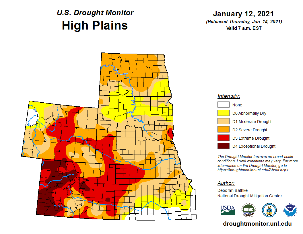
Blowing dust across the High Plains (Part 2)
![GOES-16 Dust RGB images, with and without hourly surface reports [click to play animation | MP4]](https://cimss.ssec.wisc.edu/satellite-blog/images/2021/01/210115_goes16_dustRGB_CO_KS_OK_TX_anim.gif)
GOES-16 Dust RGB images, with and without hourly surface reports [click to play animation | MP4]
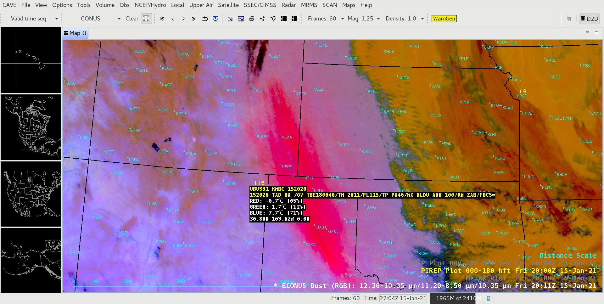
GOES-16 True Color RGB and Dust RGB images (created using Geo2Grid) are shown below.
![GOES-16 Dust RGB and True Color RGB images [click to play animation | MP4]](https://cimss.ssec.wisc.edu/satellite-blog/images/2021/01/210115_goes16_trueColorRGB_dustRGB_Plains_blowing_dust_anim.gif)
GOES-16 True Color RGB and Dust RGB images [click to play animation | MP4]

GOES-16 Dust RGB and Near-Infrared “Cirrus” (1.37 µm) images, with plots of Ceiling and Visibility [click to play animation | MP4]
![GOES-16 Dust RGB images, with and without hourly surface reports [click to play animation | MP4]](https://cimss.ssec.wisc.edu/satellite-blog/images/2021/01/210115_goes16_dustRGB_3_CO_KS_OK_TX_anim.gif)
GOES-16 Dust RGB images, with and without hourly surface reports [click to play animation | MP4]
===== 16 January Update =====
![GOES-16 Dust RGB and True Color RGB images [click to play animation | MP4]](https://cimss.ssec.wisc.edu/satellite-blog/images/2021/01/210116_goes16_dustRGB_trueColorRGB_TX_Gulf_of_Mexico_dust_plume_anim.gif)
GOES-16 Dust RGB and True Color RGB images [click to play animation | MP4]
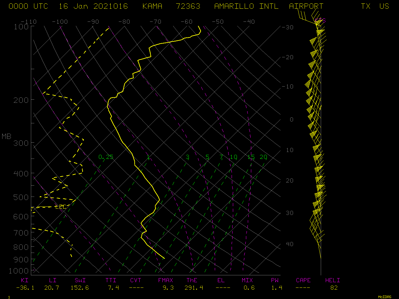
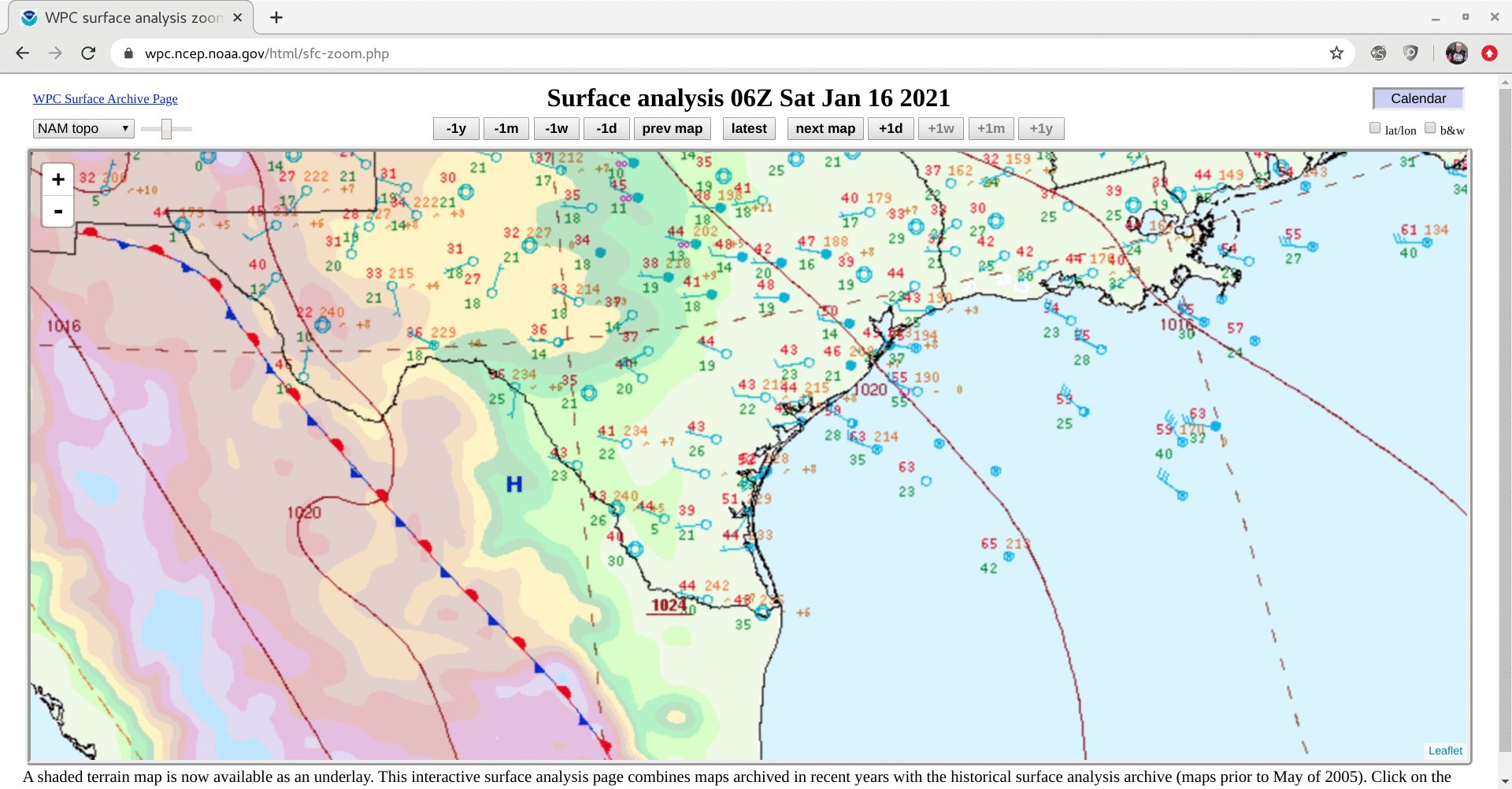
On the following day, the dust plume began to flow off the Texas coast and over the Gulf of Mexico by 06 UTC — and although the plume signature began to diminish in the GOES-16 Dust RGB images after sunrise, it was very apparent in True Color RGB imagery (above). Note that the True Color images revealed some recirculation of dust which began to move inland toward the end of the day, as surface winds near the coast shifted to southeasterly (surface analyses).
GOES-16 Natural Color RGB images with plots of Ceiling and Visibility (below) showed that the dust reduced the visibility to 2.5 miles at a site located just off the Texas coast at 14 UTC, and to 5 miles at a site located about 100 miles offshore at 15 UTC.
![GOES-16 Natural Color RGB images, with plots of Ceiling and Visibility [click to play animation| MP4]](https://cimss.ssec.wisc.edu/satellite-blog/images/2021/01/210116_goes16_cimssNaturalColorGB_TX_Gulf_of_Mexico_dust_plume_anim.gif)
GOES-16 Natural Color RGB images, with plots of Ceiling and Visibility [click to play animation| MP4]
![VIIRS True Color and False Color RGB images from Suomi NPP [click to enlarge]](https://cimss.ssec.wisc.edu/satellite-blog/images/2021/01/210116_1911utc_suomiNPP_viirs_trueColorRGB_falseColorGB_TX_Gulf_of_Mexico_blowing_dust_anim.gif)
VIIRS True Color and False Color RGB images from Suomi NPP [click to enlarge]