Typhoon Vamco approaches Vietnam
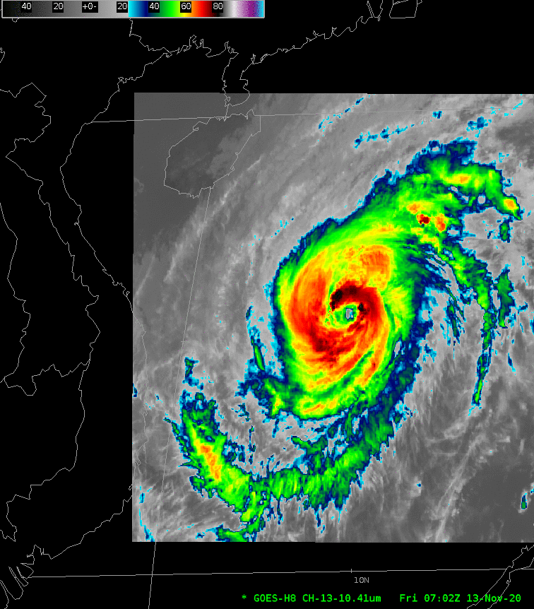
Himawari-8 Infrared Imagery (10.41 µm, Band 13) from 0702 to 1942 UTC on 13 November (Click to animate)
Himawari-8 “Target” infrared imagery at 10.41 µm (above) and 7.35 µm (below) (courtesy JMA, the Japanese Meteorological Agency) show Typhoon Vamco as it crossed the South China Sea on 13 November, approaching Vietnam. Strong convection develops frequently in the region surrounding the not-quite-circular eye (click here for an mp4 animation), and dry air is far removed from the center, based on the low-level water vapor imagery below (click here for an mp4 animation), although it is wrapping around the southern half of the storm by the end of the animation. (Click here for more information on Vamco from JMA).
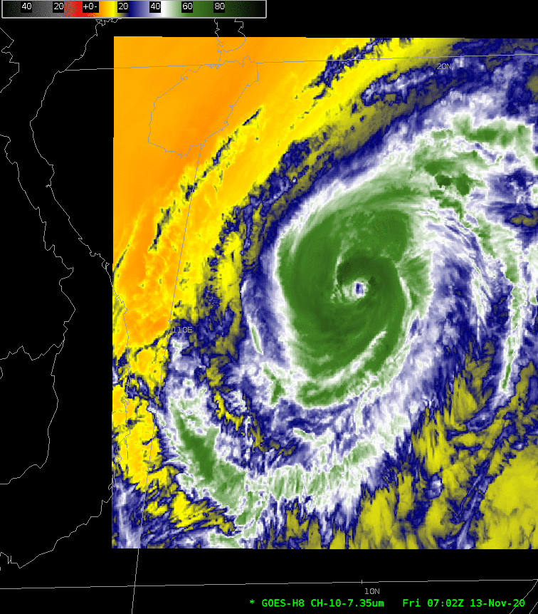
Himawari-8 Infrared Imagery (7.35 µm, Band 10) from 0702 to 1947 UTC on 13 November (Click to animate)
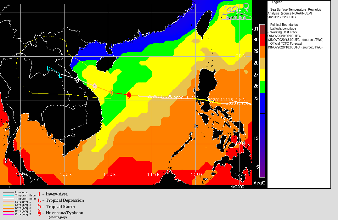
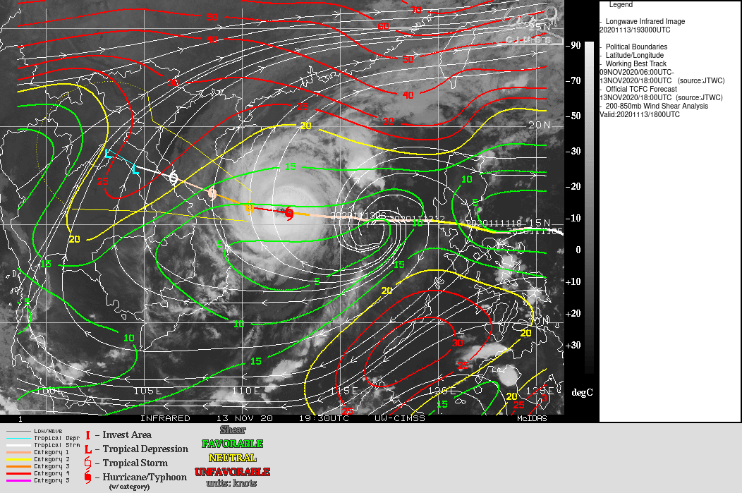
MIMIC Total Precipitable Water fields (from this site), below, show that Vamco is preceded by relatively dry air that appears to be wrapping closer and closer to the storm (The storm is however followed by abundant moisture). Dry air and relatively cool sea-surface temperatures (from this site) may be the reason that weakening is forecast before landfall. Shear values remain low but are forecast to become less favorable.

MIMIC Total Precipitable Water for the 24 hours ending 2000 UTC on 13 November 2020 (Click to enlarge)
For more information on Vamco, refer the SSEC Tropical Page, the JTWC or to JMA.