Severe weather outbreak in the Plains
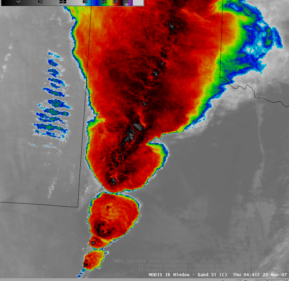
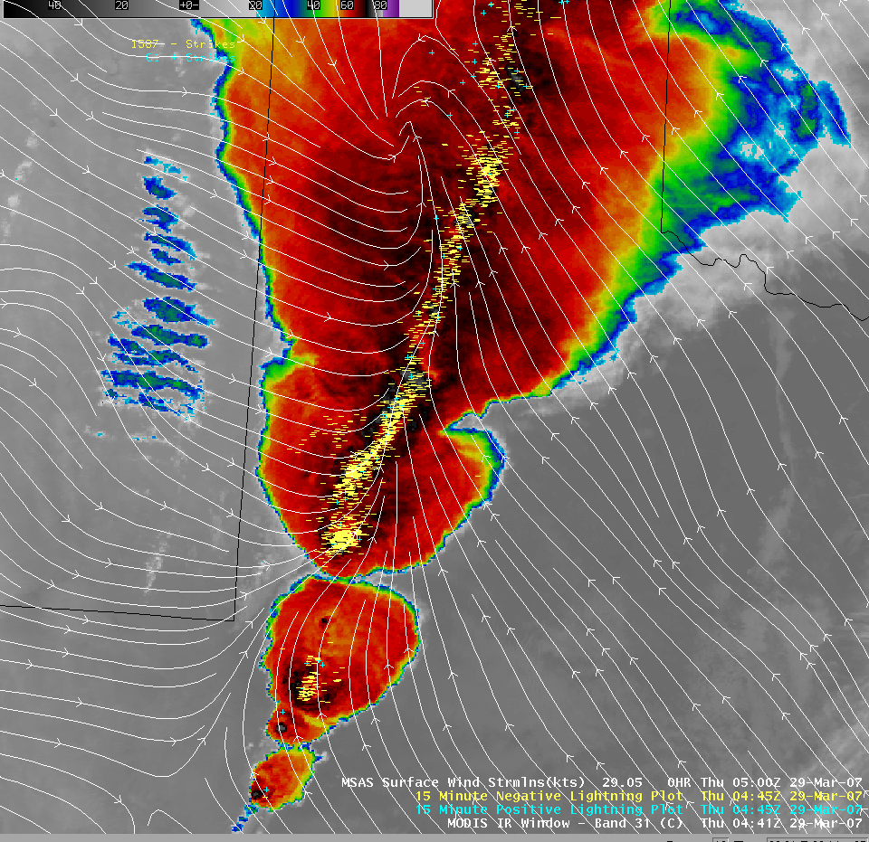
A major outbreak of severe convection developed across the southern and central Plains states during the day on 28 March and 29 March 2007; large and long-lived thunderstorms produced widespread tornadoes (including fatal tornadoes in Texas and Oklahoma, and the first tornado-related fatality in Colorado since 1960), large hail (up to 4.5 inches in diameter in Texas), and damaging winds (28 March SPC storm reports). An AWIPS image of the MODIS 11.0µm InfraRed (“IR window”) channel with overlays of cloud-to-ground lightning strikes and surface wind streamlines (above) shows the large density of lightning strikes (1587 negative strikes and 61 positive strikes in a 15-minute period) that was generally aligned along a cold frontal boundary that was moving eastward across the Texas panhandle region. If we examine the MODIS IR image without any overlays (below), we see that there were 2 examples of a subtle “warm trench” signature (a ring of warmer cloud top temperatures surrounding the coldest temperatures associated with the overshooting tops) — this satellite signature suggests that there may have been some compensating subsidence immediately surrounding the vigorous overshooting tops as they penetrated the tropopause level. You can get a sense that such a “trench†can surround an overshooting top by examining astronaut photography of thunderstorms taken from the space shuttle (image courtesy of Earth Sciences and Image Analysis Laboratory, NASA Johnson Space Center). QuickTime animations of rapid-scan GOES-11 10.7µm IR images centered on Lubbock, Texas and Goodland, Kansas show large and persistent enhanced-v signatures exhibited by many of these storms.


