Large MCS over Texas

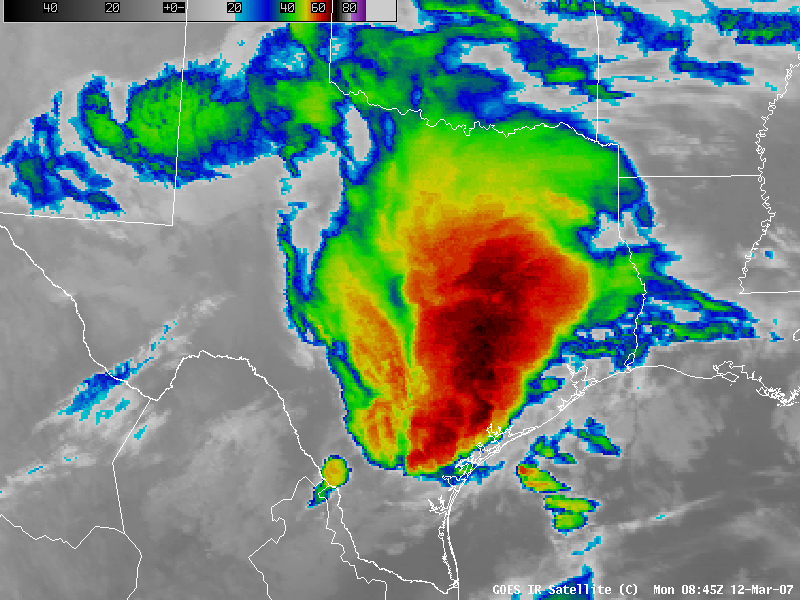
A very large and long-lived Mesoscale Convective System (MCS) developed over Texas during the pre-dawn hours on 12 March 2007, which produced reports of tornadoes, hail up to 2.5 inches in diameter, and damaging winds up to 95 mph (SPC storm reports). AWIPS images of the GOES-12 10.7µm InfraRed (IR) channel (above; QuickTime animation) shows the areal extent of cold cloud top temperatures associated with the developing MCS — IR cloud top temperatures were as cold as -72º C / -97º F (black enhancement) at 03:30 and 11:15 UTC. The supercell convection that first developed across the Big Bend region and over central Texas did exhibit enhanced-v signatures from about 23:00 UTC on 11 March to 03:00 UTC on 12 March.
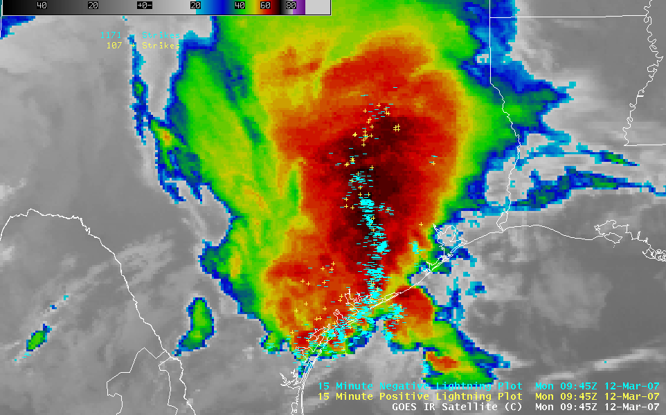
The MCS eventually developed Line Echo Wave Pattern (LEWP) structures, which were evident in the cloud to ground (CG) lightning strike data (below; QuickTime animation) — in fact, this severe convection produced over 1000 CG strikes every 15 minutes during the 09-10 UTC period. Later in the day, new convective development produced heavy rainfall (including reports of 2.00 inches in a 1 hour period, and a total of 6.94 inches) in the Brownsville, Texas area — GOES sounder derived product imagery displayed Total Precipitable Water (TPW) values of 46 mm (1.8 inch) and Convective Available Potential Energy (CAPE) values of 2480 J/kg over that region several hours earlier.


