Snow cover in Colorado, Kansas, and Nebraska
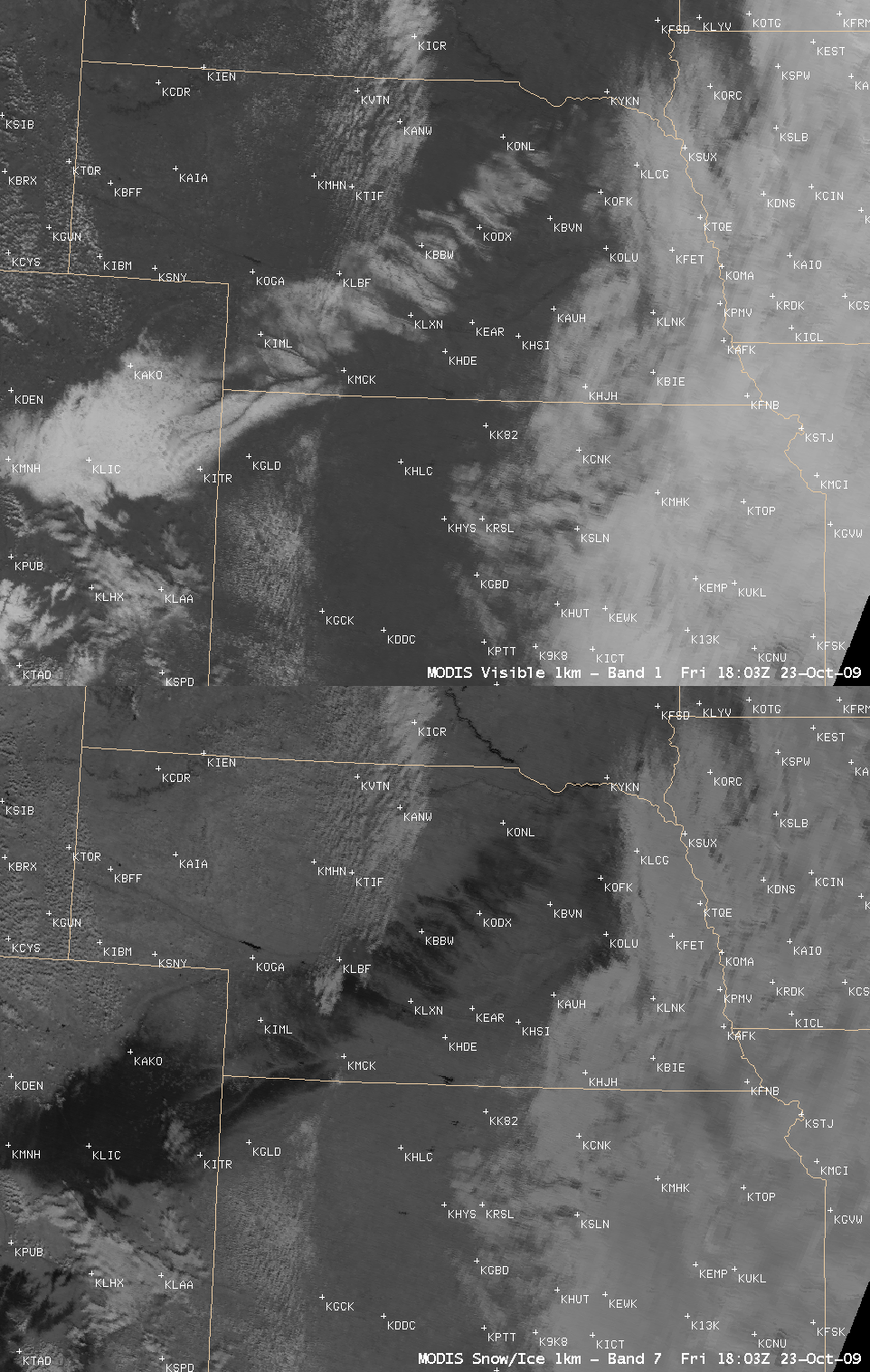
AWIPS images of the MODIS visible and 2.1 µm near-IR “snow/ice” channels (above) showed areas of snow cover across parts of eastern Colorado, far northwestern Kansas, and Nebraska on 23 October 2009. Snow is a strong absorber at the 2.1 µm wavelength, so it appears very dark on the snow/ice channel image.
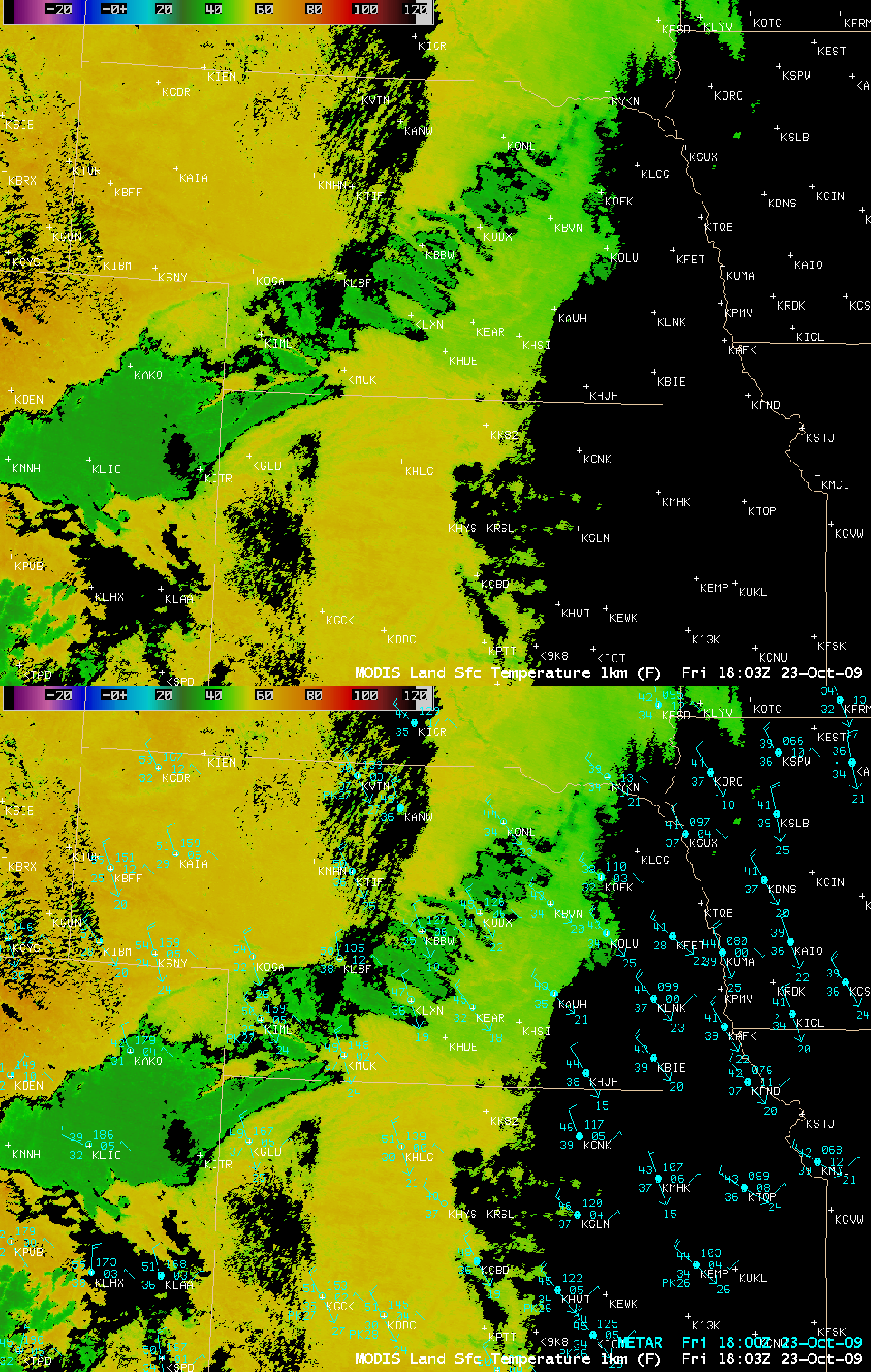
The corresponding MODIS Land Surface Temperature product (below) revealed significantly colder LST values in the middle to upper 30s F (darker green colors) where the snow cover was deeper. There was a lack of surface reports in the exact areas of deeper snow cover, except for Limon in eastern Colorado (station identifier KLIC), which was reporting a surface air temperature of 39º F at the time.
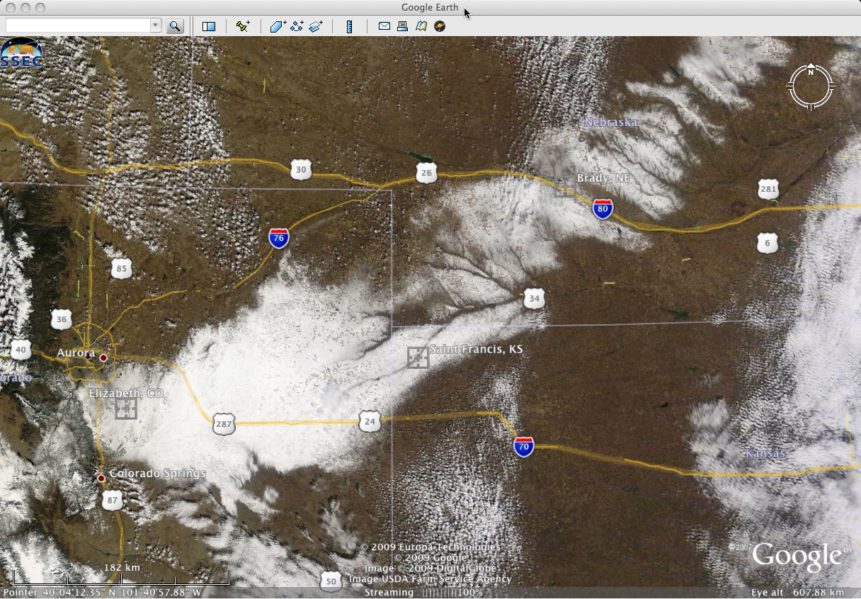
Snowfall amounts from this particular storm (which moved through the region on 22 October) included 15 inches at Elizabeth, Colorado, 12 inches at Brady, Nebraska, and 4 inches at Saint Francis, Kansas. These locations are marked on a MODIS Red/Green/Blue (RGB) true color image from the SSEC MODIS Today site (below, displayed using Google Earth).


