Flooding along the Tittabawassee River in Michigan

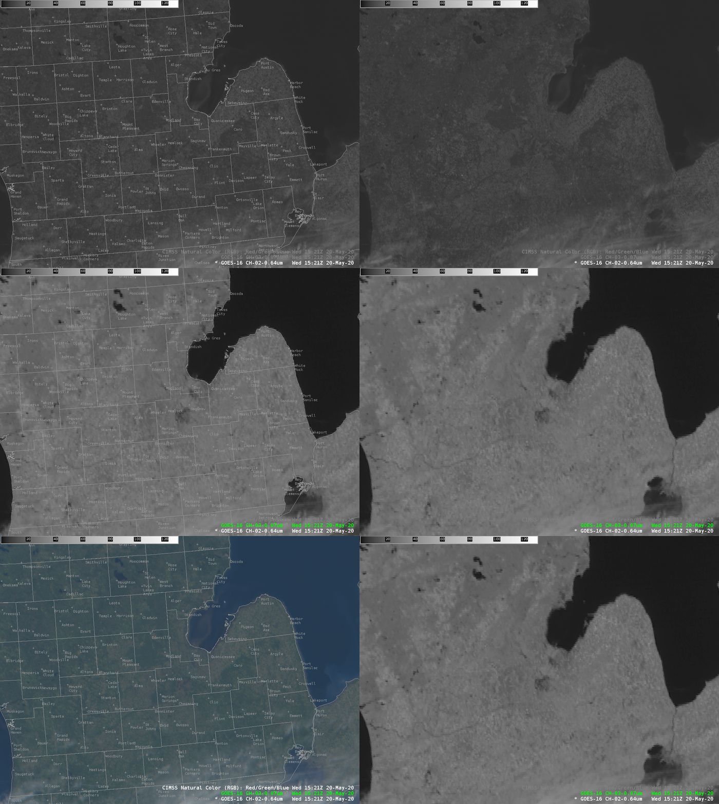
GOES-16 ABI Band 2 (0.64 µm), Band 3 (0.86 µm) and CIMSS Natural Color at 1521 UTC on 20 May 2020 (Click to enlarge)
Dam failures in central lower Michigan along the Tittabawassee River (one of the rivers in the Saginaw Bay basin) caused extensive flooding on 20 May 2020 in Midland County, including the city of Midland. Much of this region received between 4 and 5 inches of rain in the past week (analysis, from this site). The Tittabawassee River gauge at Midland (shown here, from this site), was projected to exceed its previous maximum by 4 feet (It ended up exceeding it by just over 1 foot). The heavy rains have produced a notable silt plume into Saginaw Bay in the imagery above (a plume that is rotating cyclonically).
GOES-16’s Advanced Baseline Imager (ABI) has spatial and spectral resolution to identify flooded regions near Midland, as shown in the imagery above from 1521 UTC on 20 May. Of special note are the dark pixels very close to Midland MI in the 0.86 µm imagery (shown here with a map) Water is more reflective in the visible (0.64 µm) than in the near-infrared (0.86 µm) (Compare the darkness of Lake Huron in those two channels) so when areas are flooded, they acquire a darker reflectance value. A more zoomed-in toggle, below, between Visible (0.64 µm) and 0.86 µm imagery highlights the reflectance differences near Midland where flooding is occurring. Flooded regions are also apparent south of Saginaw, to the south and east of Midland County.

GOES-16 VIsible (0.64 µm) and Near-Infrared (0.86 µm) at 1521 UTC on 20 May 2020. Midland County is outlined. (Click to enlarge)
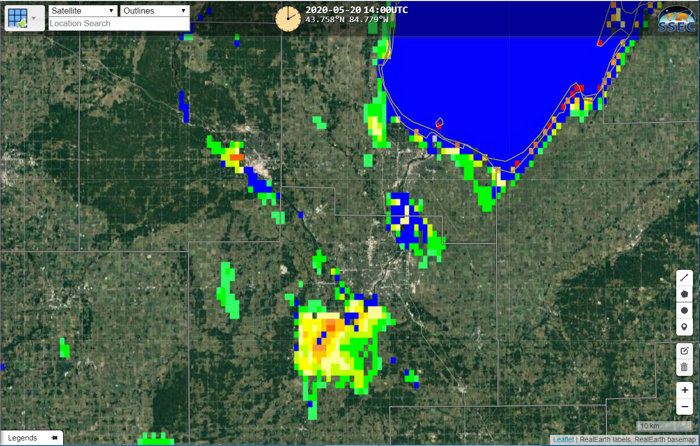
Real Earth includes Flood Products that are derived from ABI and from the VIIRS Instrument (the Visible-Infrared Imaging Radiometer Suite) on NOAA-20 and Suomi NPP. The ABI-only product, below, taken from that site, shows the regions of flooding.
This link (courtesy Tim Schmit, NOAA/CIMSS) compares Band 3 (0.86 µm) imagery from before and during the flood (13 and 20 May 2020). VIIRS true-color imagery, below, processed at the Direct Broadcast antenna at CIMSS, also show the changes from 13 May to 20 May.

VIIRS True Color Imagery over and near Saginaw Bay in lower Michigan on 13 and 20 May 2020 (click to enlarge)
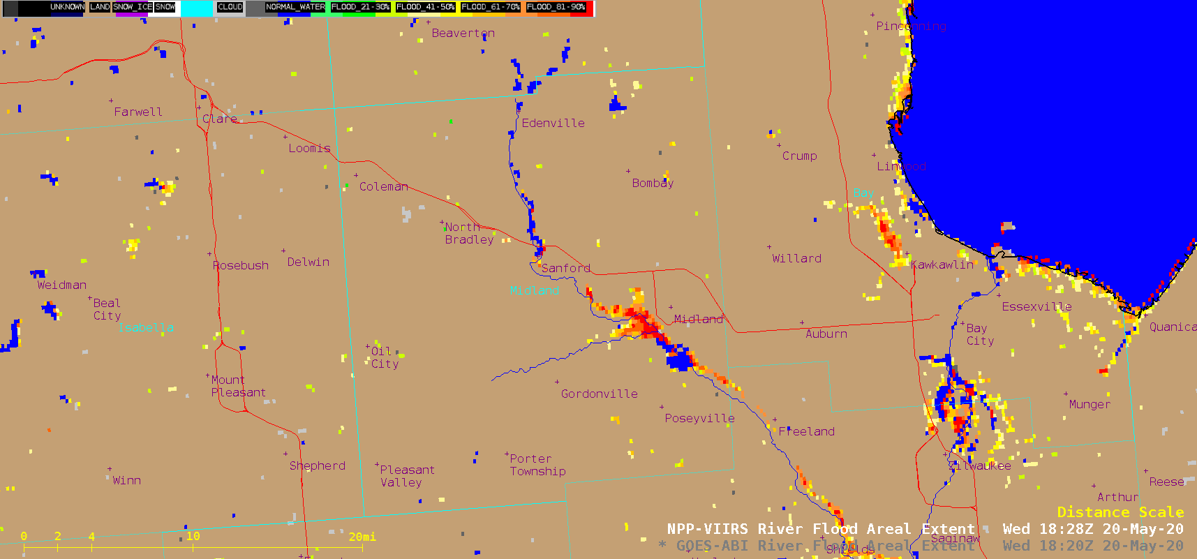
The Flood Areal Extent processed from VIIRS data is shown below. Both ABI and VIIRS products are available via LDM feed (in addition to being available in Real Earth and in GeoNETCAST). The Project Website is here. Tim Schmit has created a slider between the ABI and VIIRS flood product here.
The National Weather Service in Detroit is issuing flood warnings for this event. Midland County is in their County Warning Area.
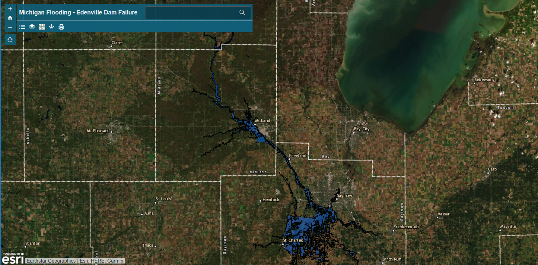
Shane Hubbard at UW-Madison/CIMSS has created an arcGIS website that shows the areal extent of the flooding. That site is here. A screen capture is shown below.
Satellite detection of this event is also discussed here.


