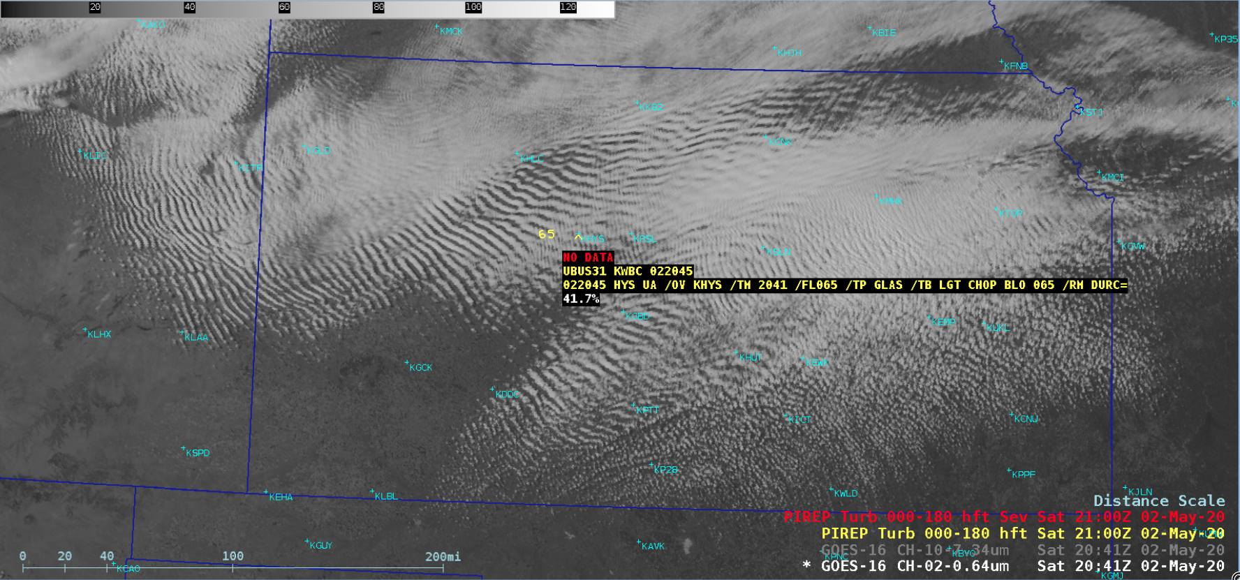
Boundary layer wave clouds over Kansas

GOES-16 “Red” Visible (0.64 µm) images, with plots of pilot reports of turbulence and AIRMET boundaries [click to play animation | MP4]
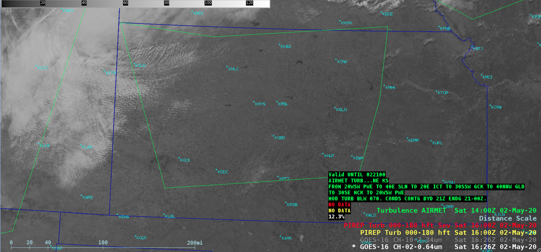
There was also a subtle signature of these waves seen in GOES-16 Low-level Water Vapor (7.3 µm) images (below).
![GOES-16 Low-level Water Vapor (7.3 µm) images, with plots of pilot reports of turbulence and AIRMETs boundaries [click to play animation | MP4]](https://cimss.ssec.wisc.edu/satellite-blog/images/2020/05/200502_goes16_waterVapor_pireps_KS_waves_anim.gif)
GOES-16 Low-level Water Vapor (7.3 µm) images, with plots of pilot reports of turbulence and AIRMETs boundaries [click to play animation | MP4]