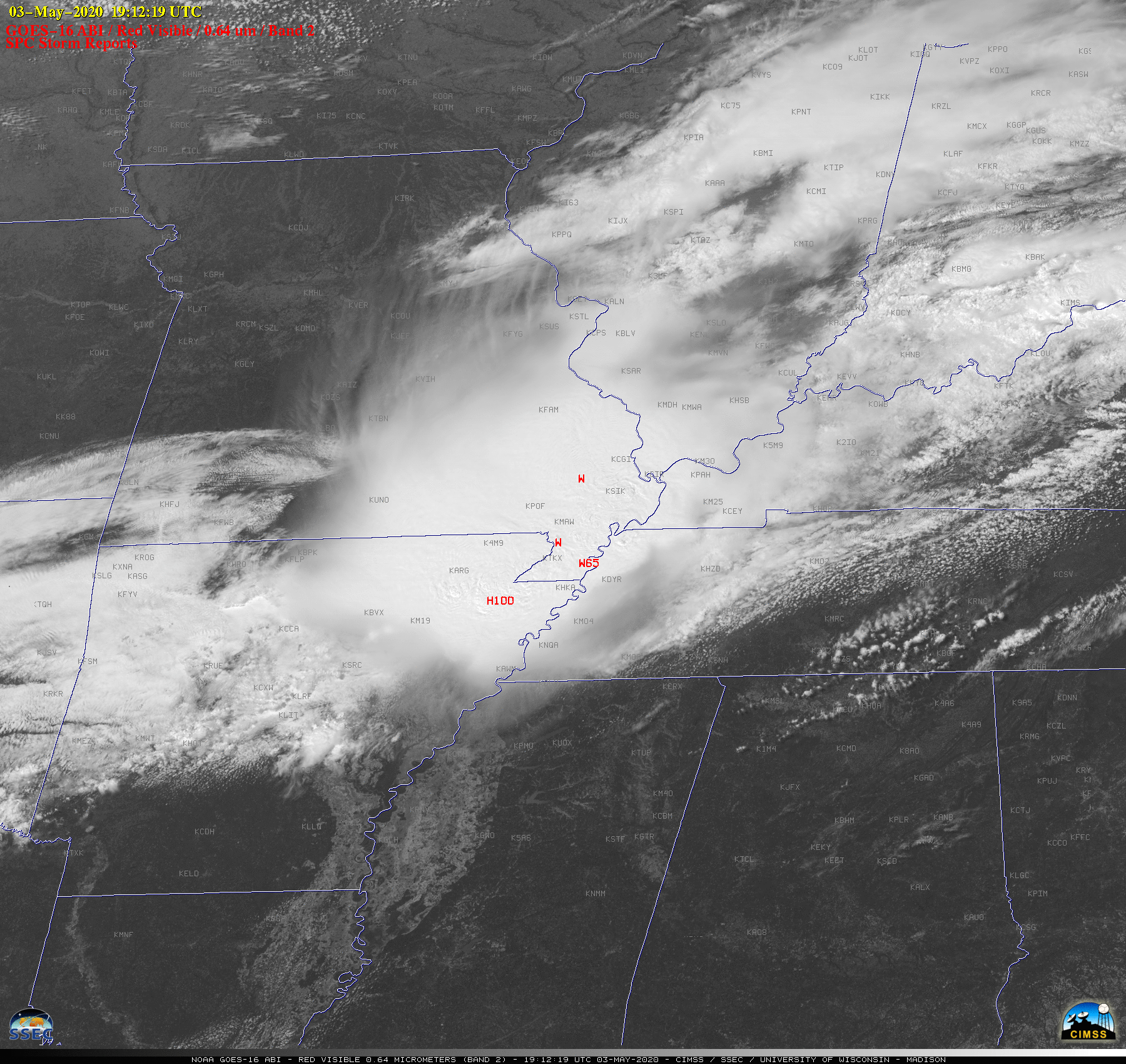
Derecho causing severe weather from the Midwest to the Mid-South

GOES-16 “Red” Visible (0.64 µm) images, with time-matched SPC Storm Reports plotted in red [click to play animation | MP4]
The corresponding GOES-16 “Clean” Infrared Window (10.35 µm) images are shown below. Pulsing overshooting tops exhibited cloud-top infrared brightness temperatures around -70ºC (black enhancement).
![GOES-16 "Clean" Infrared Window (10.35 µm) images, with SPC Storm Reports plotted in cyan [click to play animation | MP4]](https://cimss.ssec.wisc.edu/satellite-blog/images/2020/05/G16_IR_DERECHO_SPC_03MAY2020_B13_2020124_191219_GOES-16_0001PANEL_FRAME00343.GIF)
GOES-16 “Clean” Infrared Window (10.35 µm) images, with time-matched SPC Storm Reports plotted in cyan [click to play animation | MP4]
![NOAA-20 VIIRS Visible (0.64 µm) and Infrared Window (11.45 µm) images, with plots of available NUCAPS sounding points [click to enlarge]](https://cimss.ssec.wisc.edu/satellite-blog/images/2020/05/200503_1931utc_noaa20_viirs_visible_infrared_nucaps_mcs_anim.gif)
NOAA-20 VIIRS Visible (0.64 µm) and Infrared Window (11.45 µm) images, with plots of available NUCAPS sounding points [click to enlarge]
![Temperature and dew point profiles for the NUCAPS sounding point south-southeast of Jackson,Tennessee [click to enlarge]](https://cimss.ssec.wisc.edu/satellite-blog/images/2020/05/200503_19utc_nucaps_profile_kmkl.png)
Temperature and dew point profiles for the NUCAPS sounding point south-southeast of Jackson,Tennessee [click to enlarge]
Journey of a long-lived damaging mesoscale convective system (aka derecho) from the plains to the south today. #GOESEast split window IR and cold cloud top filtered longwave IR imagery, 17 hour lapse. Feature following zoom 40kts@098 @NOAASatellites @GOESguy pic.twitter.com/Ndp9iFnyXP
— William (@ChurchillWx) May 4, 2020

