Typhoon Melor: Is it generating a PRE?
Tropical Systems can occasionally be accompanied by Predecessor Rainfall Events (PREs). This band of heavy rainfall is not associated with the spiral bands of the tropical system, but rather with an interaction with a mid-latitude jet that exists Poleward of the tropical feature. Some notable PRE-producing tropical systems in the United States include Hurricane Ike from 2008 and Hurricane Floyd from 1994. Accumulated rainfall patterns from Ike and from Floyd show very heavy rains far removed from the landfall; in Ike’s case, over northwestern Indiana, and in Floyd’s case over Connecticut and New York. In both cases, PREs have been identified as a likely rain producer.
Typhoon Melor has been approaching the northwestern corner of the tropical Pacific Ocean over the past several days. At the same time, a ribbon of moist air, as denoted by high Precipitable Water values diagnosed from MIMIC, extends southwestward from Japan towards the straight of Luzon (Note also in the Precipitable Water loop the presence of former Typhoon — now Tropical Storm Parma meandering within the straight of Luzon as well.
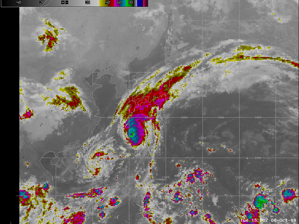
The 11-micron window channel imagery show a general blossoming of cold cloud tops in and around the ribbon air with high precipitable water as typhoon Melor approaches (Link here). Indeed, the last image in the loop, shown above in this post, bears a resemblance to the enhanced 11-micron GOES-8 image from landfall of Floyd.
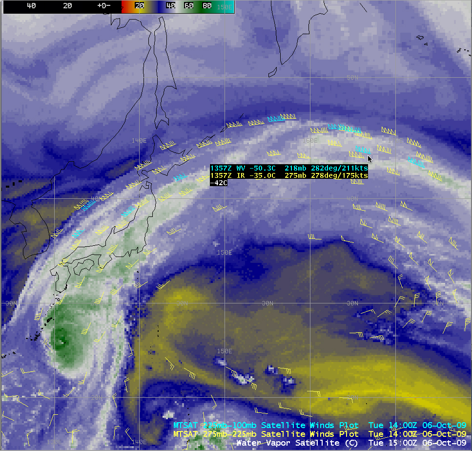
Is there evidence of a jet poleward of Melor that would support the development of the PRE? Consider the enhanced water vapor image from MTSAT below. The large gradient in brightness temperature — very warm values in and around Korea and the South China Sea northeastward to the Sea of Japan, and very cold temperatures to the east, suggest the presence of a strong jet. Plots of 300-hPa wind speeds confirm that; note the speeds exceeding 150 knots at Sapporo and at Nakashibetsu on the island of Hokkaido! The position of this jet is such that the left entrance region is supporting upward motion to help support heavy rain in a very moisture-rich atmosphere. (The GFS 00-h analysis at 1200 UTC 6 October shows this jet extending far out into the Pacific Ocean).
MTSAT atmospheric motion vectors or “satellite winds” (calculated by tracking satellite image features on 3 consecutive images) actually showed that wind speeds along the jet stream axis over the western Pacific Ocean were as high as 211 knots at the 218 mb level (below).
(Added: TRMM measurements of rainfall with Melor are here).


