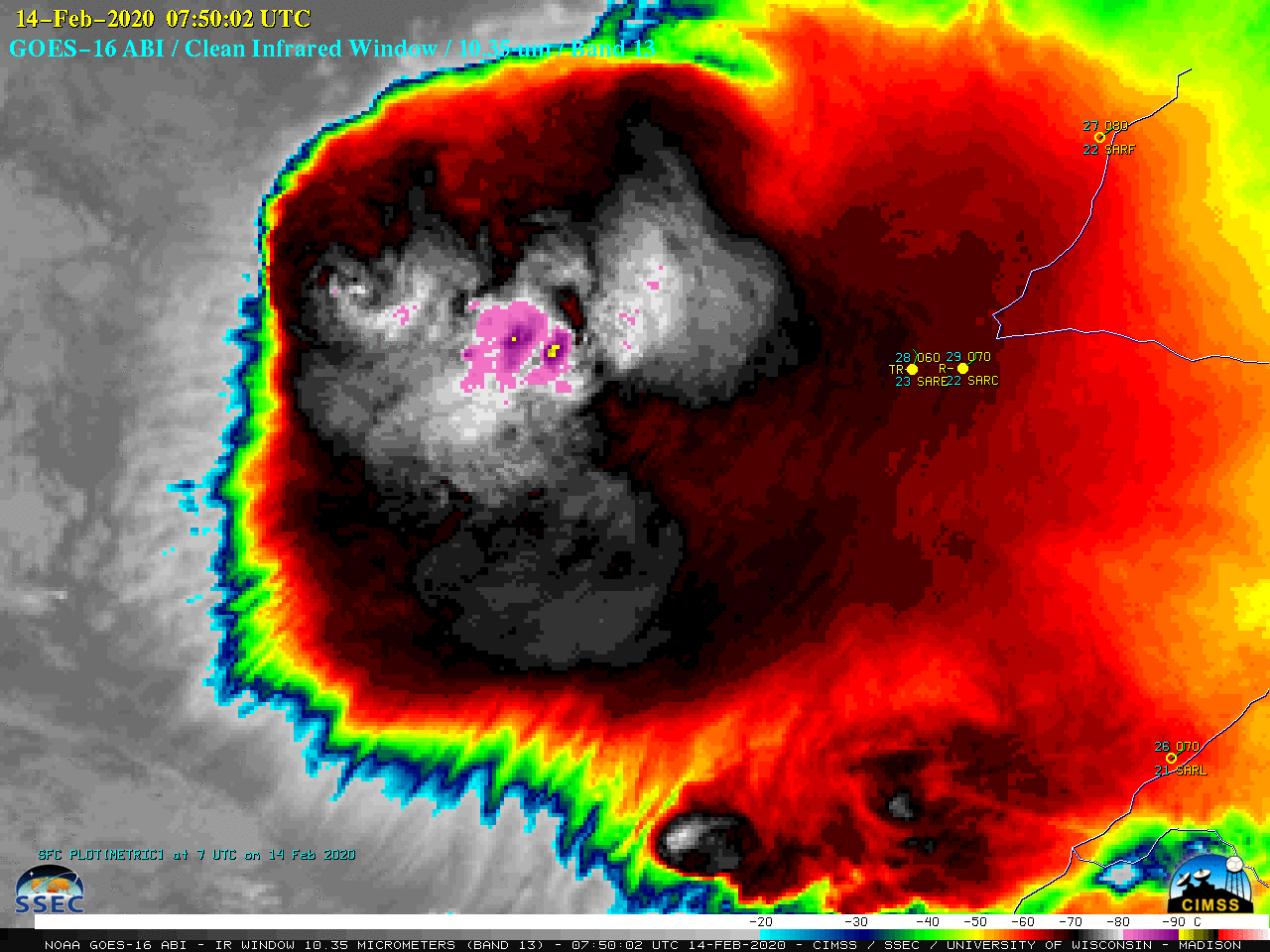
Mesoscale Convective System in Argentina

GOES-16 “Clean” Infrared Window (10.35 µm) images [click to play animation | MP4]
VIIRS Infrared Window (11.45 µm) images from NOAA-20 (at 0452 UTC) and Suomi NPP (at 0541 UTC) as viewed using RealEarth (below) revealed intricate patterns of cloud-top waves and radial banding.
![VIIRS Infrared Window (11.45 µm) images from NOAA-20 (at 0452 UTC) and Suomi NPP (at 0541 UTC) [click to enlarge]](https://cimss.ssec.wisc.edu/satellite-blog/images/2020/02/200214_noaa20_suomiNPP_viirs_infrared_Argentina_mcs_anim.gif)
VIIRS Infrared Window (11.45 µm) images from NOAA-20 (at 0452 UTC) and Suomi NPP (at 0541 UTC) [click to enlarge]
Plots of rawinsonde data from Córdoba, Argentina (below) — located not far southwest of the MCS — indicated a tropopause temperature of -74.7ºC at an altitude of 16.4 km on 14 February at 12 UTC.
You’ll have to add one @70_dbz… Here is a MCS over Argentina early this morn (0748 UTC). 18 km deep (according to GPM-DPR), with a -92 degC brightness temperature (according to GOES-16, on NASA Worldview). What. A. Beast. https://t.co/KkSVpETkuk pic.twitter.com/KJU3jieuCp
— Randy Chase (@DopplerChase) February 14, 2020


![Plots of available NUCAPS sounding points at 0341 UTC [click to enlarge]](https://cimss.ssec.wisc.edu/satellite-blog/images/2020/02/nucaps_arg-20200214_034135_sounding_points.png)
![NUCAPS profile north of the MCS [click to enlarge]](https://cimss.ssec.wisc.edu/satellite-blog/images/2020/02/200214_04utc_nucaps_profile_north.png)
![NUCAPS profile south of the MCS [click to enlarge]](https://cimss.ssec.wisc.edu/satellite-blog/images/2020/02/200214_0341utc_nucaps_profile_south.png)
![Plots of rawinsonde data from Córdoba, Argentina [click to enlarge]](https://cimss.ssec.wisc.edu/satellite-blog/images/2020/02/200213_200214_SACO_RAOBS.GIF)