Interesting circular contrail over South Dakota
![Multi-panel images of all 16 ABI spectral bands from GOES-16 [click to play animation | MP4]](https://cimss.ssec.wisc.edu/satellite-blog/images/2020/01/200129_goes16_16bands_SD_contrail_anim.gif)
Multi-panel images of all 16 ABI spectral bands from GOES-16 [click to play animation | MP4]
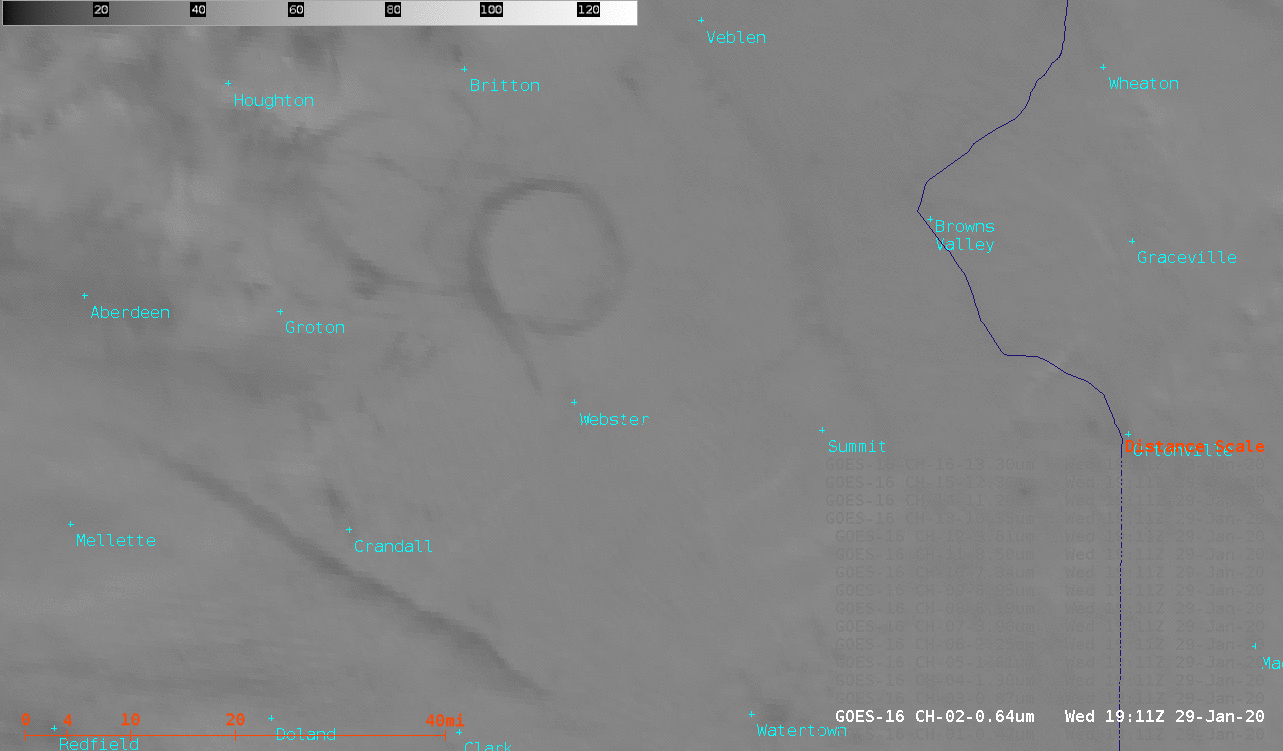
A sequence of GOES-16 ABI spectral band images covering that same 1751-2001 UTC time period (below) provided a larger view of the circular contrail — whose diameter was about 10-12 miles — along with a linear contrail located about 30 miles to the southwest.
![Sequence of GOES-16 ABI spectral band images [click to play animation | MP4]](https://cimss.ssec.wisc.edu/satellite-blog/images/2020/01/200129_goes16_SD_contrails_anim.gif)
Sequence of GOES-16 ABI spectral band images [click to play animation | MP4]
GOES-16 “Red” Visible (0.64 µm) and Near-Infrared “Cirrus” (1.37 µm) images at 1911 UTC [click to enlarge]
![Parallax correct vectors (green arrows) and magnitudes (red. in km) for cloud features at 15,000 feet and 30,000 feet over the CONUS domain [click to enlarge]](https://cimss.ssec.wisc.edu/satellite-blog/images/2020/01/GOES-16_CONUS_parallax_15kft_30kft_anim.gif)
Parallax correct vectors (green arrows) and magnitudes (red. in km) for cloud features at 15,000 feet and 30,000 feet over the CONUS domain [click to enlarge]
![Plots of rawinsonde data from Aberdeen, South Dakota [click to enlarge]](https://cimss.ssec.wisc.edu/satellite-blog/images/2020/01/200129_KABR_RAOBS.GIF)
Plots of rawinsonde data from Aberdeen, South Dakota [click to enlarge]
![GOES-16 Water Vapor weighting functions derived using rawinsonde data from Aberdeen, South Dakota [click to enlarge]](https://cimss.ssec.wisc.edu/satellite-blog/images/2020/01/200129_KABR_waterVapor_weightingFunctions_anim.gif)
GOES-16 Water Vapor weighting functions derived using rawinsonde data from Aberdeen, South Dakota [click to enlarge]