Severe weather across the Deep South

GOES-16 “Red” Visible (0.64 µm), with SPC Storm Reports plotted in red [click to play animation | MP4]
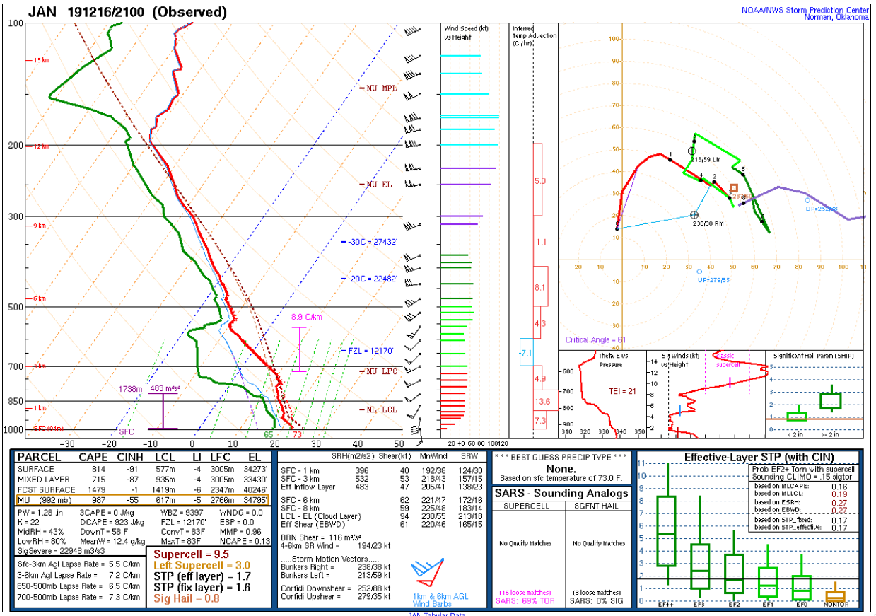
GOES-16 “Clean” Infrared Window (10.35 µm) images (below) indicated that many of the overshooting tops exhibited brightness temperatures as cold as -70ºC (darker black pixels) — which closely corresponded to the Most Unstable air parcel Maximum Parcel Level (MU MPL) calculated from 21 UTC rawinsonde data from Jackson, Mississippi.
![GOES-16 "Clean" Infrared Window (10.35 um), with SPC Storm Reports plotted in cyan [click to play animation | MP4]](https://cimss.ssec.wisc.edu/satellite-blog/wp-content/uploads/sites/5/2019/12/https://cimss.ssec.wisc.edu/satellite-blog/images/2019/12/191216_goes16_infrared_spcStormReports_Lower_Mississippi_Valley_anim.gif.gif)
GOES-16 “Clean” Infrared Window (10.35 µm), with SPC Storm Reports plotted in cyan [click to play animation | MP4]