Widespread fires across the Deep South
![GOES-16 Fire Temperature RGB, Shortwave Infrared (3.9 µm), Fire Temperature, Fire Power and Fire Area products [click to play animation | MP4]](https://cimss.ssec.wisc.edu/satellite-blog/wp-content/uploads/sites/5/2019/11/gulf_fire_t-20191119_173125.png)
GOES-16 Fire Temperature RGB, Shortwave Infrared (3.9 µm), Fire Temperature, Fire Power and Fire Area products [click to play animation | MP4]
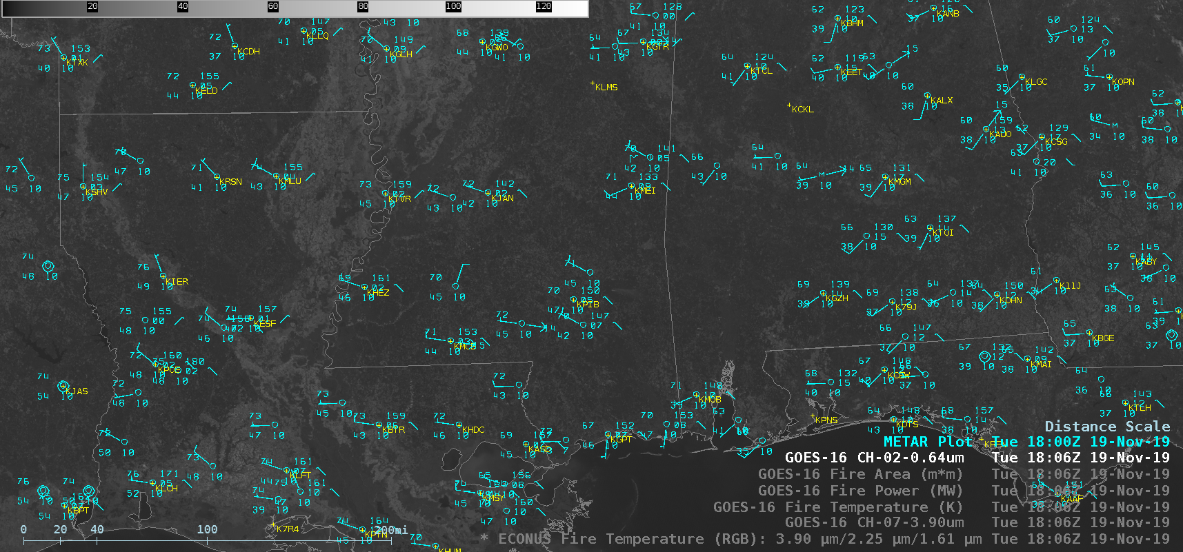
GOES-16 “Red” Visible (0.64 µm) images, with and without plots of surface observations, are shown below. While most of the fires were too small/brief to produce large smoke plumes, a prominent plume was associated with one of the hottest and most long-lived fires — which was likely a prescribed burn — in the Chickasawhay State Wildlife Management Area (located east of Hattiesburg/Laurel Airport KPIB) in southeastern Mississippi.

GOES-16 “Red” Visible (0.64 µm) images, with and without plots of surface observations [click to play animation | MP4]
Time series of surface observation data from Lafayette Regional Airport in Louisiana [click to enlarge]
![GOES-16 Shortwave Infrared (3.9 µm), Fire Temperature, Fire Power and Fire Area values at 1716 UTC [click to enlarge]](https://cimss.ssec.wisc.edu/satellite-blog/wp-content/uploads/sites/5/2019/11/191119_1716utc_goes16_MS_fire.png)
GOES-16 Shortwave Infrared (3.9 µm), Fire Temperature, Fire Power and Fire Area values at 1716 UTC [click to enlarge]


![GOES-16 Shortwave Infrared (3.9 µm), Fire Temperature, Fire Power and Fire Area values at 1731 UTC [click to enlarge]](https://cimss.ssec.wisc.edu/satellite-blog/wp-content/uploads/sites/5/2019/11/191119_1731utc_goes16_MS_fire.png)
![GOES-16 Shortwave Infrared (3.9 µm), Fire Temperature, Fire Power and Fire Area values at 1806 UTC [click to enlarge]](https://cimss.ssec.wisc.edu/satellite-blog/wp-content/uploads/sites/5/2019/11/191119_1806utc_goes16_MS_fire.png)