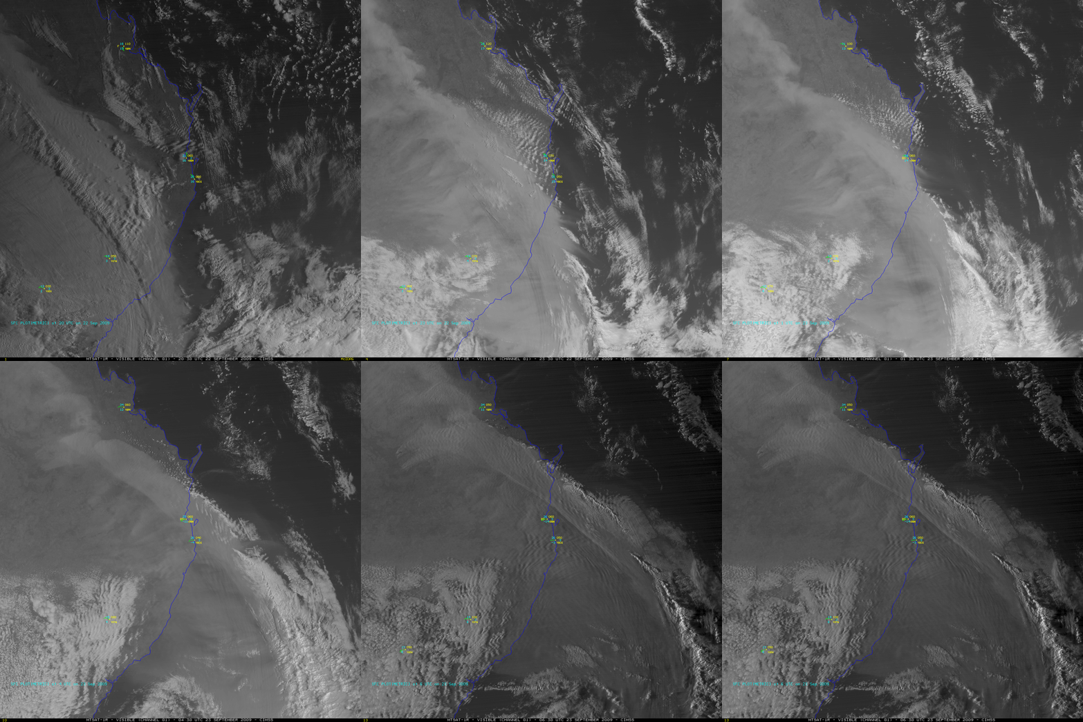
Dust storm over eastern Australia
One of the worst dust storms in the past 70 years swept across a large part of eastern Australia on 22 September – 23 September 2009 (Daily Mail Online photos). A sequence of MTSAT-1R visible images (above) showed the progression of the large dust cloud as it moved eastward during the daylight hours. Note the appearance of “lee waves” along the top of the dust cloud, as the strong winds interacted with the high terrain of the Great Dividing Range. An undular bore could also be seen forming out ahead of the cold front, over the offshore waters of the South Pacific Ocean.
The surface meteorogram for Brisbane, Australia (station identifier YBBN) is shown below; note that the surface visibility dropped to 0.2 km (0.1 mile) as the cold front passed, and following the frontal passage the dew point dropped from +16º C (61º F) to -16º C (+3º F).
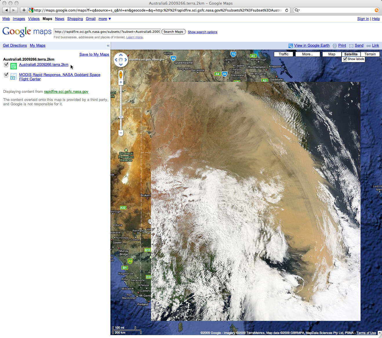
A larger-scale view of the dust cloud feature could be seen using MODIS true color imagery from the NASA MODIS Rapid Response site (below, viewed using Google Maps). See also the NASAÂ MODIS Image of the Day.


