Severe thunderstorms in the southern US
![GOES-16 “Clean” Infrared Window (10.35 µm) images, with SPC Storm Reports plotted in cyan [click to play animation | MP4]](https://cimss.ssec.wisc.edu/satellite-blog/wp-content/uploads/sites/5/2019/10/191020_goes16_infrared_spcStormReports_DFW_zoom_v2_anim.gif)
GOES-16 “Clean” Infrared Window (10.35 µm) images, with SPC Storm Reports plotted in cyan [click to play animation | MP4]
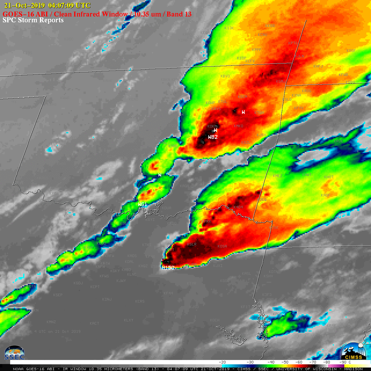
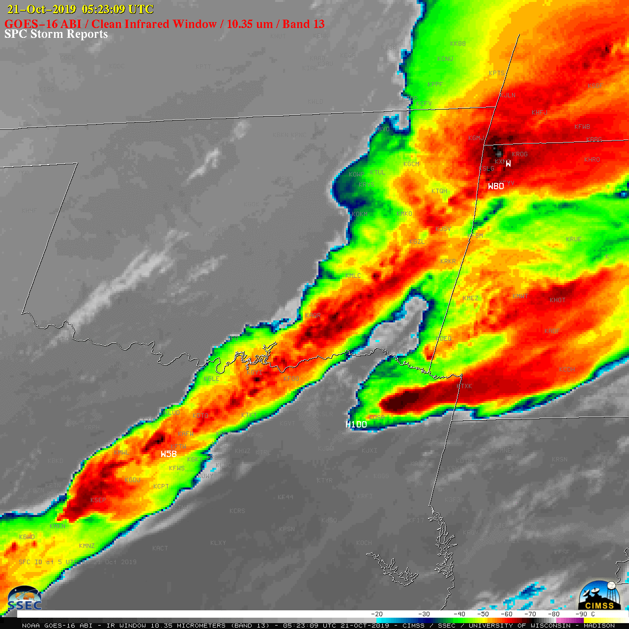
In a larger-scale view of GOES-16 Infrared images (below), other thunderstorms were seen that produced a variety of severe weather in other parts of Texas, Louisiana, Oklahoma, Arkansas and Missouri — including winds of 82 mph in Oklahoma and 80 mph in Arkansas. The rapidly-pulsing behavior of overshooting tops was well captured by the 1-minute imagery.
![GOES-16 “Clean” Infrared Window (10.35 µm) images, with SPC Storm Reports plotted in white [click to play animation | MP4]](https://cimss.ssec.wisc.edu/satellite-blog/wp-content/uploads/sites/5/2019/10/191020_goes16_infrared_spcStormReports_OK_TX_AR_LA_anim.gif)
GOES-16 “Clean” Infrared Window (10.35 µm) images, with SPC Storm Reports plotted in white [click to play animation | MP4]