Typhoon Hagibis south of Japan

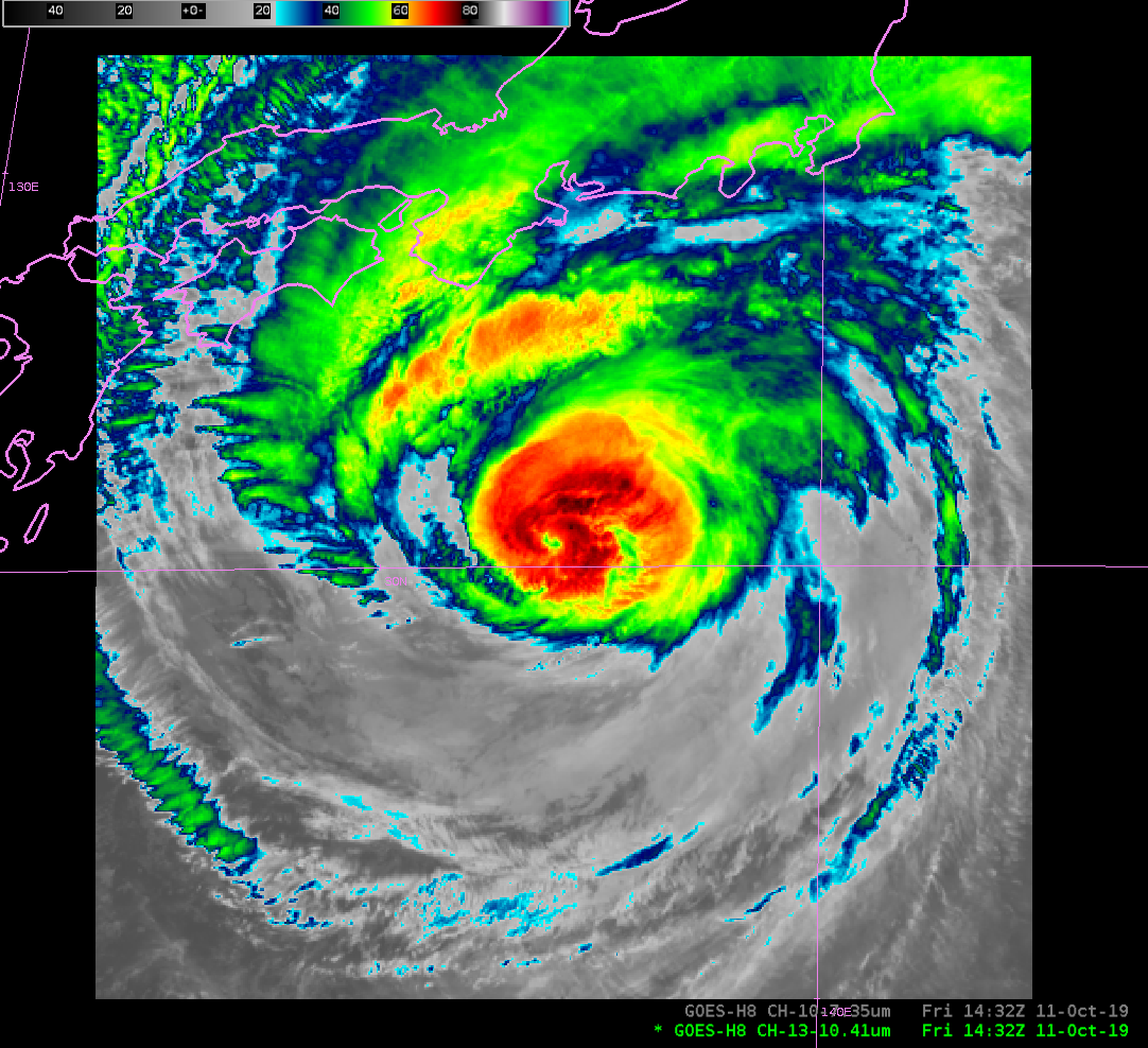
Himawari-8 Clean Window Infrared (10.41 µm) imagery every 2.5 minutes, from 1429 UTC to 1932 UTC on 11 October 2019. Imagery courtesy JMA (Click to animate)
Himawari-8 Advanced Himawari Imagery (AHI) from the ‘Target’ sector, above, show a strong albeit asymmetric storm south of Ise Bay and southwest of Tokyo Bay. Clean window infrared (10.41 µm) imagery, above, shows a compact eye that is cooling with time, suggesting weakening (and/or becoming more cloud-filled). Most of the cold clouds in the storm are north of the center, a distribution that suggests shear. However, the storm is still producing strong convection that is wrapping around the eye. By the end of the animation, at 1929 UTC, the eye is no longer distinct. This toggle compares the 1432 and 1929 UTC images. A decrease in storm cloud-top organization near the eye is apparent.
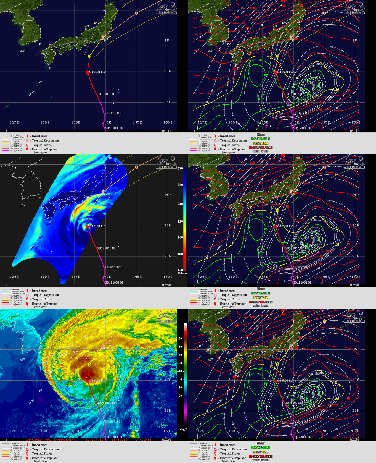
Data from the CIMSS Tropical Page at 1530 UTC on 11 October, shown below in a stepped animation, show southerly shear that will increase with time over the storm as it moves towards Japan. Microwave imagery (85 GHz) also suggest a sheared storm, as does the infrared imagery. Low-level water vapor imagery (7.3 µm), here), shows dry air (yellows in the color enhancement chosen) prevalent over the southern half of the storm. These data suggest that a slow extratropical transition is underway.

Past and Predicted path of Hagibis, Observed Shear at 1500 UTC, the latest 85 GHz image over the storm, and Infrared window imagery at 1530 UTC. (Click to enlarge) All imagery from the CIMSS Tropical Page.
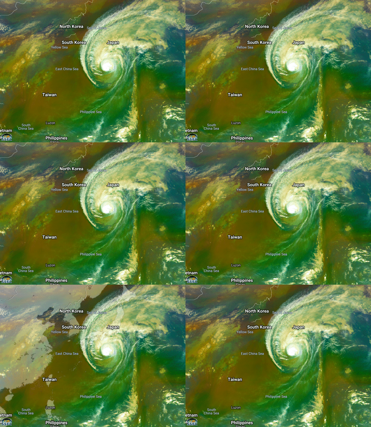
The Airmass RGB image over the Pacific Basin, (animation), (from this site at CIRA) also shows dry air consistent with a transition from tropical to extratropical. The zoomed-in image of the Airmass RGB, below, from Real Earth, shows the dry air as shades or orange/copper southwest of the storm, in contrast to the deep tropical moisture, feeding into the storm from the south, that is greener.
The Joint Typhoon Warning Center has the latest on Hagibis. A projected path valid at 1500 UTC 11 October is here.
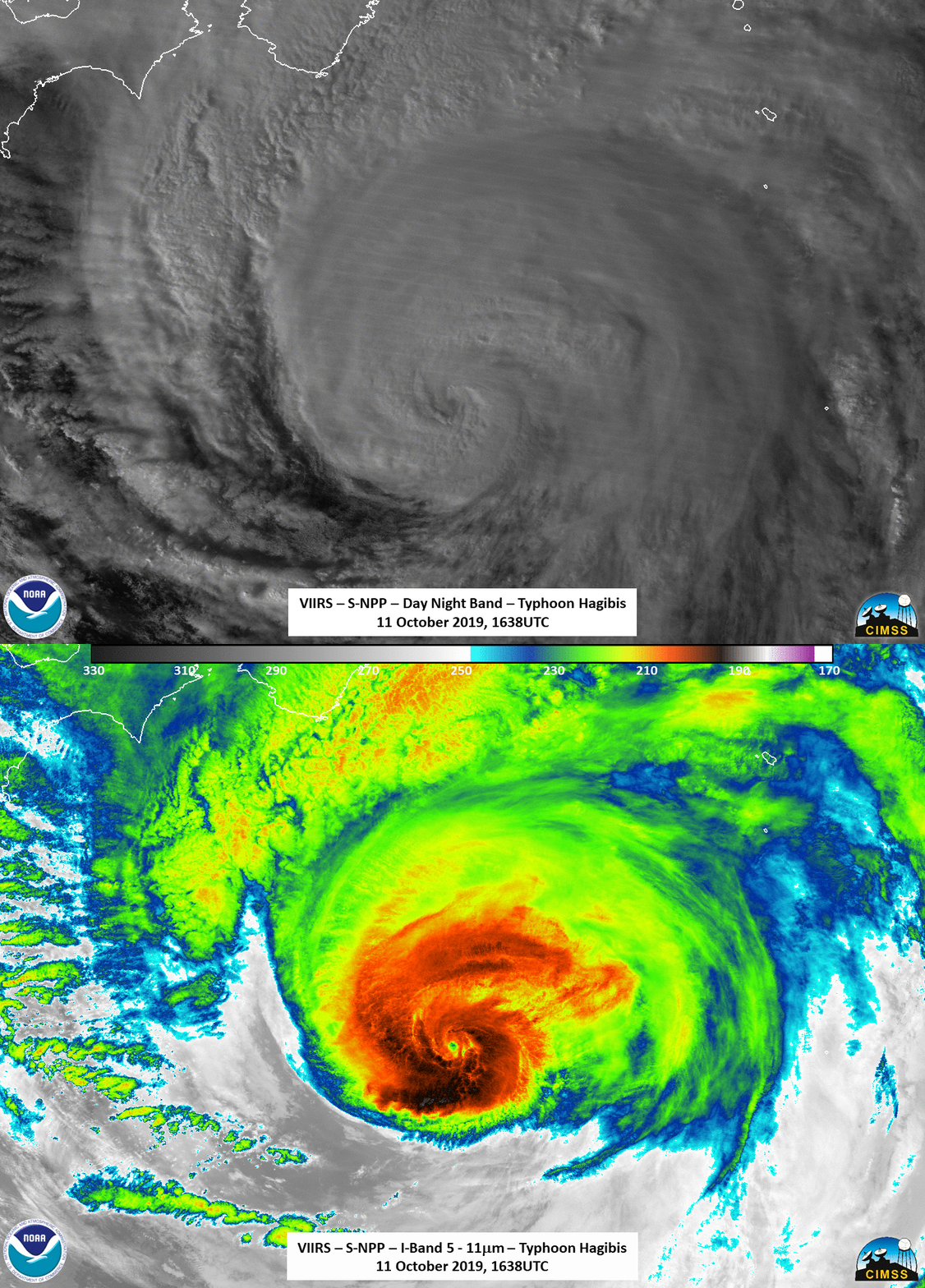
Suomi NPP overflew Hagibis at 1639 UTC on 11 October. The toggle below shows the Day Night Band (0.7 µm Visible imagery) and the 11.45 µm infrared imagery from the Visible Infrared Imaging Radiometer Suite (VIIRS) Instrument. A larger-scale view of the Day Night Band is here. (Imagery courtesy William Straka, CIMSS)


