Severe thunderstorms in the Upper Midwest
![GOES-16 “Clean” Infrared Window (10.35 µm) images, with SPC Storm Reports plotted in cyan [click to play animation | MP4]](https://cimss.ssec.wisc.edu/satellite-blog/wp-content/uploads/sites/5/2019/09/190924_goes16_infrared_spcStormReports_Upper_Midwest_anim.gif)
GOES-16 “Clean” Infrared Window (10.35 µm) images, with SPC Storm Reports plotted in cyan [click to play animation | MP4]
The corresponding 1-minute GOES-16 “Red” Visible (0.64 µm) images leading up to sunset are shown below.
![GOES-16 “Red” Visible (0.64 µm) images, with SPC Storm Reports plotted in red [click to play animation | MP4]](https://cimss.ssec.wisc.edu/satellite-blog/wp-content/uploads/sites/5/2019/09/190924_goes16_visible_spcStormReports_Upper_Midwest_anim.gif)
GOES-16 “Red” Visible (0.64 µm) images, with SPC Storm Reports plotted in red [click to play animation | MP4]
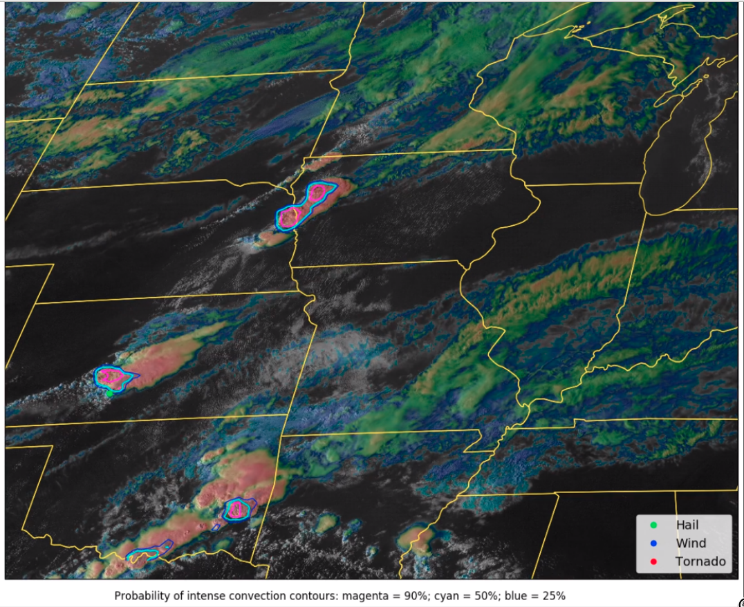
“Probability of intense convection” model [click to play MP4 animation]