Largest hailstone on record for the state of Colorado
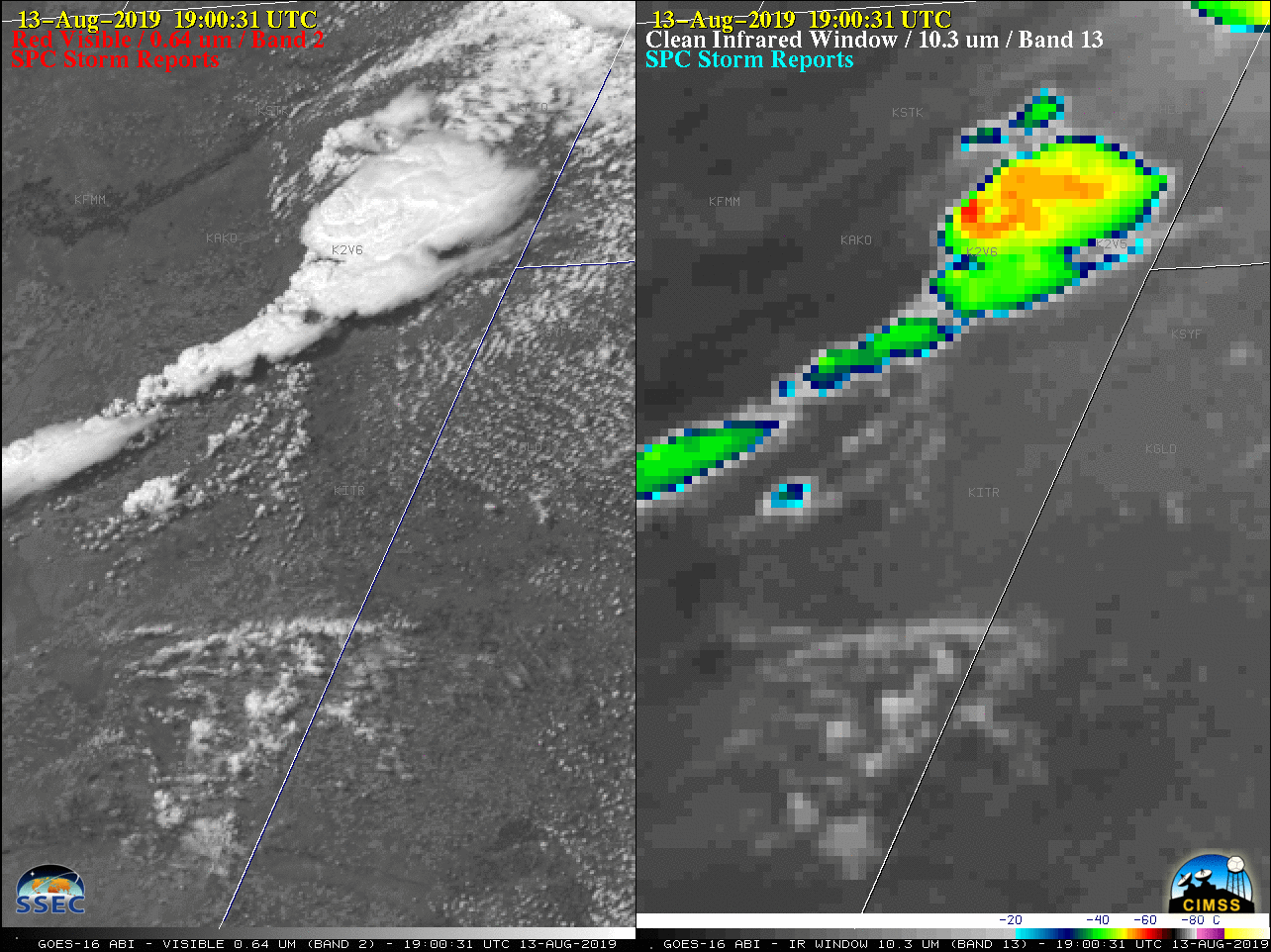
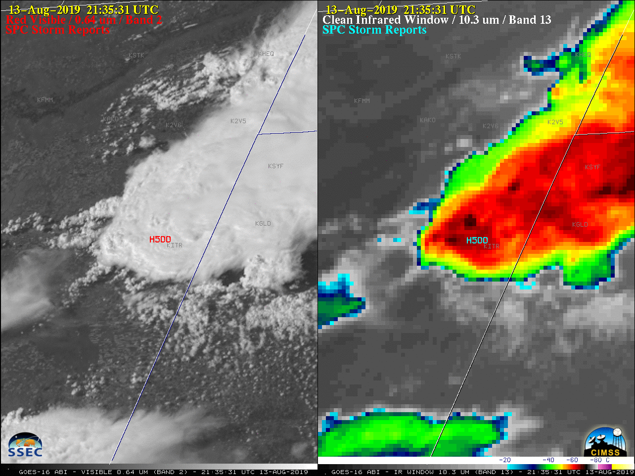
GOES-16 “Red” Visible (0.64 µm, left) and “Clean” Infrared Window (10.35 µm, right) images, with plots of SPC Storm Reports [click to play animation | MP4]
@NWSBoulder @NWSGoodland I am verifying what looks to be a record setting hailstone for #cowx Am told this fell near Bethune this afternoon. Would easily beat the 4.5″ record… Given the way the radar looked, I wouldn’t be surprised. Stay tuned! pic.twitter.com/LiUazILn6r
— Brian Bledsoe (@BrianBledsoe) August 13, 2019
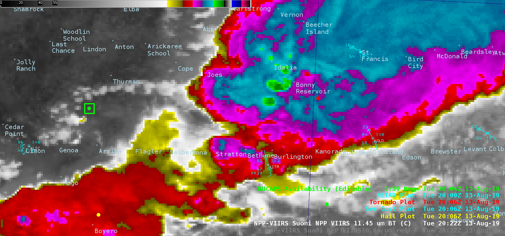
A toggle between NOAA-20 VIIRS Visible (0.64 µm) and Infrared Window (11.45 µm) images (below) showed the storms at 2022 UTC — just over an hour before the 5.00-inch hail report at 2135 UTC. Note that the NOAA-20 images are incorrectly labelled as Suomi NPP.
![NOAA-20 Visible (0.64 µm) and Infrared Window (11.45 µm) images, with NUCAPS sounding locations and surface reports [click to enlarge]](https://cimss.ssec.wisc.edu/satellite-blog/wp-content/uploads/sites/5/2019/08/190813_2022utc_noaa20_viirs_visible_infrared_nucaps_CO_KS_anim.gif)
NOAA-20 VIIRS Visible (0.64 µm) and Infrared Window (11.45 µm) images, with NUCAPS sounding locations and surface reports [click to enlarge]
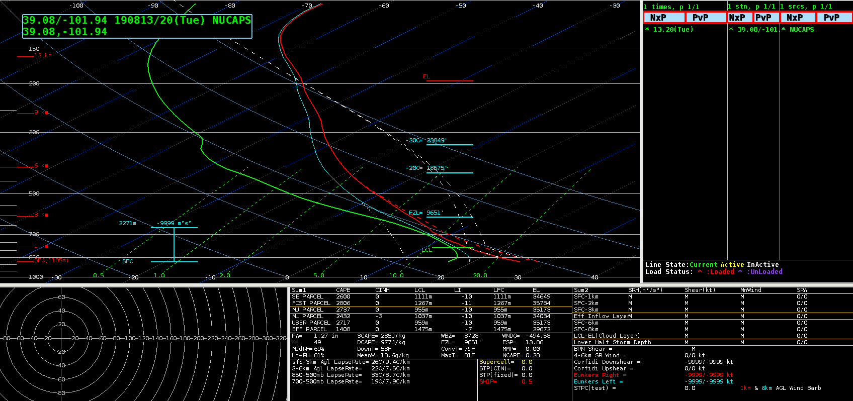
NOAA-20 NUCAPS profile in far western Kansas [click to enlarge]
![NOAA-20 NUCAPS profile in eastern Colorado [click to enlarge]](https://cimss.ssec.wisc.edu/satellite-blog/wp-content/uploads/sites/5/2019/08/190813_20utc_co_nucaps_profile_orig.png)
NOAA-20 NUCAPS profile in eastern Colorado [click to enlarge]
===== 14 August Update =====
NWS Goodland Public Information Statement.
Preliminary results from NWS Goodland and @ColoradoClimate survey. These results will undergo final review for an official measurement. pic.twitter.com/2E279DeTsa
— NWS Goodland (@NWSGoodland) August 14, 2019
Update: along with @NWSGoodland, today we measured the hailstone that fell NW of Bethune, CO on Tuesday, 13 August. The maximum diameter was 4.83″, which exceeds the long-standing state record of 4.5″. (1/2) #cowx
— ColoClimateCenter (@ColoradoClimate) August 14, 2019