Severe thunderstorms in Minnesota
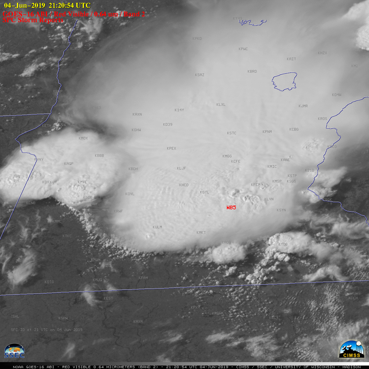
![GOES-16 “Red” Visible (0.64 µm) images, with SPC Storm Reports plotted in red [click to play animation | MP4]](https://cimss.ssec.wisc.edu/satellite-blog/wp-content/uploads/sites/5/2019/06/190604_goes16_visible_spcStormReports_MN_anim.gif)
GOES-16 “Red” Visible (0.64 µm) images, with SPC Storm Reports plotted in red [click to play animation | MP4]
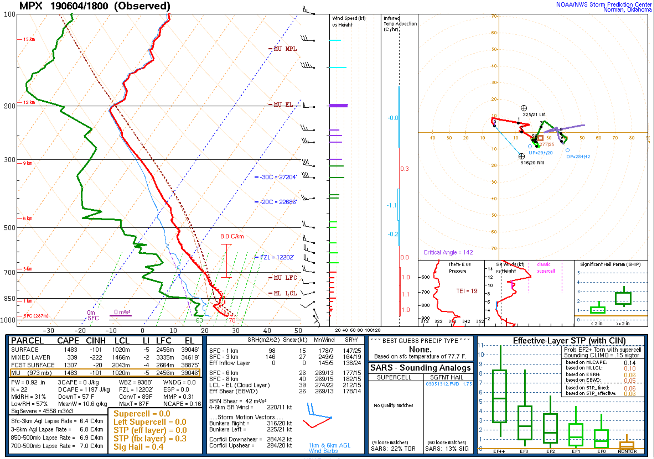
The corresponding GOES-16 “Clean” Infrared Window (10.35 µm) images (below) revealed overshooting tops with infrared brightness temperatures as cold as -70ºC — which corresponded to an air parcel rising to altitude around 13 km according to 18 UTC rawinsonde data from Chanhassen, Minnesota.
![GOES-16 “Clean” Infrared Window (10.35 µm) images, with SPC Storm Reports plotted in cyan [click to play animation | MP4]](https://cimss.ssec.wisc.edu/satellite-blog/wp-content/uploads/sites/5/2019/06/190604_goes16_infrared_spcStormReports_MN_anim.gif)
GOES-16 “Clean” Infrared Window (10.35 µm) images, with SPC Storm Reports plotted in cyan [click to play animation | MP4]