Severe Thunderstorms with Above-Anvil Cirrus Plumes over Texas
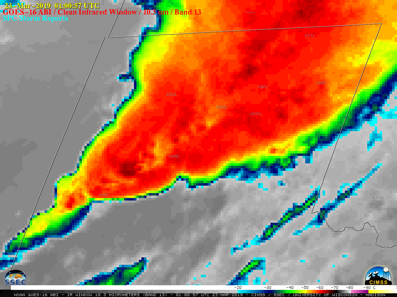
![GOES-16 "Clean" Infrared Window (10.3 µm) images, with SPC storm replorts plotted in cyan [click to play animation | MP4]](https://cimss.ssec.wisc.edu/satellite-blog/wp-content/uploads/sites/5/2019/03/190322_goes16_visible_infrared_spcStormReports_TX_anim.gif)
GOES-16 “Red” Visible (0.64 µm, left) and “Clean” Infrared Window (10.3 µm, right) images, with SPC storm reports plotted in red/cyan [click to play animation | MP4]
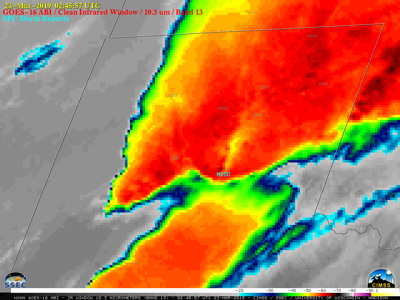
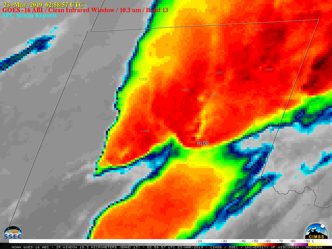
GOES-16 “Clean” Infrared Window (10.3 µm) images, with SPC storm reports plotted in cyan [click to play animation | MP4]
![Plot of 00 UTC rawinsonde data from Amarillo, Texas [click to enlarge]](https://cimss.ssec.wisc.edu/satellite-blog/wp-content/uploads/sites/5/2019/03/190323_00utc_kama_raob.png)
Plot of 00 UTC rawinsonde data from Amarillo, Texas [click to enlarge]
![GOES-16 "Red" Visible (0.64 µm) and Near-infrared "Snow/Ice" (1.61 µm) imagery [click to play animation | MP4]](https://cimss.ssec.wisc.edu/satellite-blog/wp-content/uploads/sites/5/2019/03/190323_goes16_visible_snowIce_TX_hail_swath_anim.gif)
GOES-16 “Red” Visible (0.64 µm) and Near-infrared “Snow/Ice” (1.61 µm) imagery [click to play animation | MP4]
![GOES-16 Land Surface Temperature product at 1402 and 1502 UTC [click to enlarge]](https://cimss.ssec.wisc.edu/satellite-blog/wp-content/uploads/sites/5/2019/03/190323_goes16_landSurfaceTemperature_TX_anim.gif)
GOES-16 Land Surface Temperature product at 1402 and 1502 UTC [click to enlarge]
![Suomi NPP VIIRS Day/Night Band (0.7 µm) image at 0748 UTC and GOES-16 "Red" Visible (0.64 µm) image at 1427 UTC [click to enlarge]](https://cimss.ssec.wisc.edu/satellite-blog/wp-content/uploads/sites/5/2019/03/190323_0748utc_viirs_dayNightBand_1427utc_goes16_visible_TX_hail_swath_anim.gif)
Suomi NPP VIIRS Day/Night Band (0.7 µm) image at 0748 UTC and GOES-16 “Red” Visible (0.64 µm) image at 1427 UTC [click to enlarge]