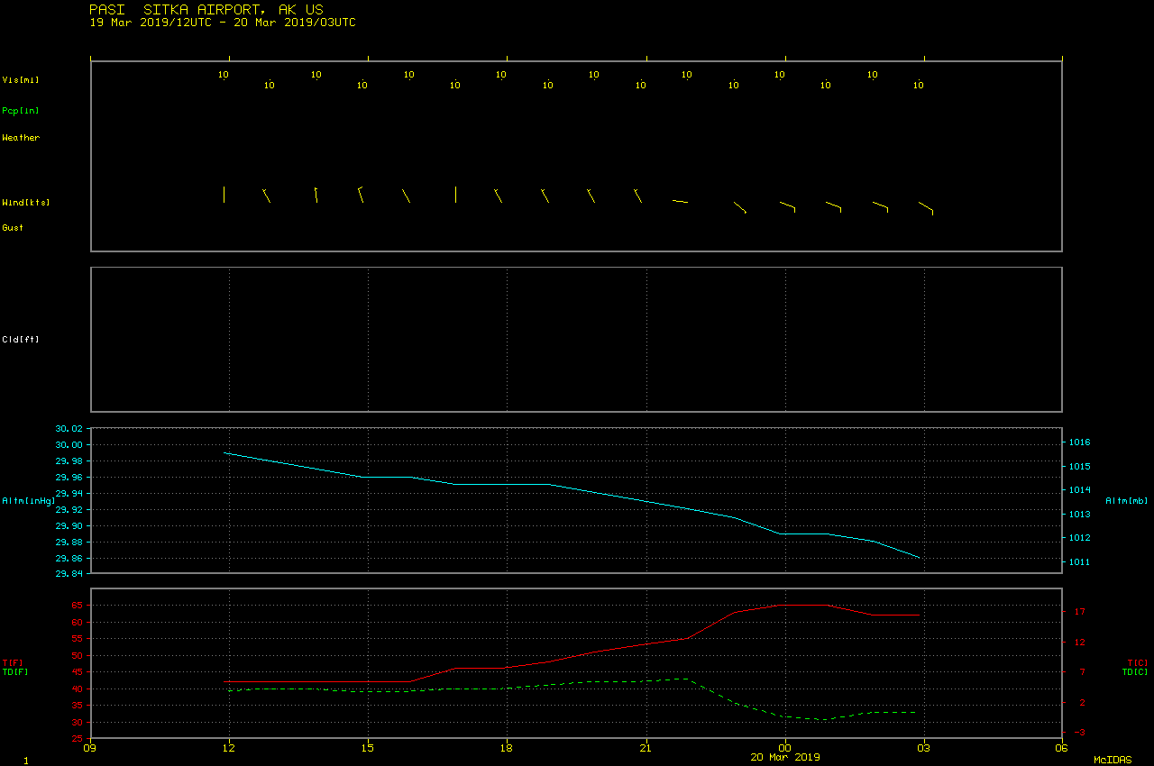
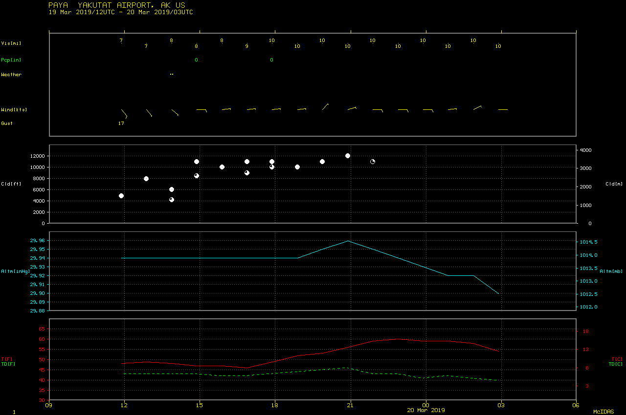
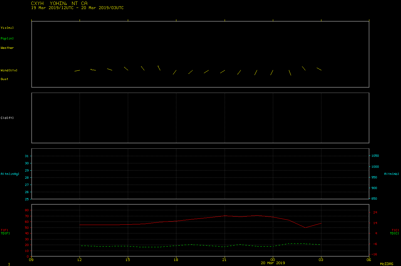
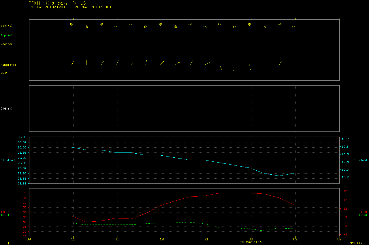
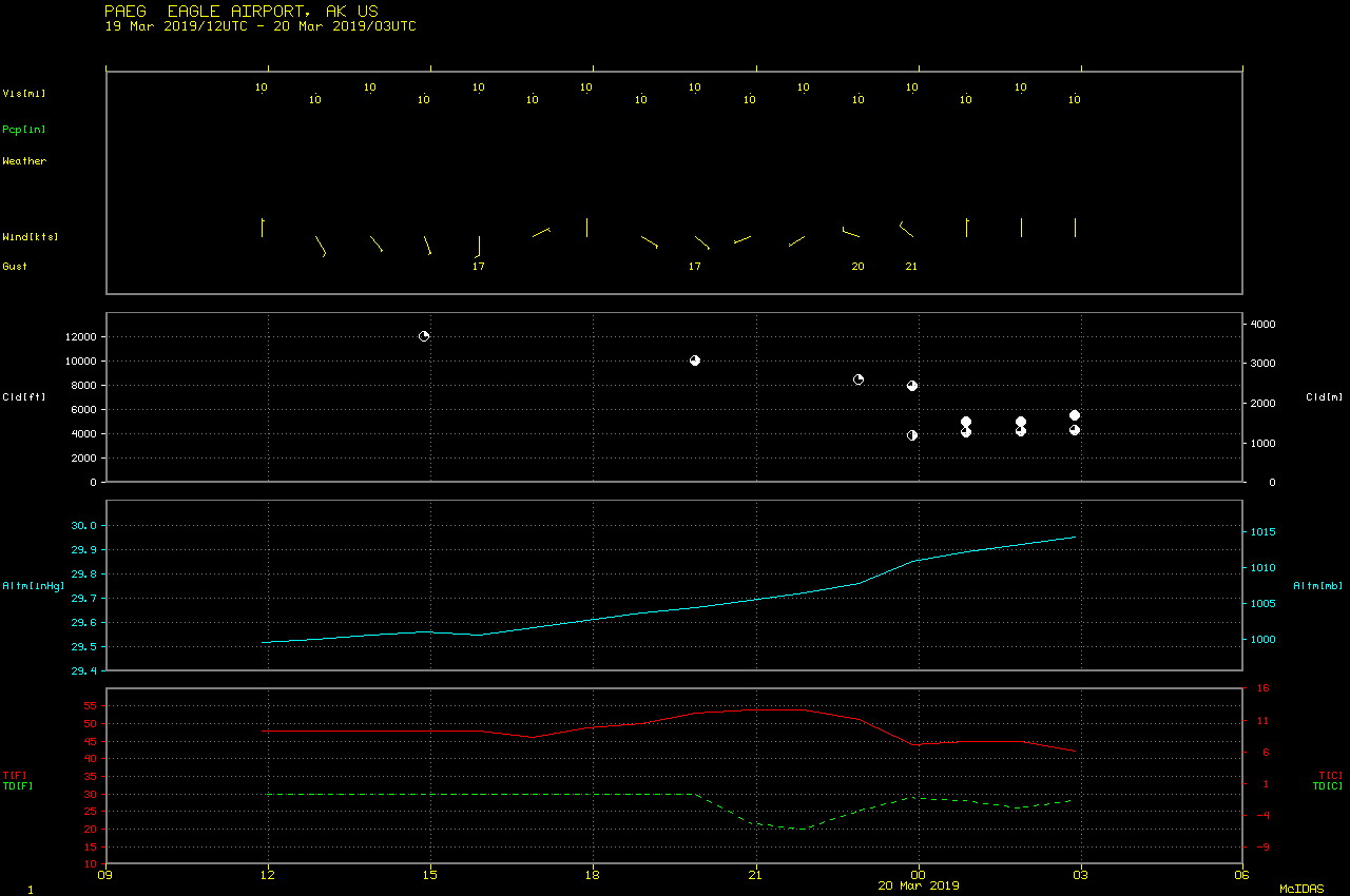
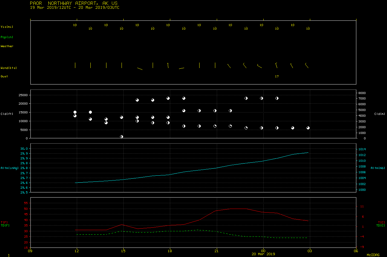
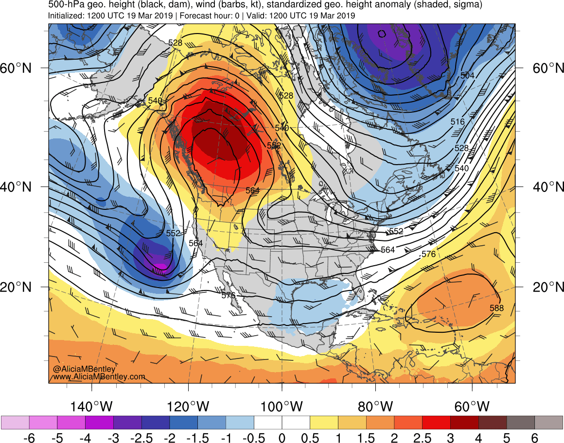
Record warmth in Alaska and Canada
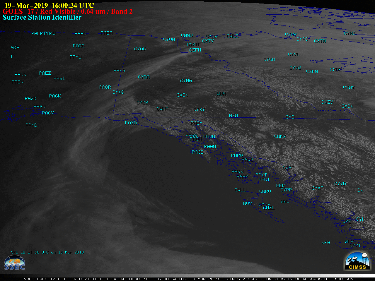
GOES-17 “Red” Visible (0.64 µm) images, with hourly surface temperatures plotted in cyan [click to play animation | MP4]
GOES-17 Air Mass RGB images from the AOS site (below) helped to highlight the anomalous mid-tropospheric ridge and warm lower-tropospheric temperatures over western North America — note the northwestward surge of green hues that are more characteristic of warm subtropical air masses south of the polar jet stream over the central Pacific Ocean. Note that GOES-17 was conducting a test of the Mode 6 scan schedule, so Full Disk images were available every 10 minutes.
![GOES-17 Air Mass RGB images [click to play animation | MP4]](https://cimss.ssec.wisc.edu/satellite-blog/wp-content/uploads/sites/5/2019/03/190319_goes17_airmassRGB_North_Pacific_anim.gif)
GOES-17 Air Mass RGB images [click to play animation | MP4]
Unreasonably hot: Here's a sampling (not complete) of March and seasonal all-time record high temps that have been set in the past few days in Alaska and northwest Canada. H/T @Pat_wx for great tweets on the Canadian records. #Arctic #akwx #ntwx #ykwx @Climatologist49 @DaveSnider pic.twitter.com/g1uFLVAzPb
— Rick Thoman (@AlaskaWx) March 20, 2019
Third day of record-smashing heat in the northwest yesterday. Up to 21.8°C in Yohin Lake, and several more March records were set or improved from previous days. Cooling down a bit today, but remaining much above normals all week. #Arctic #Yukon #NWT pic.twitter.com/vLH6luYrkW
— Patrick Duplessis (@Pat_wx) March 20, 2019