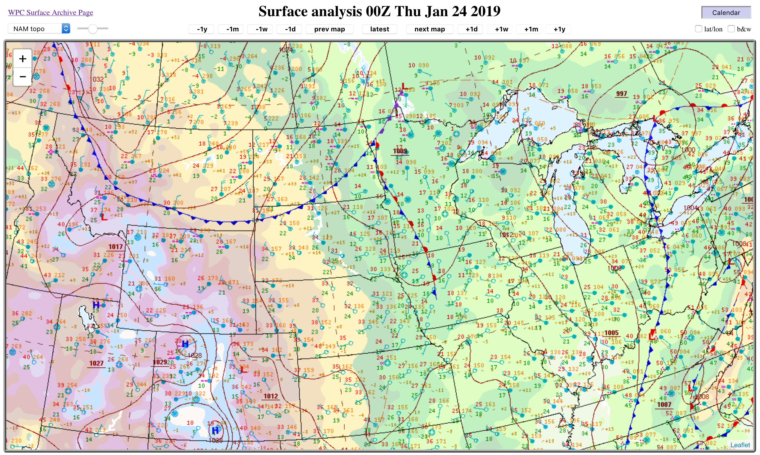
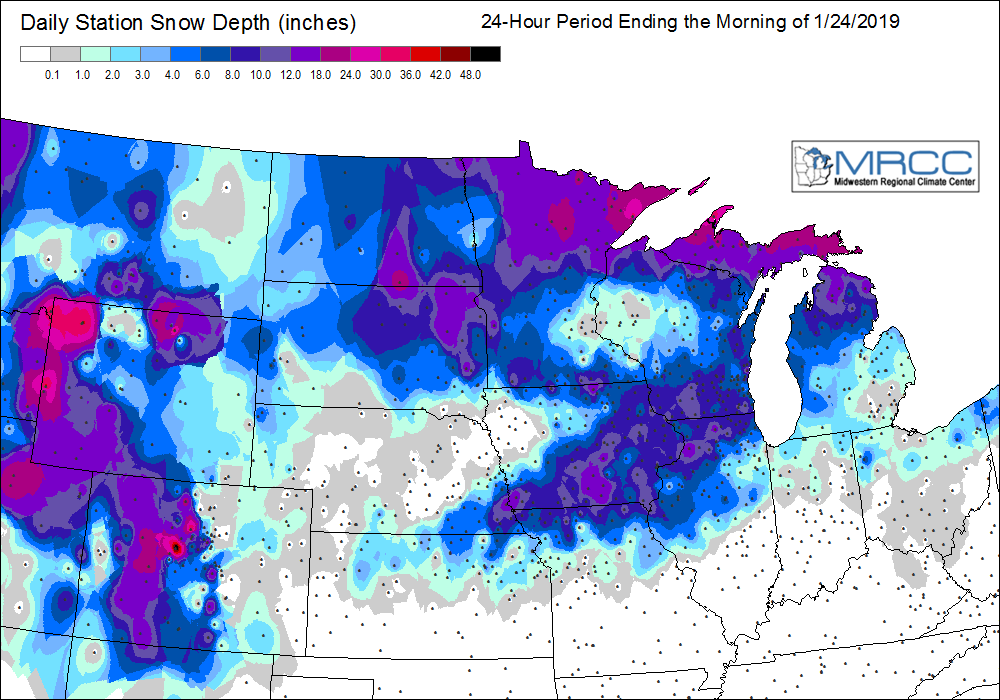
Blowing snow across the Upper Midwest
GOES-16 “Red” Visible (0.64 µm) and Near-Infrared “Snow/Ice” (1.61 µm) images [click to play MP4 animation]
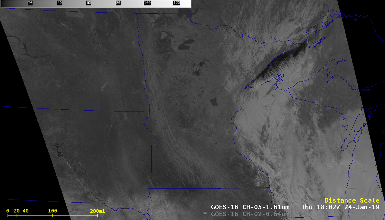
Animations of GOES-16 Visible and Snow/Ice images with plots of surface winds and weather type are shown below. ASOS sites report Haze (“H”) when the surface visibility — in this case, reduced by blowing snow — is less than 7 miles but greater than or equal to 4 miles. Some sites in Minnesota and Iowa reported a visibility between 0.5 and 2.0 miles at times (animation).
![GOES-16 "Red" Visible (0.64 µm) images, with hourly plots of surface wind barbs and weather type [click to play MP4 animation]](https://cimss.ssec.wisc.edu/satellite-blog/wp-content/uploads/sites/5/2019/01/G16_VIS_MIDWEST_BLSN_24JAN2019_2019024_180224_GOES-16_0001PANEL.GIF)
GOES-16 “Red” Visible (0.64 µm) images, with hourly plots of surface wind barbs and weather type [click to play MP4 animation]
![GOES-16 Near-Infrared "Snow/Ice" (1.61 µm) images, with hourly plots of surface wind barbs and weather type [click to play MP4 animation]](https://cimss.ssec.wisc.edu/satellite-blog/wp-content/uploads/sites/5/2019/01/G16_SNOWICE_MIDWEST_BLSN_24JAN2019_2019024_180224_GOES-16_0001PANEL.GIF)
GOES-16 Near-Infrared “Snow/Ice” (1.61 µm) images, with hourly plots of surface wind barbs and weather type [click to play MP4 animation]
![GOES-16 Day Cloud Phase Distinction RGB images [click to play animation | MP4]](https://cimss.ssec.wisc.edu/satellite-blog/wp-content/uploads/sites/5/2019/01/190124_goes16_dayCloudPhaseRGB_Upper_Midwest_anim.gif)
GOES-16 Day Cloud Phase Distinction RGB images [click to play animation | MP4]