Contrails along the Florida coast
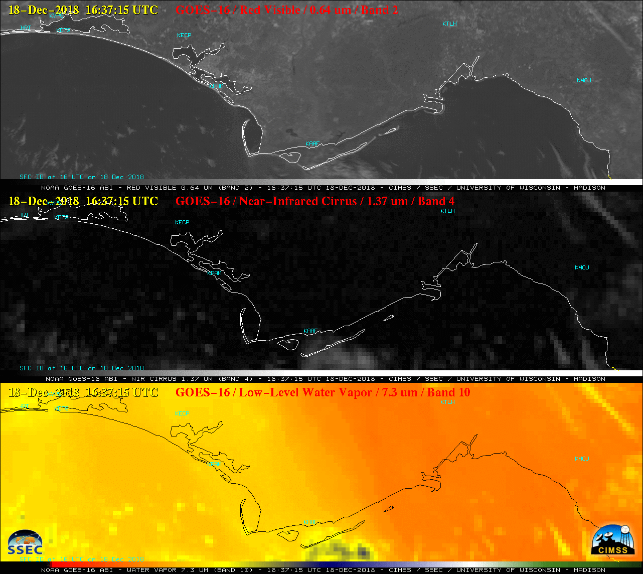
GOES-16 “Red” Visible (0.64 µm, top), Near-Infrared “Cirrus” (1.37 µm, middle) and Low-level Water Vapor (7.3 µm, bottom) images [click to play animation | MP4]
GOES-16 Water Vapor weighting functions derived using 12 UTC rawinsonde data from Tallahassee, Florida (below) revealed significant contributions by radiation being sensed from levels peaking at either 424 hPa or 442 hPa with all 3 spectral bands — due to a shallow layer of mid-tropospheric moisture — with secondary higher-altitude weighting function peaks around the 300 hPa pressure level.
![Water Vapor weighting functions derived using 12 UTC rawinsonde data from Tallahassee, Florida [click to enlarge]](https://cimss.ssec.wisc.edu/satellite-blog/wp-content/uploads/sites/5/2018/12/181218_12utc_ktae_wv_wf.png)
GOES-16 Water Vapor weighting functions derived using 12 UTC rawinsonde data from Tallahassee, Florida [click to enlarge]
![Plot of 12 UTC rawinsonde data from Tallahassee, Florida [click to enlarge]](https://cimss.ssec.wisc.edu/satellite-blog/wp-content/uploads/sites/5/2018/12/181218_12utc_ktae_raob.png)
Plot of 12 UTC rawinsonde data from Tallahassee, Florida [click to enlarge]
![GOES-16 Infrared and Water Vapor winds [click to play animation]](https://cimss.ssec.wisc.edu/satellite-blog/wp-content/uploads/sites/5/2018/12/181218_goes16_infrared_waterVapor_derivedMotionWinds_Atlantic_anim.gif)
GOES-16 Infrared and Water Vapor winds [click to play animation]