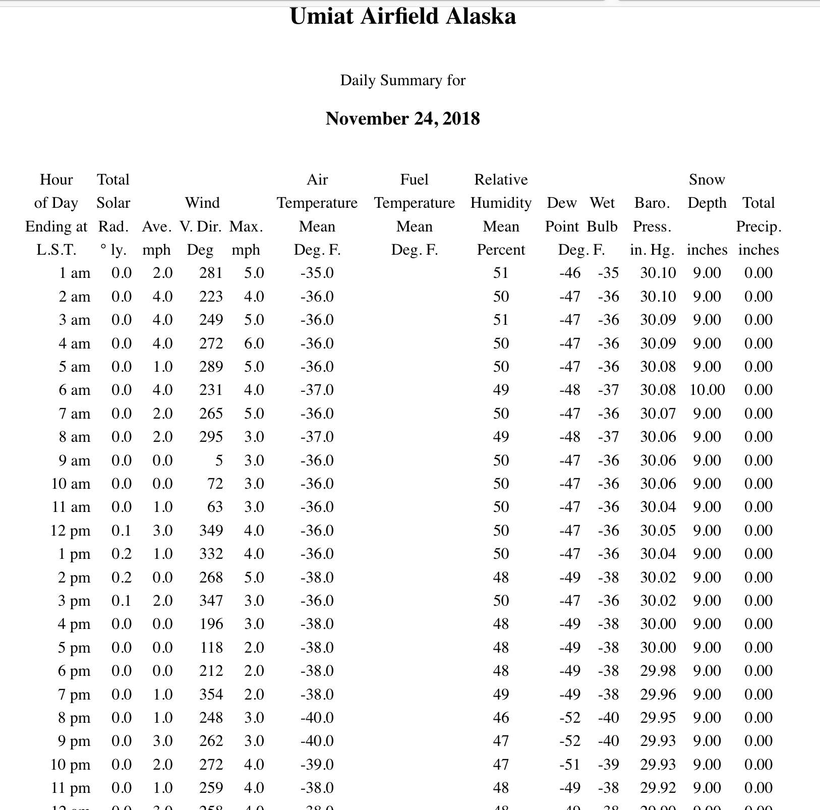
The first -40º temperature of the winter in Alaska
![Suomi NPP VIIRS Day/Night Band (0.7 µm) and Infrared Window (11.45 µm) images [click to enlarge]](https://cimss.ssec.wisc.edu/satellite-blog/wp-content/uploads/sites/5/2018/11/181124_suomiNPP_viirs_dayNightBand_infraredWindow_AK_2_anim.gif)
Suomi NPP VIIRS Day/Night Band (0.7 µm) and Infrared Window (11.45 µm) images [click to enlarge]
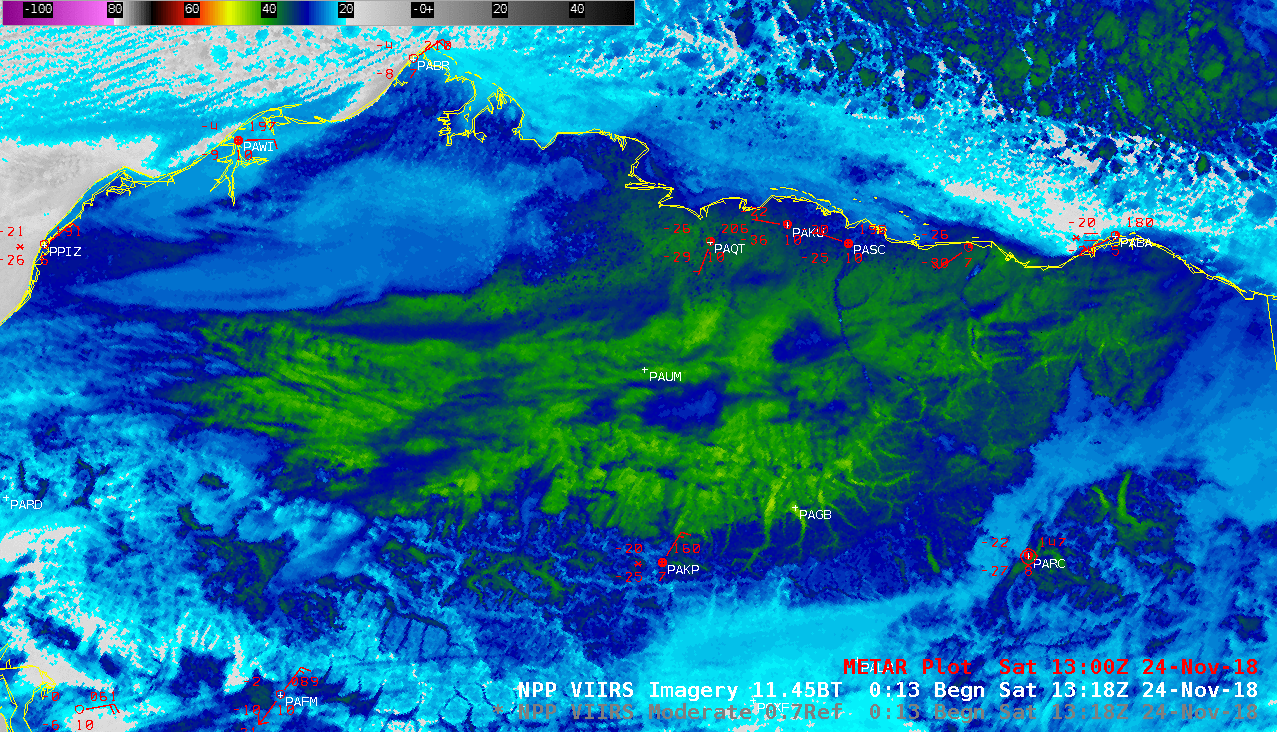
In areas with deeper snow cover that remained generally cloud-free for long periods of time, temperatures at first-order stations dropped into the -20s and -30s F; a low of -35ºF was recorded at Nuiqsut (PAQT). A closer look at the 2314 UTC Infrared image (below) revealed surface brightness temperatures as cold as -47ºC or -53ºF (lighter shades of yellow) in the valleys near Galbraith Lake (PAGB).
![Suomi NPP VIIRS Infrared Window (11.45 µm) image at 2314 UTC [click to enlarge]](https://cimss.ssec.wisc.edu/satellite-blog/wp-content/uploads/sites/5/2018/11/ak_viirs_ir_paum_zoom_1-20181124_231420.png)
Suomi NPP VIIRS Infrared Window (11.45 µm) image at 2314 UTC [click to enlarge]
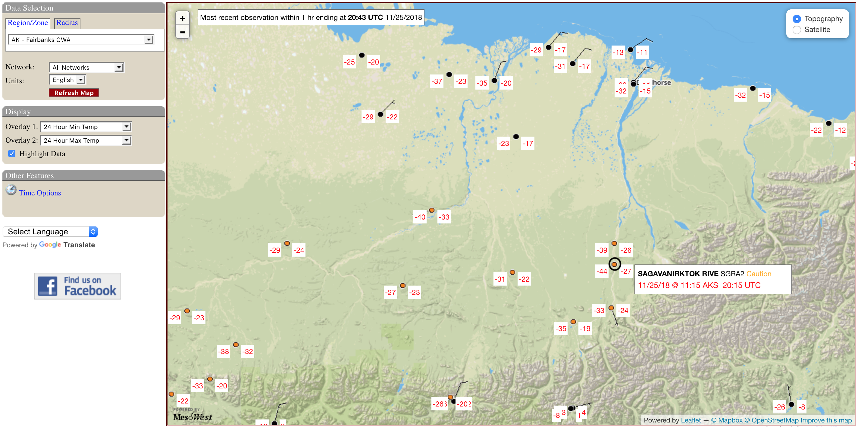
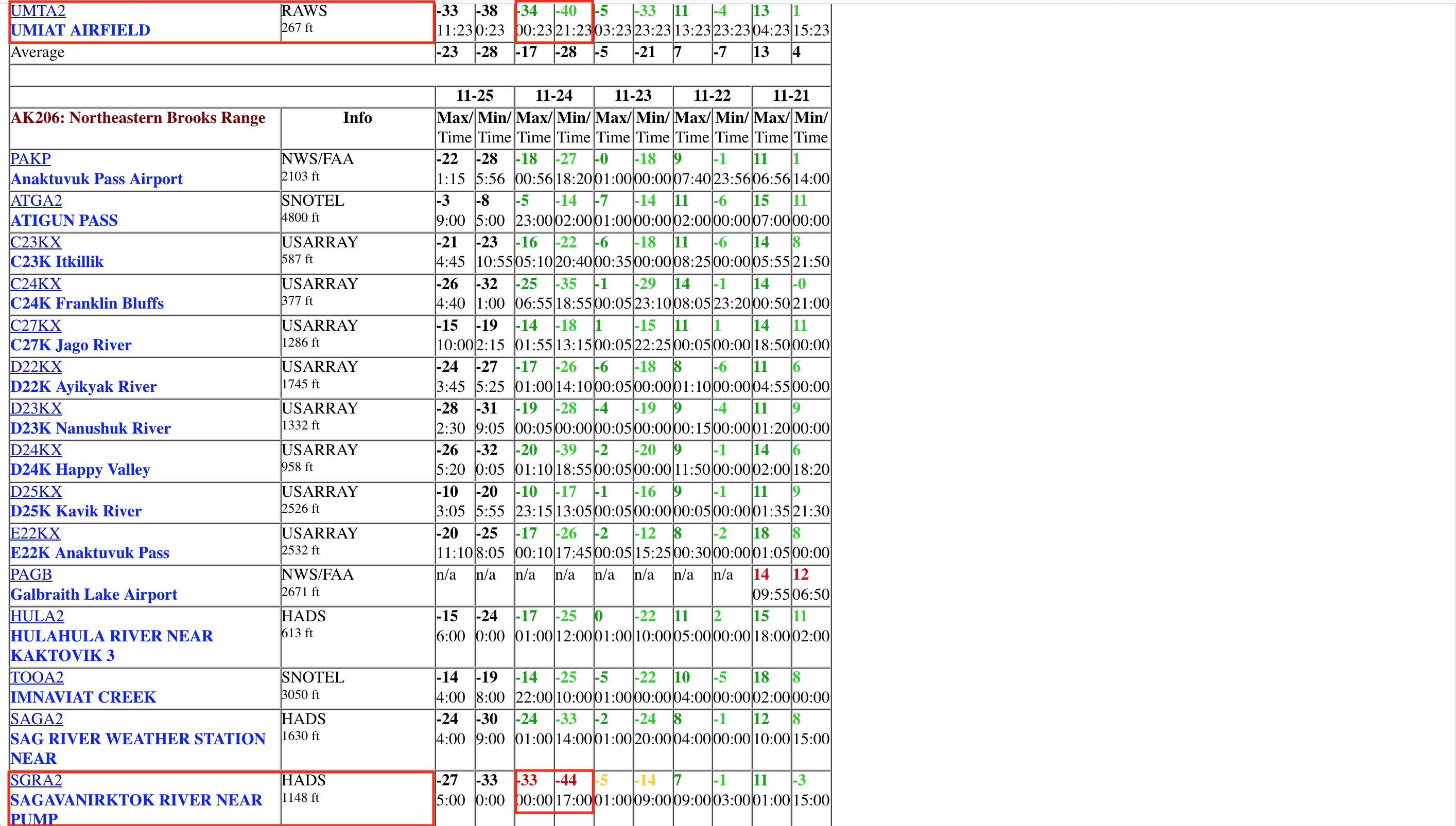
![Minimum and maximum temperatures for the 24-hour period ending at 20 UTC on 25 November [click to enlarge]](https://cimss.ssec.wisc.edu/satellite-blog/wp-content/uploads/sites/5/2018/11/181125_20utc_24hour_maximum_minimum_temperatures_Umiat_AK.png)
Minimum and maximum temperatures for the 24-hour period ending at 20 UTC on 25 November [click to enlarge]