Lake-enhanced snow along the south shore of Lake Superior
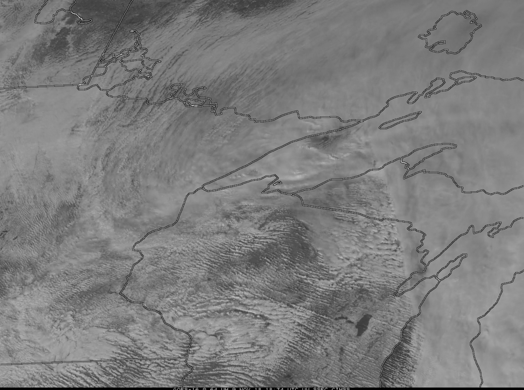
GOES-16 “Red” Visible (0.64 µm) images [click to play MP4 animation]
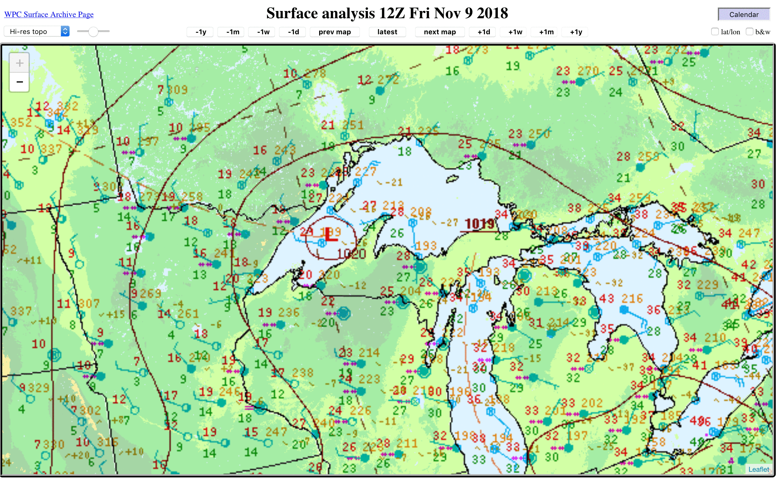
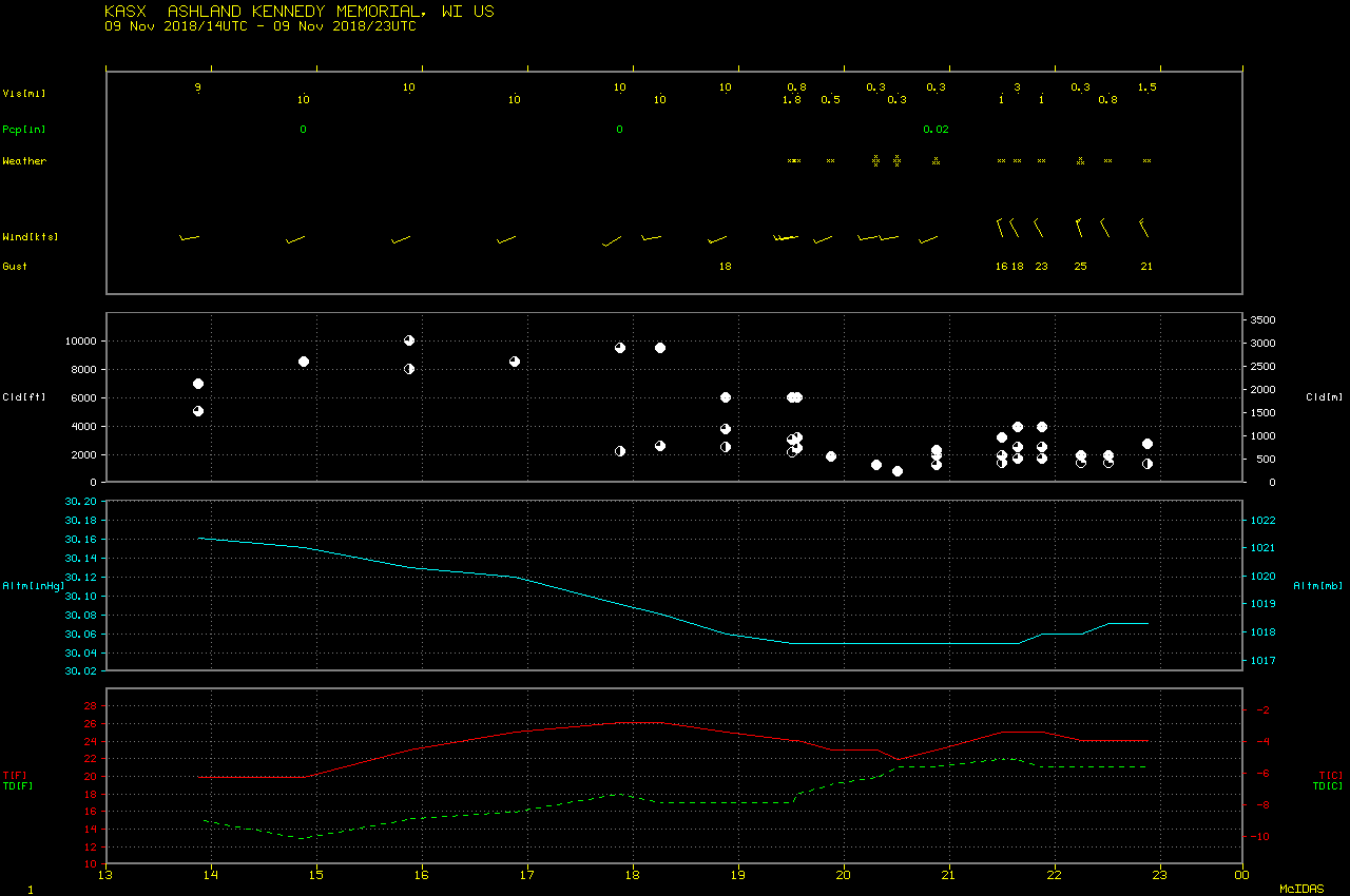
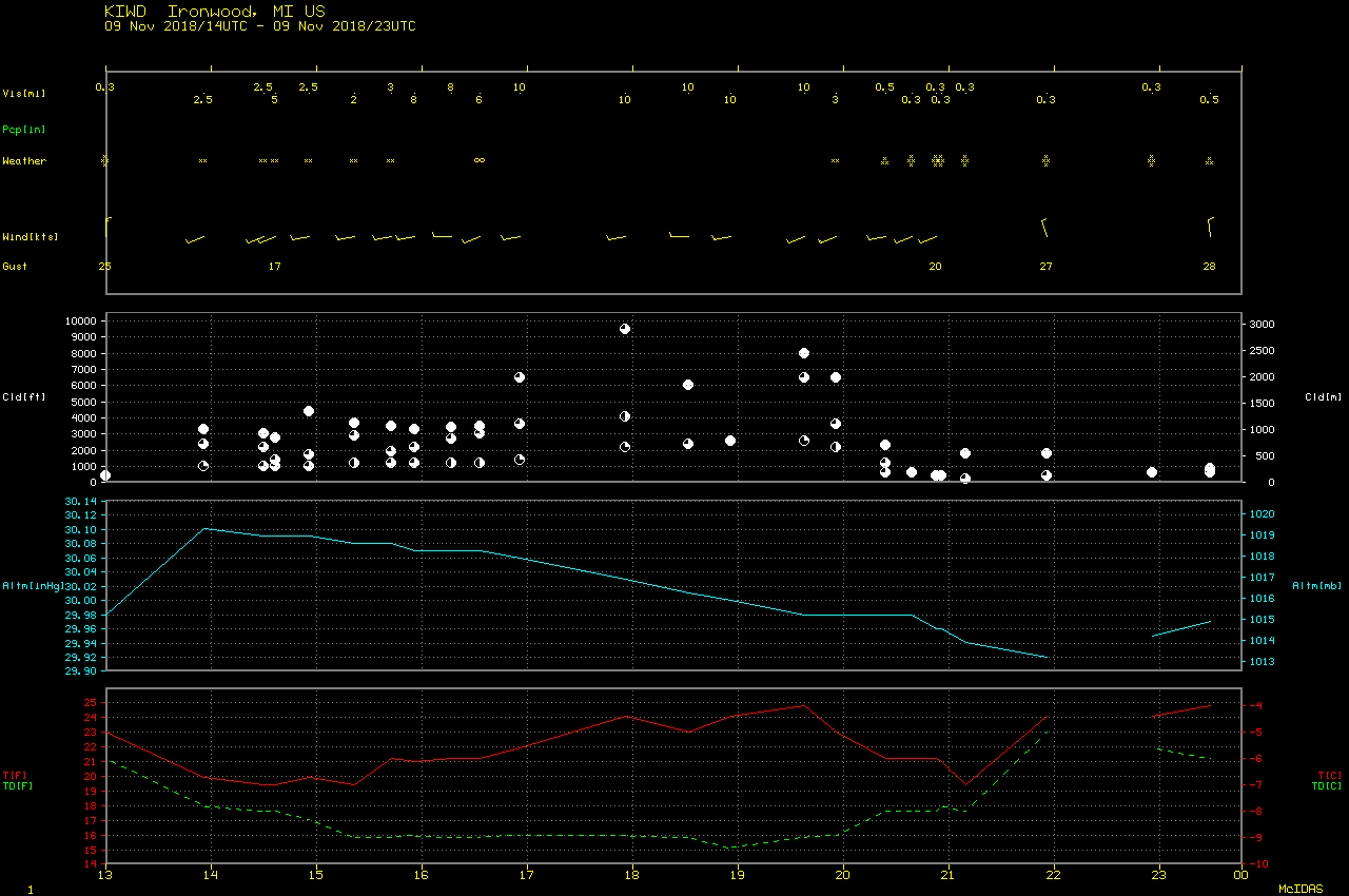
A closer look at GOES-16 Visible imagery (below) showed that as the convection moved inland over north-central Wisconsin and far western Upper Michigan, moderate snow developed at Ashland WI and heavy snow was reported at Ironwood MI beginning around 2030 UTC. GOES-16 GLM Flash data did not indicate any lightning associated with the lake-enhanced convection. Hourly surface wind barbs are also plotted; 10-minute wind data for Buoys ROAM4 and DISW3 are available here and here — northerly wind gusts at Buoy ROAM4 reached 25.2 m/s (49 knots) at 2257 UTC and 21.1 m/s (41 knots) at Buoy DISW3 at 2048 and 2202 UTC.
![GOES-16 "Red" Visible (0.64 µm) images, with hourly surface weather type plotted in yellow [click to play MP4 animation]](https://cimss.ssec.wisc.edu/satellite-blog/wp-content/uploads/sites/5/2018/11/G16_VIS_GLM_FLASHES_DLH_LES_09NOV2018_2018313_210155_GOES-16_0001PANEL.GIF)
GOES-16 “Red” Visible (0.64 µm) images, with hourly surface weather type plotted in yellow and wind barbs (knots) plotted in cyan [click to play MP4 animation]
![Suomi NPP and NOAA-20 VIIRS Visible (0.64 µm) and Infrared Window (11.45 µm) images, with Topography [click to enlarge]](https://cimss.ssec.wisc.edu/satellite-blog/wp-content/uploads/sites/5/2018/11/181109_viirs_visible_infrared_Lake_Superior_anim.gif)
Suomi NPP and NOAA-20 VIIRS Visible (0.64 µm) and Infrared Window (11.45 µm) images, with Topography [click to enlarge]
![Snow Depth at 12 UTC on 09 and 10 November, plus 24-hour snow accumulation ending at 12 UTC on 10 November [click to enlarge]](https://cimss.ssec.wisc.edu/satellite-blog/wp-content/uploads/sites/5/2018/11/181109_181110_snowdepth_snowfall_DLH_les_anim.gif)
Snow Depth at 12 UTC on 09 and 10 November, plus 24-hour Total Snowfall ending at 12 UTC on 10 November [click to enlarge]