Upper-tropospheric gravity waves in the wake of a decaying MCS
![GOES-16 Upper-level Water Vapor (6.2 µm) images [click to play MP4 animation]](https://cimss.ssec.wisc.edu/satellite-blog/wp-content/uploads/sites/5/2018/09/180901_goes16_water_vapor_anim.gif)
GOES-16 Upper-level Water Vapor (6.2 µm) images [click to play MP4 animation]
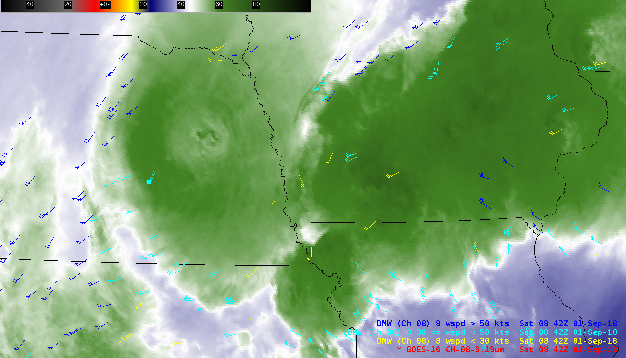
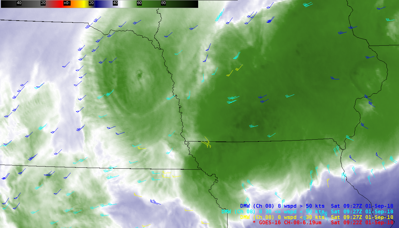
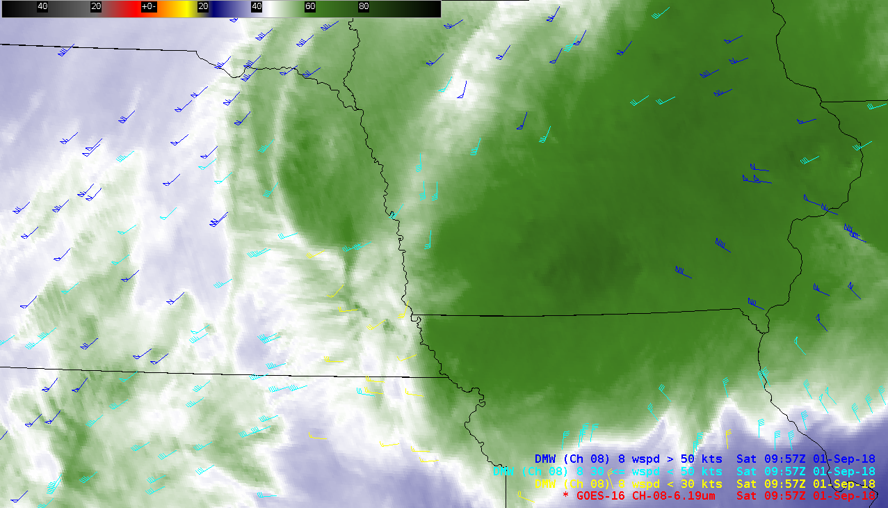
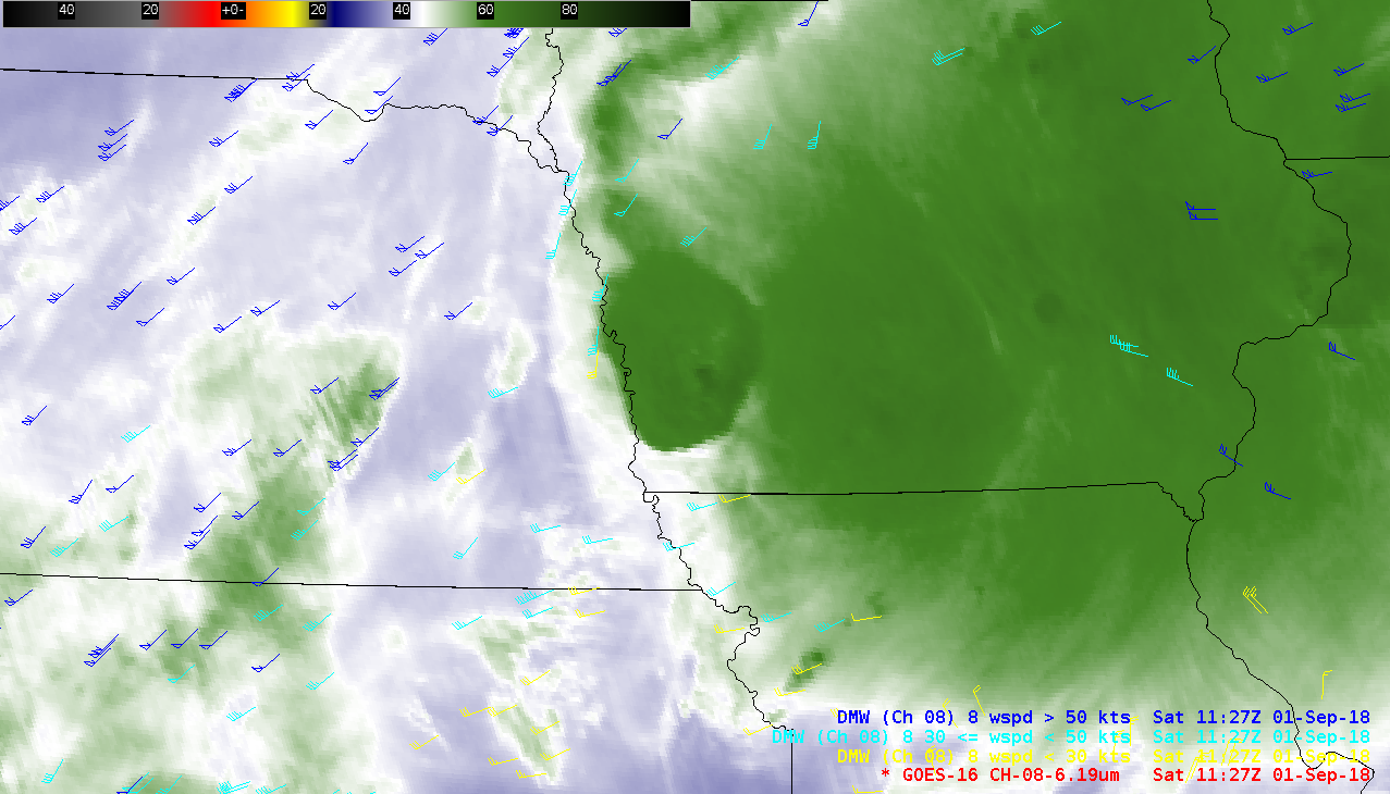
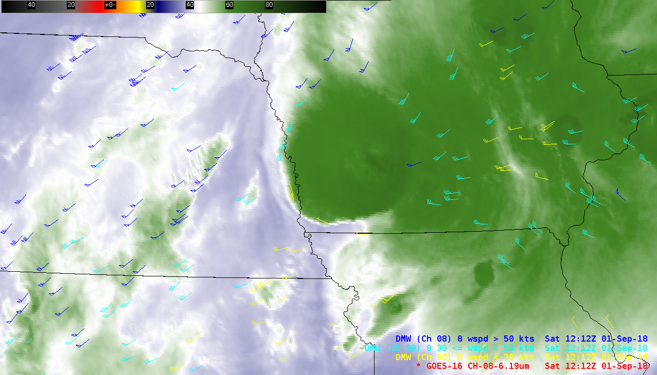
6.2 µm Water Vapor images with plots of GOES-16 Derived Motion Winds (below) intermittently showed these high-altitude anticyclonic winds along the western edges of decaying convection — for example, at 0842 UTC, 0922 UTC, 0957 UTC, 1127 UTC, 1212 UTC and 1312 UTC.
![GOES-16 Upper-level Water Vapor (6.2 µm) images, with plots of Derived Motion Winds [click to play MP4 animation]](https://cimss.ssec.wisc.edu/satellite-blog/wp-content/uploads/sites/5/2018/09/mcs_wv8_winds-20180901_131218.png)
GOES-16 Upper-level Water Vapor (6.2 µm) images, with plots of Derived Motion Winds [click to play MP4 animation]
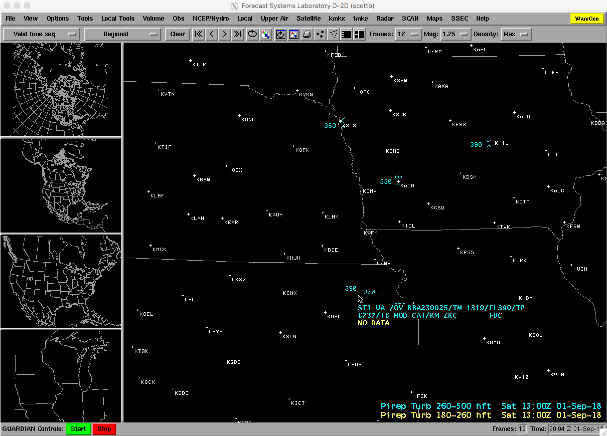
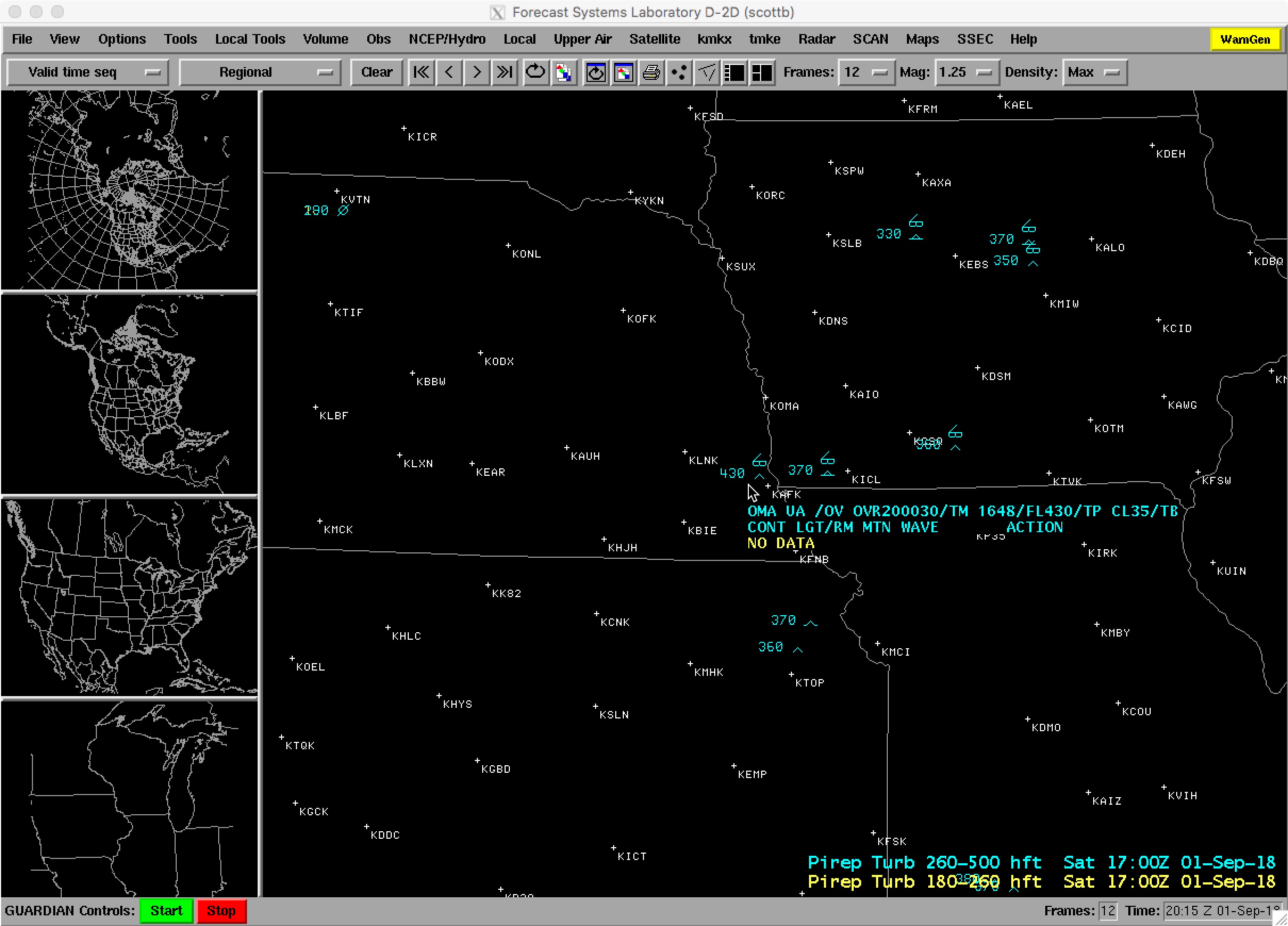
![Pilot reports of turbulence [click to play animation]](https://cimss.ssec.wisc.edu/satellite-blog/wp-content/uploads/sites/5/2018/09/180901_pilot_reports_turbulence_anim.gif)
Pilot reports of turbulence [click to play animation]
![Suomi NPP VIIRS Day/Night Band (0.7 µm) and Infrared Window (11.45 µm) images, with plots of SPC storm reports [click to enlarge]](https://cimss.ssec.wisc.edu/satellite-blog/wp-content/uploads/sites/5/2018/09/180901_0755utc_suomiNPP_viirs_DayNightBand_InfraredWindow_anim.gif)
Suomi NPP VIIRS Day/Night Band (0.7 µm) and Infrared Window (11.45 µm) images, with plots of SPC storm reports [click to enlarge]
![NOAA-20 VIIRS Day/Night Band (0.7 µm) and Infrared Window (11.45 µm) images [click to enlarge]](https://cimss.ssec.wisc.edu/satellite-blog/wp-content/uploads/sites/5/2018/09/180901_0845utc_noaa20_viirs_DayNightBand_InfraredWindow_anim.gif)
NOAA-20 VIIRS Day/Night Band (0.7 µm) and Infrared Window (11.45 µm) images [click to enlarge]