Severe thunderstorms in South Dakota and Nebraska
GOES-16 “Red” Visible (0.64 µm) images, with time-matched (+/- 3 minutes) SPC Storm Reports plotted in red [click to play MP4 animation]
The corresponding GOES-16 Mid-level Water Vapor (6.9 µm) images (below) better revealed the broad circulation of a middle-tropospheric low that was centered over South Dakota (500 hPa analysis).
![GOES-16 Mid-level Water Vapor (6.9 µm) images, with SPC storm reports plotted in red [click to play MP4 animation]](https://cimss.ssec.wisc.edu/satellite-blog/wp-content/uploads/sites/5/2018/08/G16_WV_SD_NE_SVR_15AUG2018_960x1280_B9_2018227_223437_0001PANEL_00155.GIF)
GOES-16 Mid-level Water Vapor (6.9 µm) images, with time-matched (+/- 3 minutes) SPC Storm Reports plotted in red [click to play MP4 animation]
![GOES-16 "Clean" Infrared Window (10.4 µm) images, with SPC storm reports plotted in purple [click to play MP4 animation]](https://cimss.ssec.wisc.edu/satellite-blog/wp-content/uploads/sites/5/2018/08/G16_IR_SD_NE_SVR_15AUG2018_960x1280_B13_2018227_223437_0001PANEL_00155.GIF)
GOES-16 “Clean” Infrared Window (10.3 µm) images, with time-matched (+/- 3 minutes) SPC Storm Reports plotted in purple [click to play MP4 animation]
![Plots of rawinsonde data from North Platte, Nebraska at 12 UTC on 15 August and 16 August [click to enlarge]](https://cimss.ssec.wisc.edu/satellite-blog/wp-content/uploads/sites/5/2018/08/180815_180816_KLBF_RAOBS.GIF)
Plots of rawinsonde data from North Platte, Nebraska at 12 UTC on 15 August and 16 August [click to enlarge]
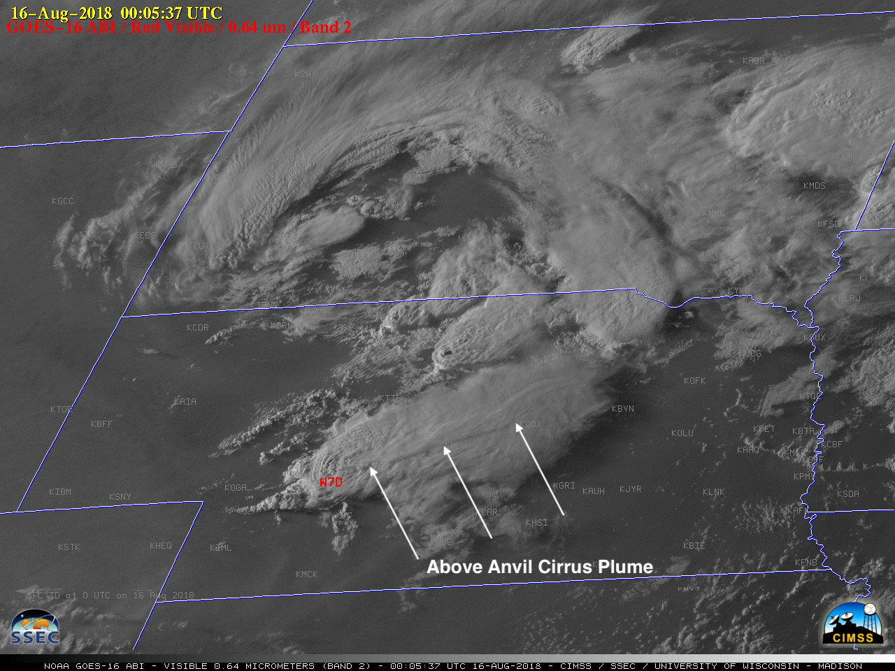
GOES-16 “Red” Visible (0.64 µm) and “Clean” Infrared Window (10.3 µm) images at 0005 UTC [click to enlarge]
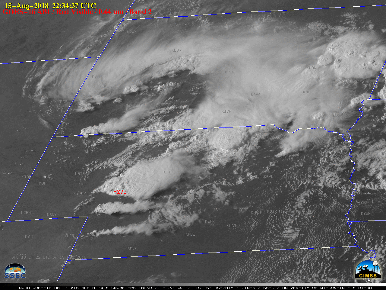
GOES-16 “Clean” Infrared Window (10.3 µm) image at 2234 UTC, with the actual and “parallax-corrected” locations of a 2.75-inch hail report [click to enlarge]
![GOES-16 "Clean" Infrared Window (10.3 µm) image at 0005 UTC, with the actual and parallax-corrected locations of a 70 mph wind gust [click to enlarge]](https://cimss.ssec.wisc.edu/satellite-blog/wp-content/uploads/sites/5/2018/08/180816_0005utc_goes16_infrared_spc_storm_report_parallax_NE_anim.gif)
GOES-16 “Clean” Infrared Window (10.3 µm) image at 0005 UTC, with the actual and “parallax-corrected” locations of a 70 mph wind gust report [click to enlarge]