Airborne Saharan dust over the North Atlantic Ocean
A Meteosat-9 visible image at 18:00 UTC (above) showed the presence of a great deal of airborne Saharan dust over the North Atlantic Ocean on 30 June 2009. Due to a favorable forward scattering angle, this dust appeared as a large “hazy” feature between Africa and South America. Also note the well-defined “comma cloud” signature of a strong mid-latitude cyclone off the southeastern coast of South America.
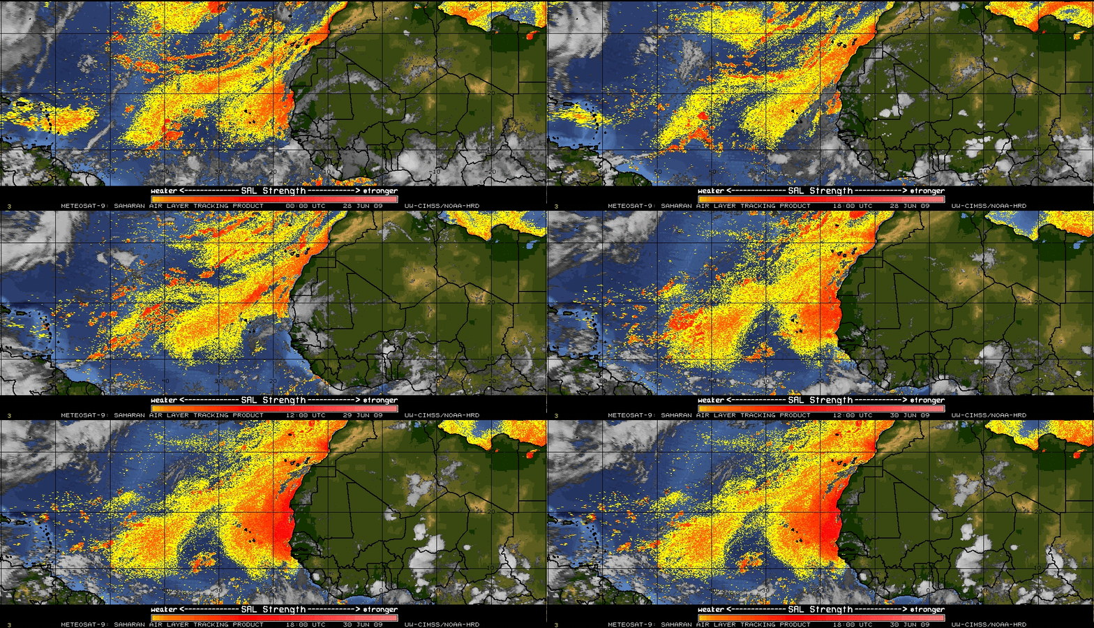
The Meteosat-9 Saharan Air Layer (SAL) tracking product from the CIMSS Tropical Cyclones site (below) displayed a strong signal (darker red colors) of this latest pulse of thick dust beginning to move westward off the coast of western Africa on 30 June.
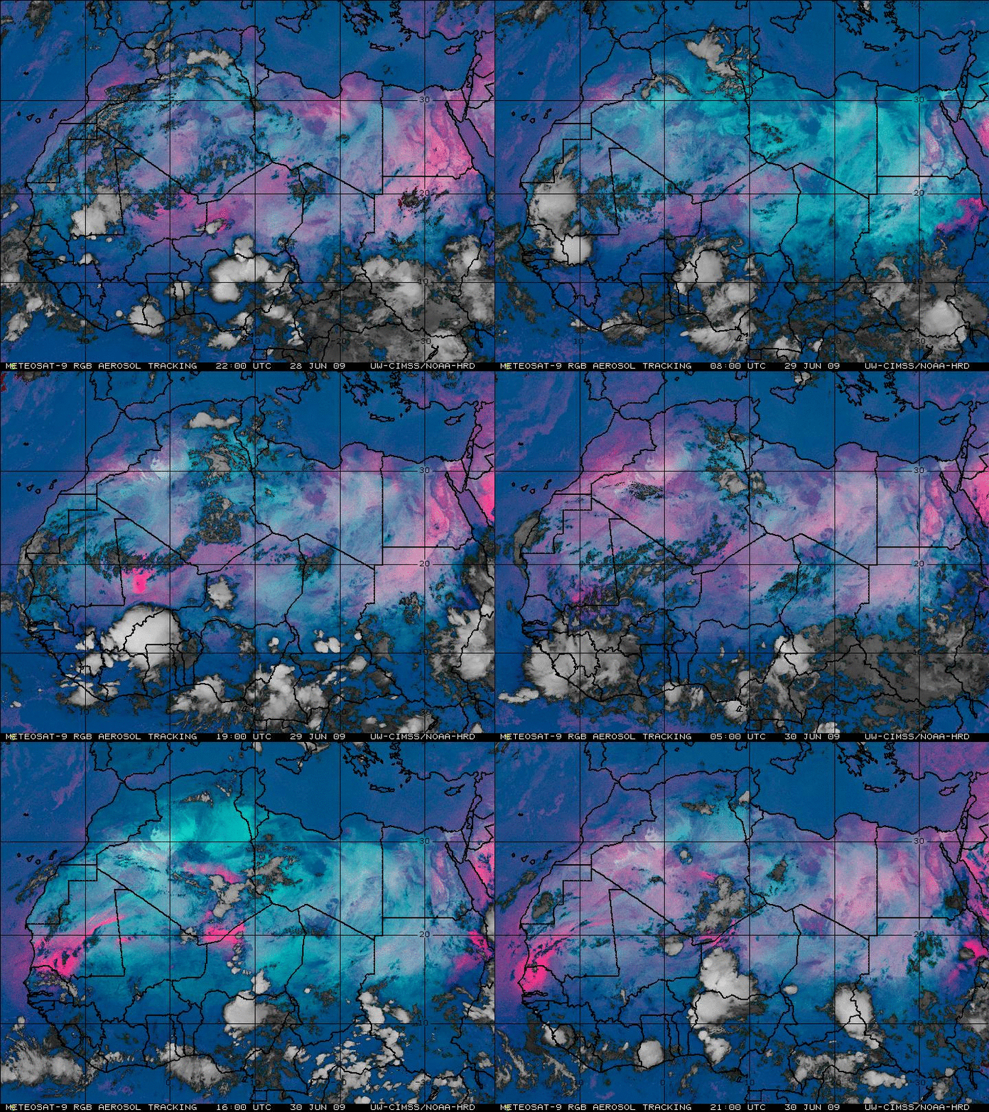
This pulse of dust was also apparent on Meteosat-9 Red/Green/Blue (RGB) aerosol tracking product images (below), showing up as a brighter pink feature to the north of a large Mesoscale Convective System that was moving westward across western Africa during the 28-30 June period.
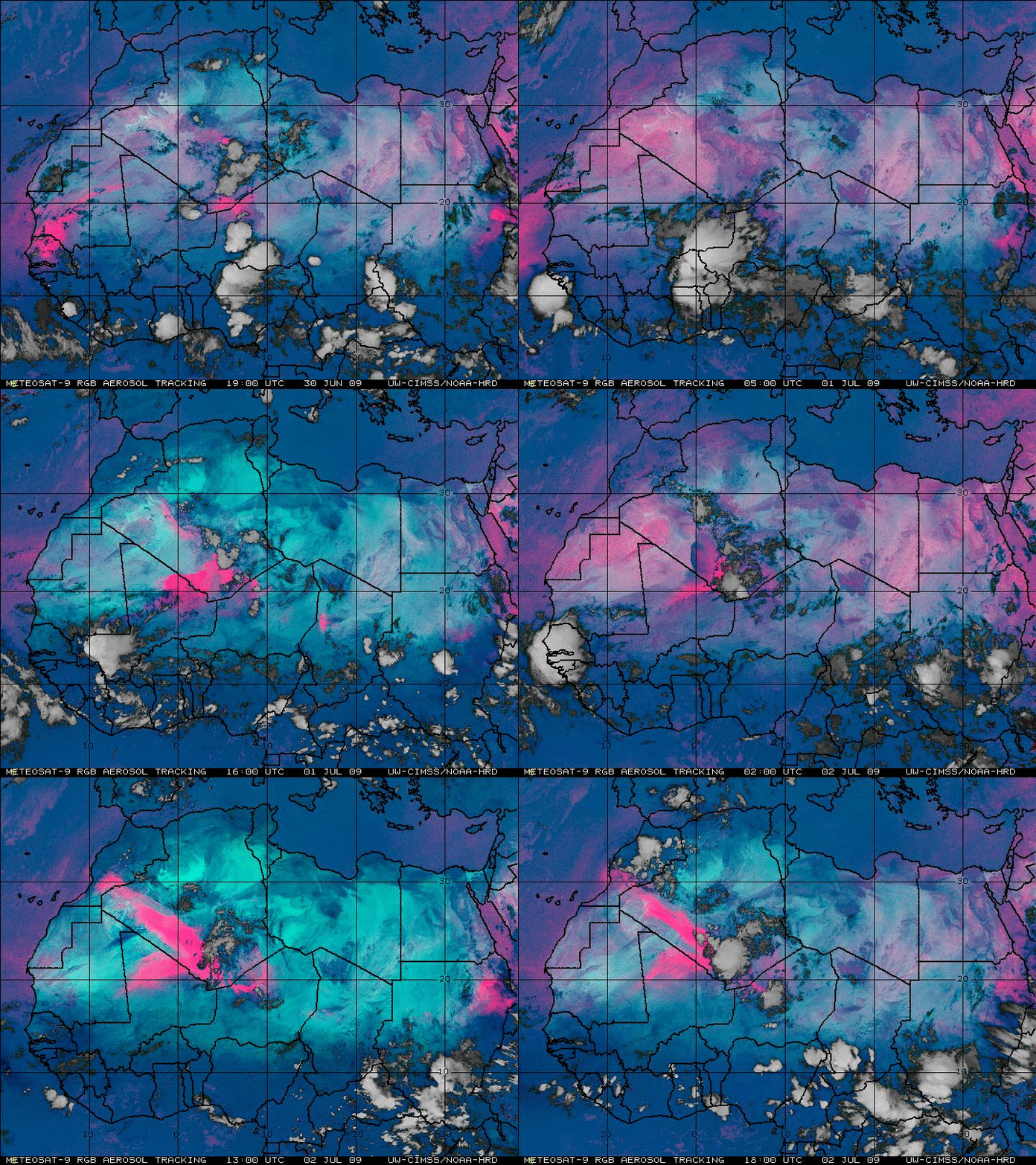
After the initial pulse of Saharan dust was seen to move off the west coast of Africa around the end of June, another strong pulse of blowing sand/dust (the brighter pink features) was seen to develop inland over northwestern Africa (across parts of Algeria, Niger, and Mali) during the 01-02 July period (below), with some of this dust reaching the coast on 02 July.


