Using MODIS to detect ice-covered ground

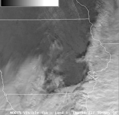
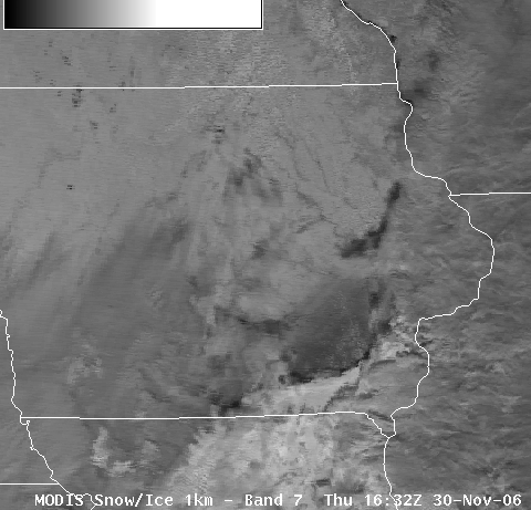
A fast-moving winter storm was responsible for widespread snow, sleet, and freezing rain across much of central US on 29 November 2006; several counties in southeastern Iowa reported 1/8 to 1/4 inch of ice accumulation from the storm (MODIS false-color composite image). AWIPS MODIS images from the following day (30 November 2006) show the extent of the ice-covered ground: the area affected by the ice storm in southeastern Iowa appears to be bare ground on the visible channel image (above), but note the dark signal over that same region on the Band 7 (2.1µm) near-IR channel (below) — this dark signal confirms the presence of a coating of ice. This ice glaze was not apparent on the visible channel image since it had very little impact on the albedo of the ground surface, but the ice coating is strongly absorbent in the 2.1µm portion of the electromagnetic radiation spectrum (which yields a dark signal on that particular channel). Just to the north of the large patch of ice-covered ground is a narrower feature over east-central Iowa which exhibits a somewhat darker signal on the 2.1µm image; this is due to cloud shadows being cast onto the surface from the high cloud layer that was present (note that those shadows were also apparent on the visible channel image). An examination of the corresponding 11.0µm IR window and the 3.7µm shortwave IR images (Java applet) shows that there was very little thermal contrast between this ice-covered ground and the adjacent bare ground over the remainder of Iowa (due to the presence of a cold arctic air mass over the entire region on that day).
The remainder of the ice-covered ground (across southcentral Iowa into northern Missouri) was revealed by MODIS true color and false color image composites on the following day (01 December 2006), as clouds from a departing winter storm cleared from that area.


