TransCanada pipeline explosion and fire in West Virginia
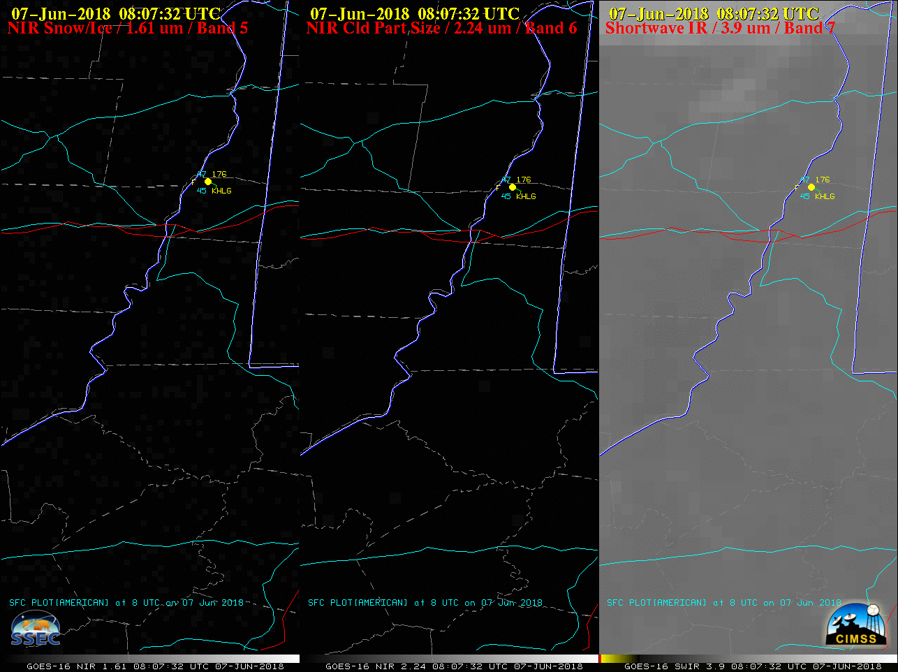
GOES-16 Near-Infrared “Snow/Ice” (1.61 µm, left), Near-Infrared “Cloud Particle Size” (2.24 µm, center) and Shortwave Infrared (3.9 µm, right) images; Interstate Highways are plotted in red, with State Highways in cyan [click to play animation | MP4]
This is drone footage from @MarshallCoWVOEM Director Tom Hart says this is at the end of Nixon Ridge near Fish Creek. The explosion left a crater. The DEP estimates 10 acres are affected @WTRF7News pic.twitter.com/QXTOsWBvNg
— Tessa DiTirro (@TDiTirroWTRF) June 7, 2018