Storm-force low in the central Atlantic Ocean
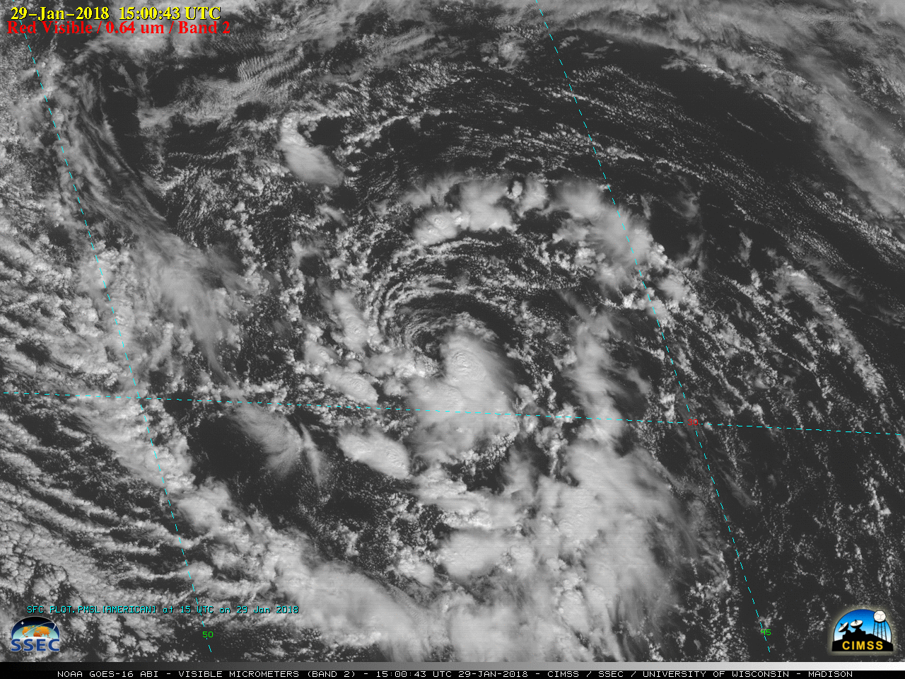
GOES-16 “Red” Visible (0.64 µm) images [click to play MP4 animation]
This surface low was located beneath a larger upper-level low, as seen on GOES-16 Low-level (7.3 µm), Mid-level (6.9 µm) and Upper-level (6.2 µm) Water Vapor images (below). Very dry air (yellow to red enhancement) was evident just to the south and southwest of the storm.
![GOES-16 Low-level (7.3 µm, left), Mid-level (6.9 µm, center) and Upper-level (6.2 µm) images [click to play MP4 animation]](https://cimss.ssec.wisc.edu/satellite-blog/wp-content/uploads/sites/5/2018/01/G16_WATER_VAPOR_ATL_LOW_29AN2018_EXP_960x427_B1098_2018029_150043_0003PANELS_00061.GIF)
GOES-16 Low-level (7.3 µm, left), Mid-level (6.9 µm, center) and Upper-level (6.2 µm, right) images [click to play MP4 animation]
![GOES-16 Deep-layer Wind Shear products [click to play animation]](https://cimss.ssec.wisc.edu/satellite-blog/wp-content/uploads/sites/5/2018/01/180129_goes16_deep_layer_shear_anim.gif)
GOES-16 Deep-layer Wind Shear products [click to play animation]