Chesapeake Bay effect snow in North Carolina
![Suomi NPP VIIRS Day/Night Band (0.7 µm) and Infrared Window (11.45 µm) images at 0710 UTC, with plots of 07 UTC surface reports [click to enlarge]](https://cimss.ssec.wisc.edu/satellite-blog/wp-content/uploads/sites/5/2018/01/180101_0710utc_suomi_npp_viirs_DayNightBand_InfraredWindow_Chesapeake_Bay_streamer_anim.gif)
Suomi NPP VIIRS Day/Night Band (0.7 µm) and Infrared Window (11.45 µm) images at 0710 UTC, with plots of 07 UTC surface reports [click to enlarge]
During the subsequent daylight hours, 1-minute Mesoscale Sector GOES-16 (GOES-East) “Red” Visible (0.64 µm) images (below) showed the Chesapeake Bay streamer cloud moving southward. Note that this cloud produced light snow as far south as Currituck, North Carolina (KOTX) from 14-15 UTC or 10-11 AM local time. It is possible that some light snow also occurred across a portion of the Eastern Shore of Virginia and the Outer Banks of North Carolina, but verification is not possible due to the scarcity of surface observation sites in those areas.
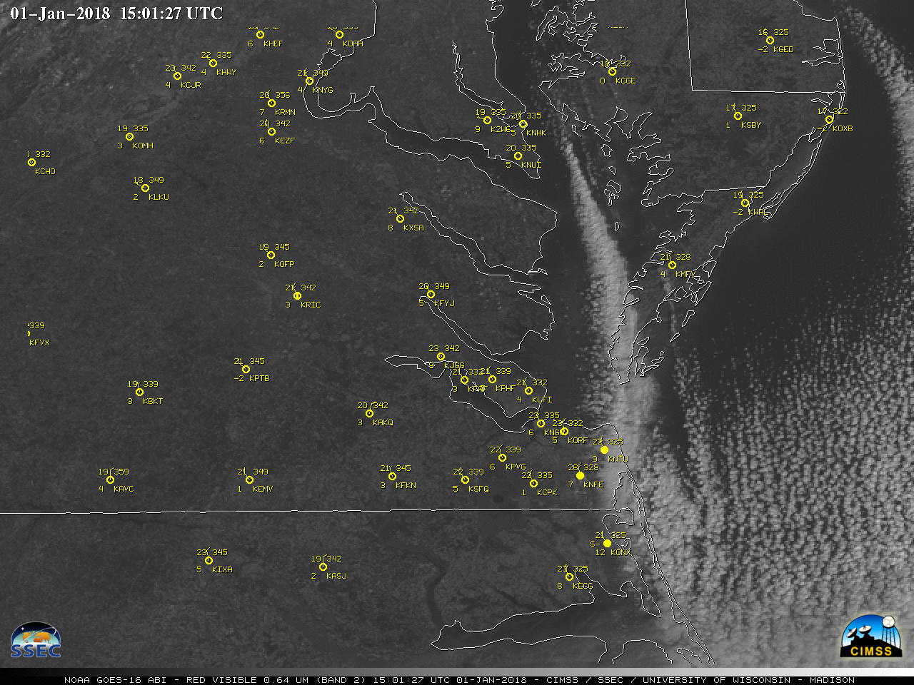
1-minute GOES-16 “Red” Visible (0.64 µm) images, with hourly surface reports plotted in yellow [click to play MP4 animation]
![Time series plot of surface weather conditions at Currituck, North Carolina [click to enlarge]](https://cimss.ssec.wisc.edu/satellite-blog/wp-content/uploads/sites/5/2018/01/180101_KONX_SFCMG.GIF)
Time series plot of surface weather conditions at Currituck, North Carolina [click to enlarge]