Heavy rain in Florida
Aided in part by precipitation associated with Hurricane Irma, some areas of Florida have received record rainfall during the June-October 2017 period:
Tuesday’s 2.22″ of rainfall at Melbourne pushed the total since September 1st over 3″ ahead of the previous record wettest September-October pic.twitter.com/dMdI43OkdI
— NWS Melbourne (@NWSMelbourne) October 25, 2017
Wettest June 1-Oct 31 (~wet season) on record (since 1911) for #Miami– yes it has been a wet 5 months (with more coming Saturday)! ?? pic.twitter.com/VmhSqkU7uO
— Eric Blake ? (@EricBlake12) October 26, 2017
* GOES-16 data posted on this page are preliminary, non-operational and are undergoing testing *
GOES-16 Visible (0.64 µm, left), Near-Infrared “Vegetation” (0.86 µm, center) and Near-Infrared “Snow/Ice” (1.61 µm, right) images [click to play animation]
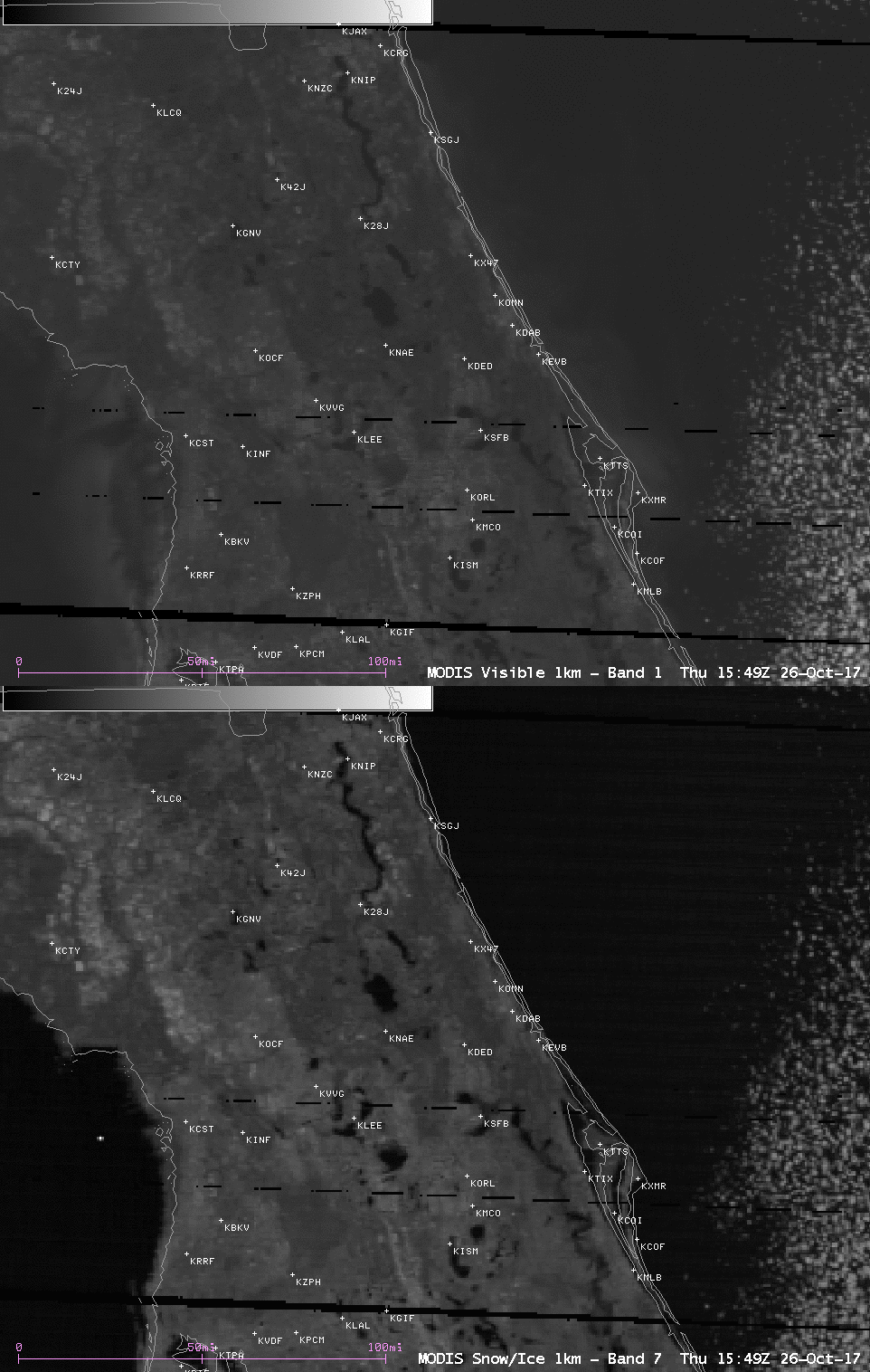
Two areas in Florida are noteworthy on the images: the St. Johns River in the northeast part of the state (where Moderate Flooding had been occurring), and parts of South Florida (which had just received an additional 1-5 inches of rain on the previous day).
A closer look at those 2 areas using Terra MODIS Visible (0.65 µm) and Near-Infrared “:Snow/Ice” (1.61 µm) images are shown below.

Terra MODIS Visible (0.65 µm) and Near-Infrared :Snow/Ice” (1.61 µm) images, showing central and northeastern Florida [click to enlarge]
![Terra MODIS Visible (0.65 µm) and Near-Infrared :Snow/Ice" (1.61 µm) images, showing southern Florida [click to enlarge]](https://cimss.ssec.wisc.edu/satellite-blog/wp-content/uploads/sites/5/2017/10/171026_1549utc_terra_modis_Visible_SnowIce_South_Florida_anim.gif)
Terra MODIS Visible (0.65 µm) and Near-Infrared :Snow/Ice” (1.61 µm) images, showing southern Florida [click to enlarge]
In stark contrast to the periods of heavy rain, a strong cold front brought clear skies and very dry air over Florida, as seen in MIMIC Total Precipitble Water product (below).
This dry air evoked enthusiasm in least one South Florida resident:
Amazing Fall day across south #Florida– lowest precipitable water on record so early in the dry season- beautiful! HT @tuffiewx pic.twitter.com/iAbSc6L3tA
— Eric Blake ? (@EricBlake12) October 26, 2017


![MIMIC Total Precipitable Water product [click to enlarge]](https://cimss.ssec.wisc.edu/satellite-blog/wp-content/uploads/sites/5/2017/10/171026_mimic_tpw_anim.gif)