Hurricane Irma moves along the north coast of Cuba

GOES-16 “Clean Window” Infrared Imagery (10.3 µm) from 0357 to 1202 UTC on 9 September 2017 (Click to animate)
GOES-16 data posted on this page are preliminary, non-operational and are undergoing testing
Hurricane Irma hit Cuba as a category 5 Storm late on 8 September 2017. The animation above shows the storm paralleling the north coast of Cuba; outer rainbands are moving into southern Florida. Irma is forecast to turn northwest and north during the day on 9 September, and then move up along the Gulf Coast of Florida, threatening the entire Florida Peninsula with Hurricane-force winds. Irma’s prolonged proximity to the Cuban landmass has affected the storm’s structure and its satellite presentation. (Compare this animation above to one from 8 September in this blog post). The microwave animation, below, (source) suggests that the disruption to the storm might include the eyewall, and the central pressure of the storm has increased.
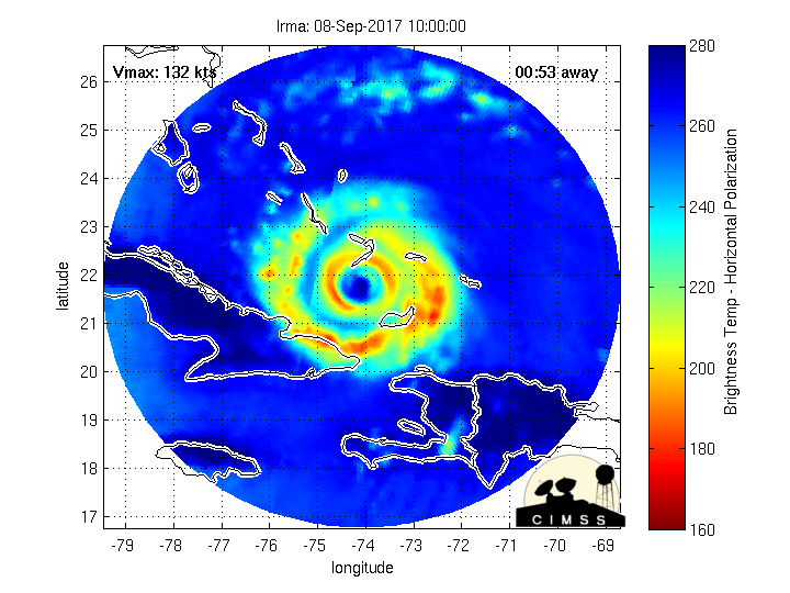
Morphed Microwave Imagery of Irma for the 24 hours ending around 0900 UTC on 9 September 2017 (Click to enlarge)
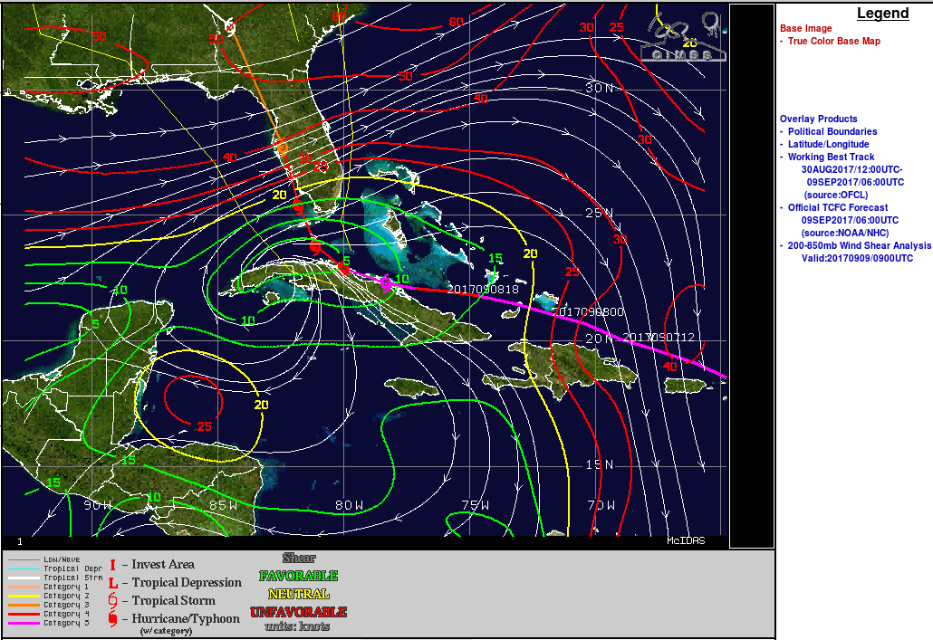
850-250 hPa Wind Shear over Irma, 0900 UTC on 9 September (Click to enlarge)
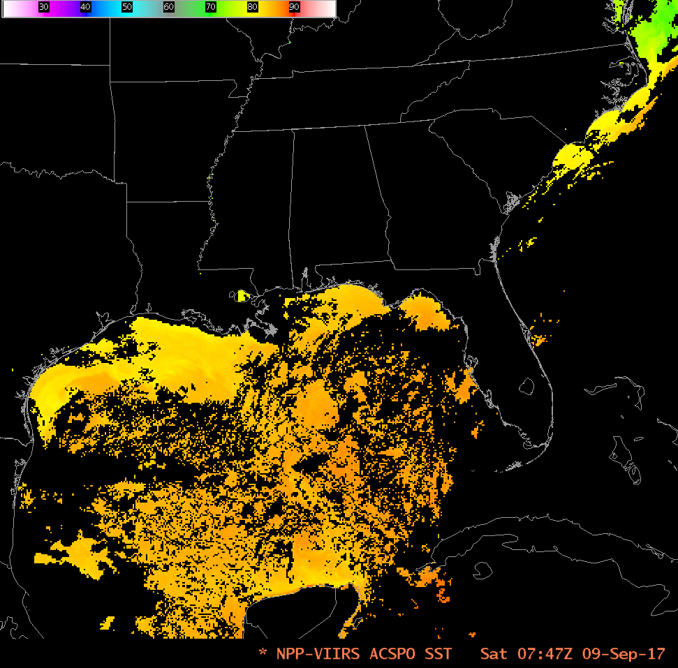
Wind shear in the atmosphere, shown above as 850-250 mb wind shear (Source), remains very low over the storm. Shear will increase over the storm during the day however as it moves north. This could slow any intensification that might occur as the storm moves over the very warm waters of the Florida Straits and eastern Gulf of Mexico, where Sea-Surface Temperatures are 30-32 C.
The latest Geostationary Lightning Mapper data over the storm (from this source) as the sun rises, shows little lightning over the center of Irma.
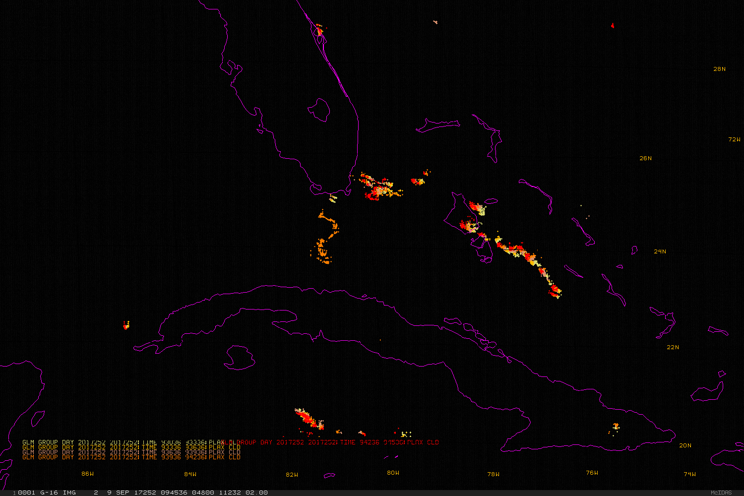
GOES-16 Visible (0.64 µm) Imagery at 15-minute intervals underneath plots of GLM Group Activity in 3-minute intervals, 0945-1200 UTC9 September 2017 (Click to enlarge)
William Straka, CIMSS, provided the Suomi NPP Visible (from the Day Night Band) and Infrared Imagery below.
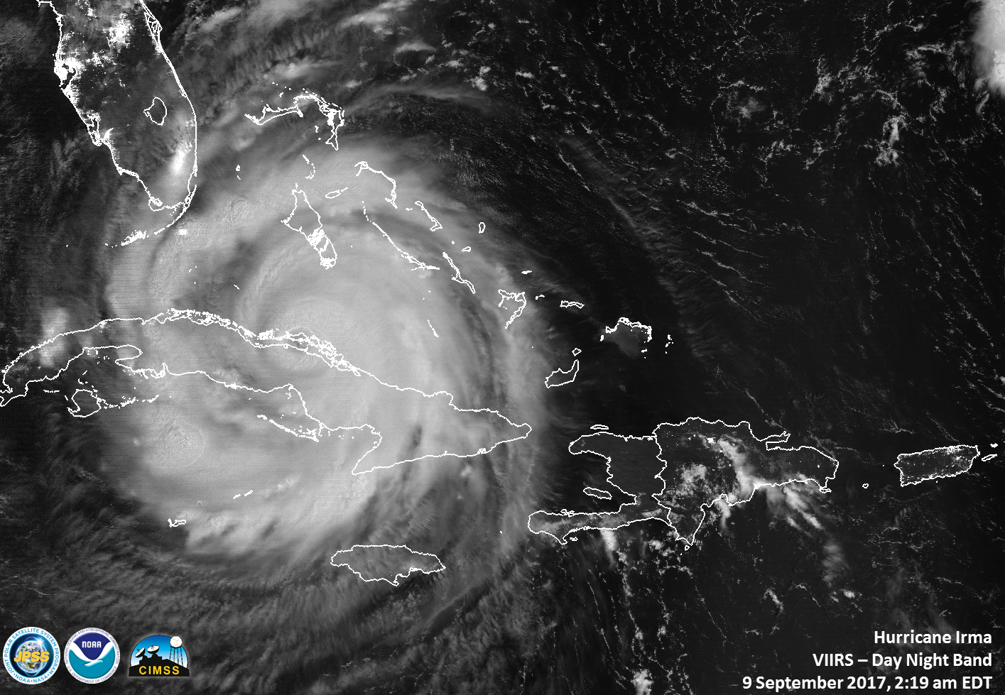
Suomi NPP VIIRS Day Night Band Visible (0.7 µm) from 0619 UTC on 9 September 2017 (Click to enlarge)
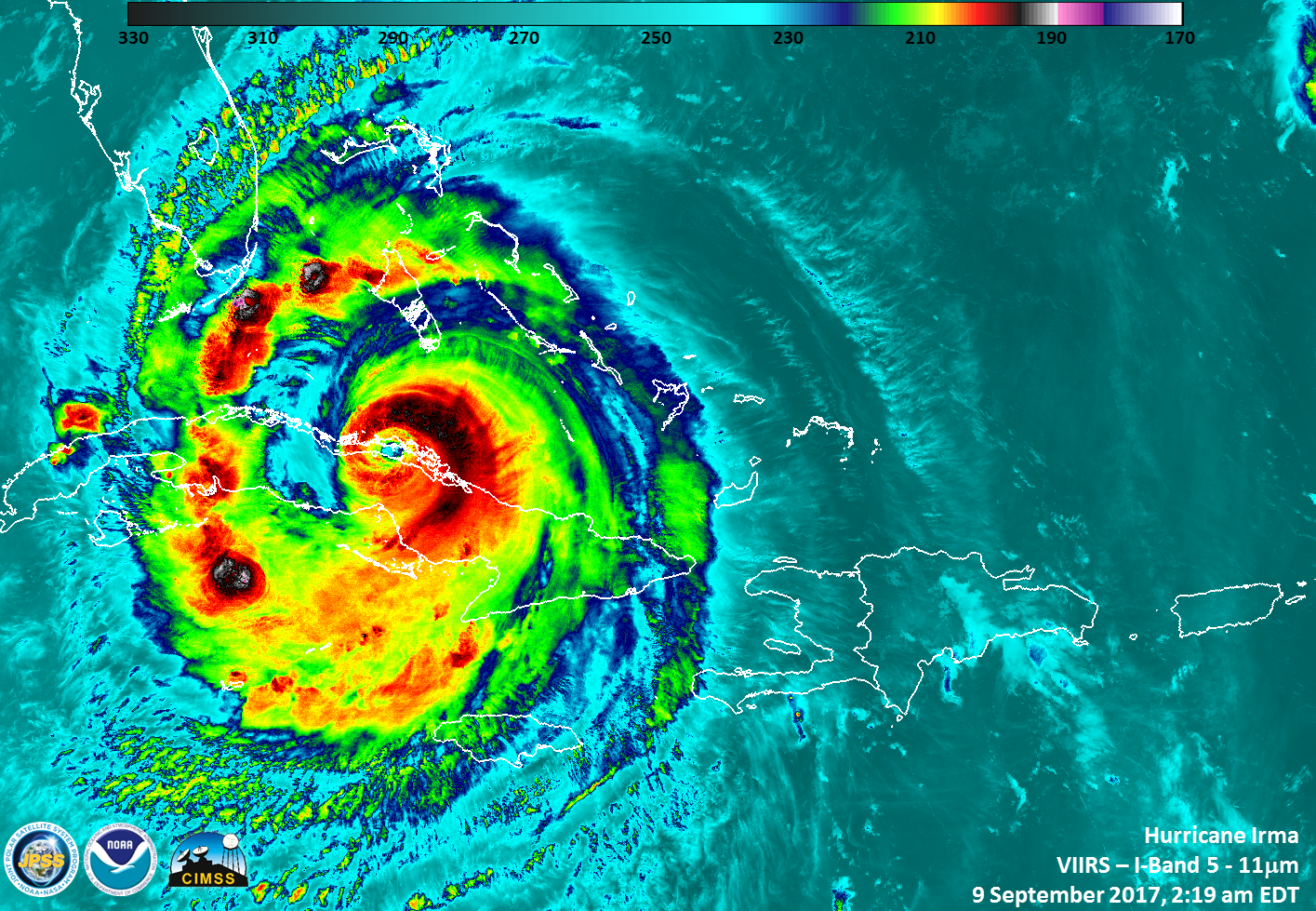
Suomi NPP VIIRS Infrared Imagery (11.45 µm) from 0619 UTC on 9 September 2017 (Click to enlarge)
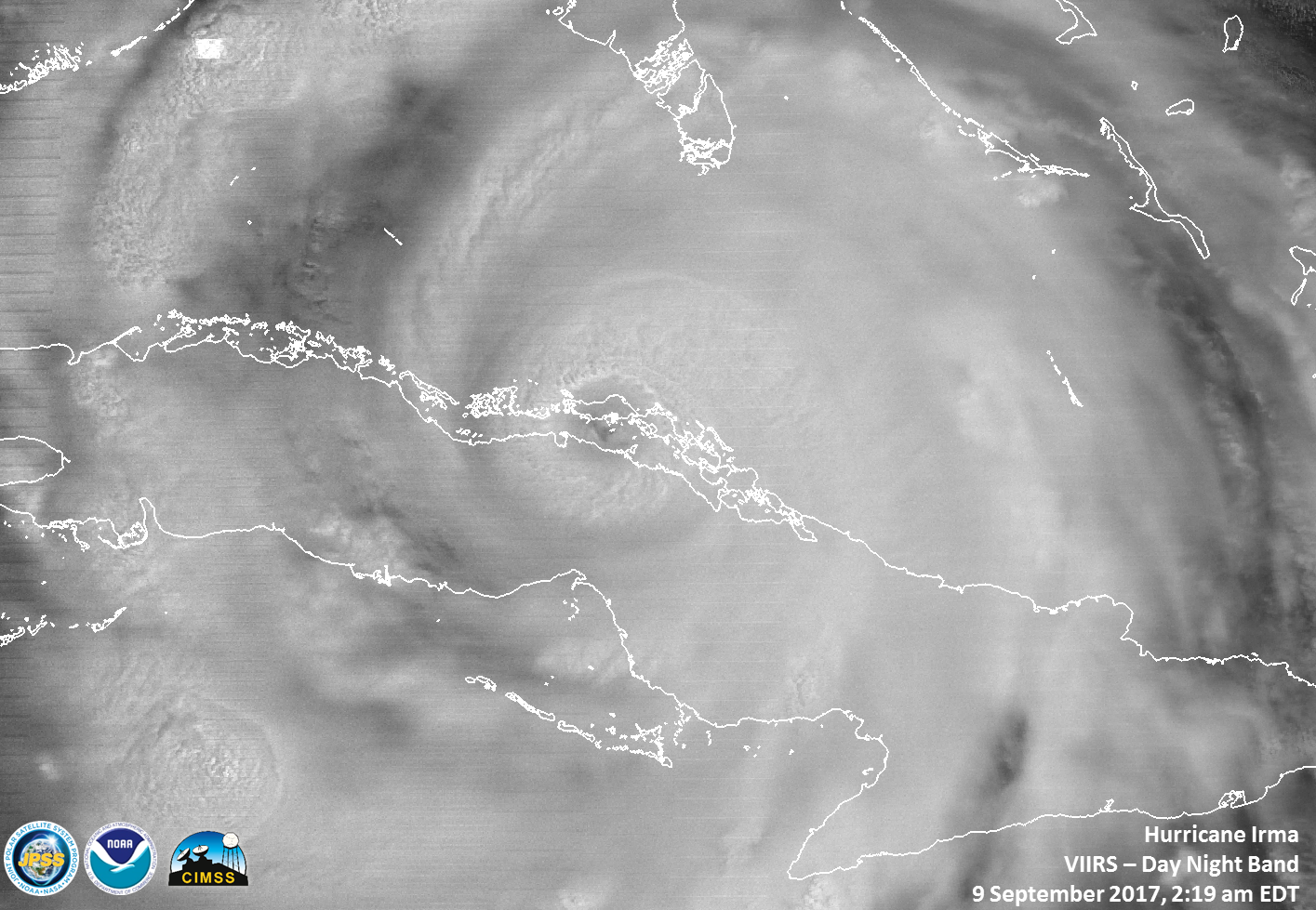
A zoomed-in, annotated view of the eye is below. (Click here for an image with no labels)
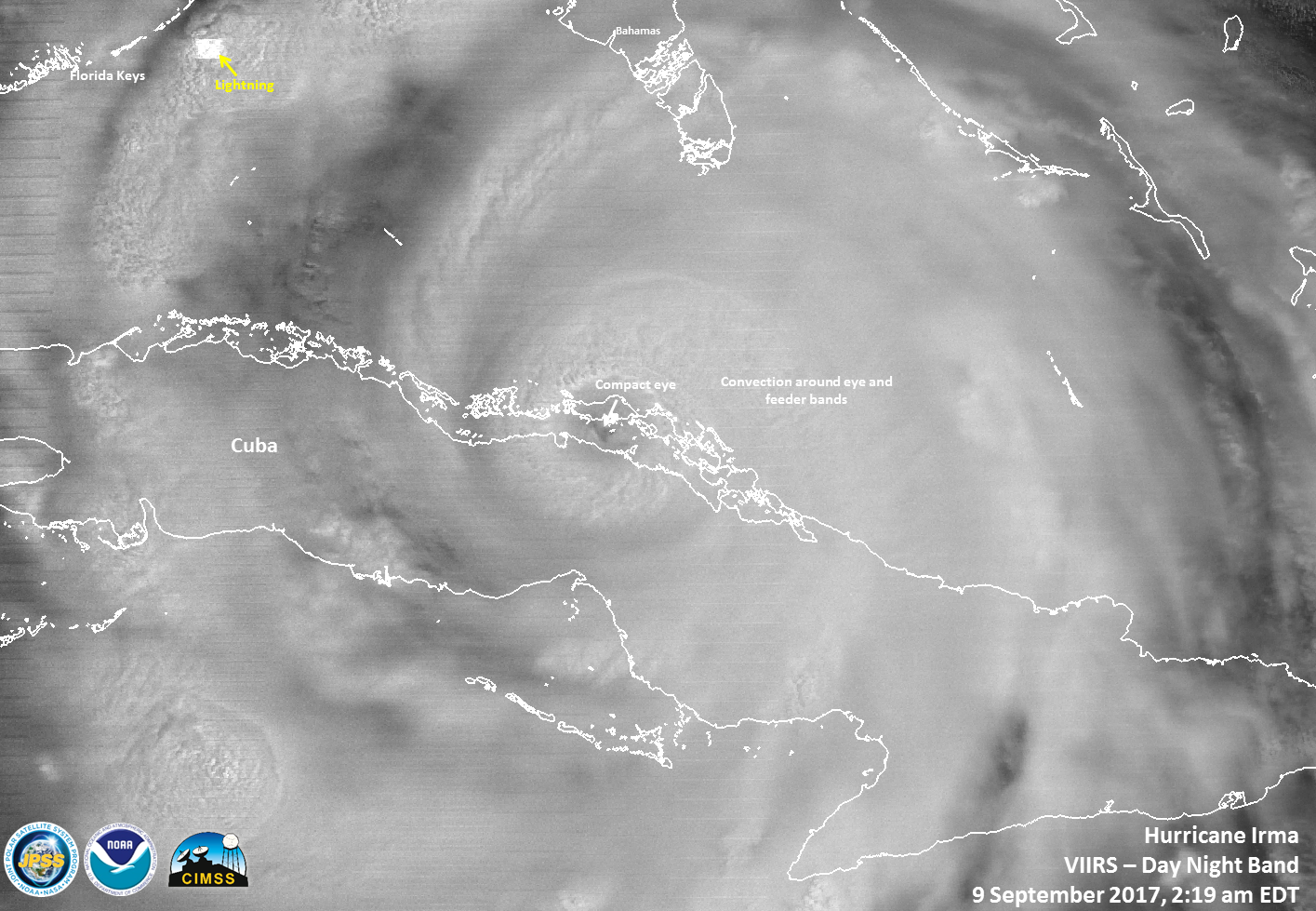
Annotated Suomi NPP VIIRS Day Night Band Visible (0.7 µm) from 0619 UTC on 9 September 2017 (Click to enlarge)
For further information on this dangerous storm, consult the National Hurricane Center, or the CIMSS Tropical Weather Website.