Hurricane Harvey approaches the Texas Gulf Coast

GOES-16 Low-Level Water Vapor Infrared (7.3 µm) images, 0217-1347 UTC on 25 August 2017 (click to play animation)
GOES-16 data posted on this page are preliminary, non-operational and are undergoing testing
Low-Level Water Vapor Infrared imagery (7.34 µm) from GOES-16, above, shows Hurricane Harvey developing a distinct eye shortly after sunrise on 25 August 2017 after intermittent appearances of the eye during the night. Harvey is a strong Hurricane at 950 mb (as of 700 AM CDT according to the National Hurricane Center) and is approaching the central Gulf Coast of Texas. Strong upper-level outflow to the north and then east and south is apparent in the Water Vapor animation above, and an absence of dry air near the storm portends no significant weakening before the storm reaches the Coastline. Microwave estimates of Total Precipitable Water, below, from this site, continue to show extreme moisture amounts enveloping the storm.
MIMIC Total Precipitable Water estimates for the 24 hours ending 1300 UTC on 25 August 2017 (Click to enlarge)
Visible imagery, below, from after sunrise on 25 August 2017, show a symmetric storm with a visible eye. The “Cirrus Channel” near-infrared GOES-16 Channel (1.38), bottom, shows the extensive cirrus canopy from the storm covering much of the western Gulf of Mexico and adjacent states.
GOES-16 Visible Images (0.64 µm) images, 1242-1417 UTC on 25 August 2017 (click to play animation)
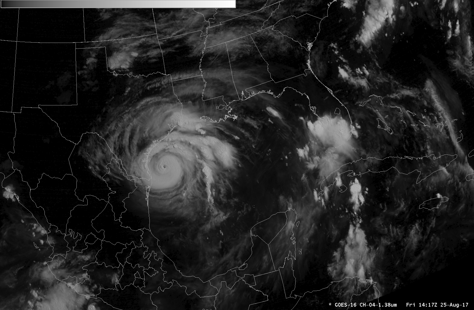
GOES-16 near-Infrared Images (1.38 µm) image, 1432 UTC on 25 August 2017 (Click to enlarge)
For the latest information on Harvey, consult the pages of the National Hurricane Center, or the CIMSS Tropical Weather Website. In addition to the flooding threat posed from Harveywith multiple days of rain, storm surge at the coast promises considerable inundation.

GOES-16 animation showing Clean Window IR (10.3 µm) and City Lights Background at night, True Color Imagery during the day, 1100-1900 UTC on 25 August 2017 (Click to enlarge)
A toggle between Suomi NPP VIIRS Visible (0.64 µm) and Infrared Window (11.45 µm) images at 1853 UTC , below, provided a detailed view of the hurricane as it continued to near the Texas coast.
Suomi NPP VIIRS Visible (0.64 µm) and Infrared Window (11.45 µm) images (Click to enlarge)