GOES-16 and Tropical Depression #4 in the Atlantic Ocean

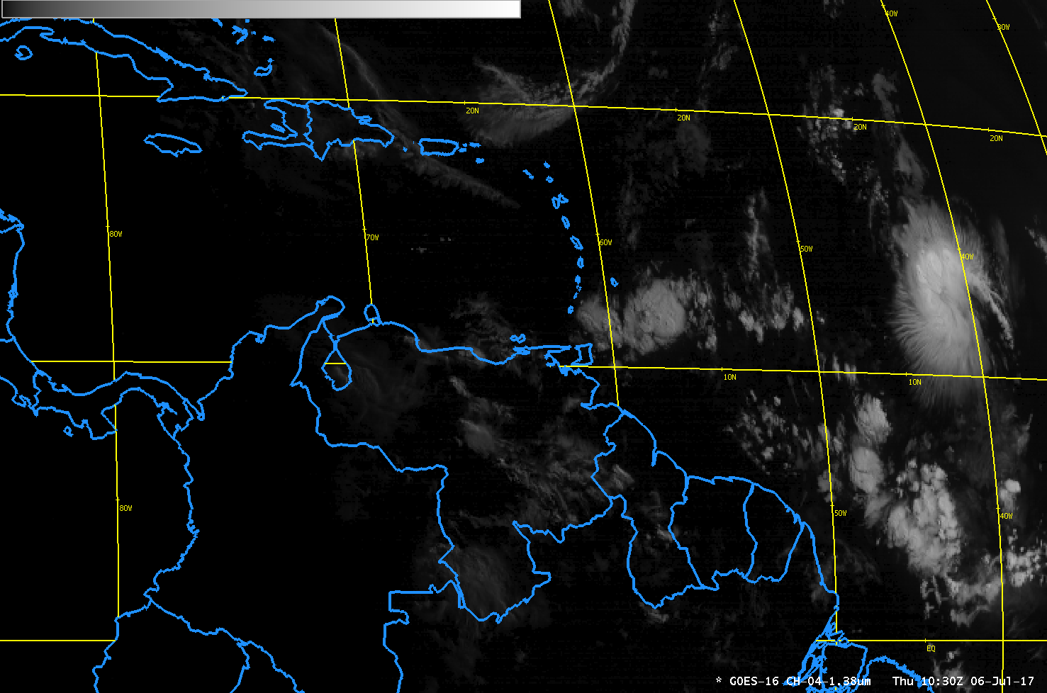
GOES-16 “Cirrus Channel” (1.38 µm) near-infrared imagery, 0900-2100 UTC on 6 July 2017 (Click to play animated gif)
GOES-16 data posted on this page are preliminary, non-operational data and are undergoing testing
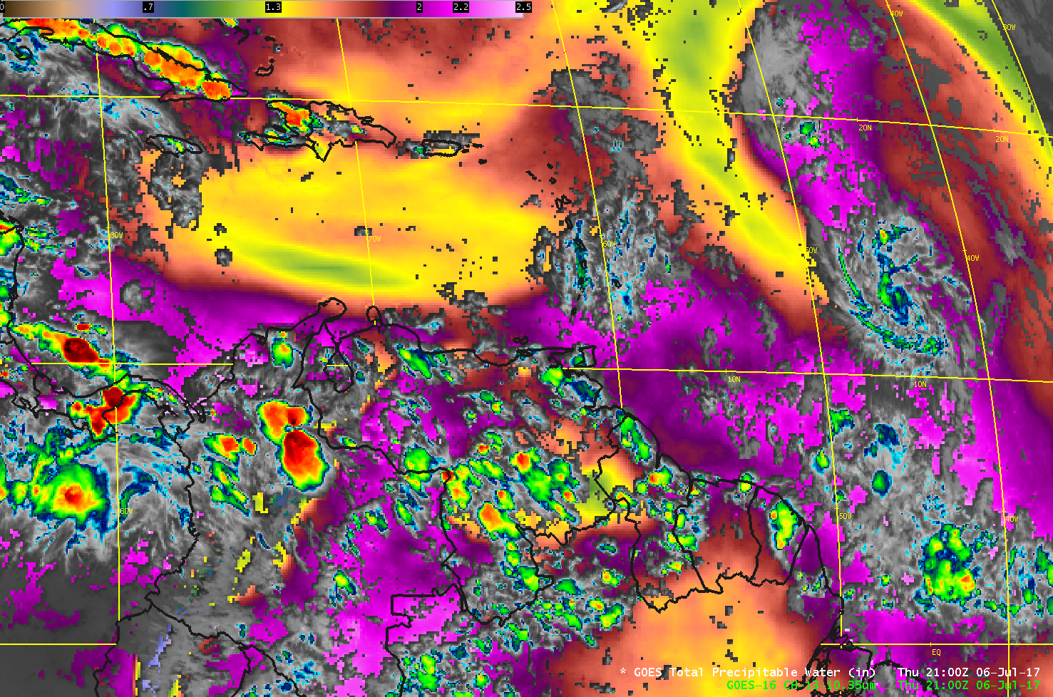
Tropical Depression #4 formed in the tropical Atlantic on 5 July 2017 (Click here for National Hurricane Center advisories on the system). The Depression is not forecast to strengthen, and two GOES-16 products give evidence to its weakened state. The animation of GOES-16 Band 4 (1.38 µm “Cirrus Channel”), above, shows a general decrease in the high clouds associated with this system (located north of 10º North Latitude and between 40º and 50º West Longitude), meaning convection is not strong. A closer view reveals intricate cirrus transverse banding around the periphery of the system during the early part of the day. In addition, the 10.3 µm “Clean Window” image, below, overlain on top of the GOES-16 Baseline Total Precipitable Water (TPW) Product, shows dry air west of the circulation. A Saharan Air Layer (SAL) analysis from here that uses Meteosat data, shows dry air moving towards the system from the east as well (Link). A toggle between GOES-13 Infrared Window, Meteosat-10 SAL product, and MIMIC TPW imagery can be seen here.
Refer to the National Hurricane Center website, or the CIMSS Tropical Weather website, for more information on this sytem.


