Undular bores over the Gulf of Maine
** The GOES-16 data posted on this page are preliminary, non-operational data and are undergoing testing. **
As pointed out by NWS Caribou:
Beautiful gravity waves over Gulf of Maine today, at several different levels too! #GOES16 data is preliminary, non-operational. #mewx pic.twitter.com/jbQEbAnPzz
— NWS Caribou (@NWSCaribou) April 27, 2017
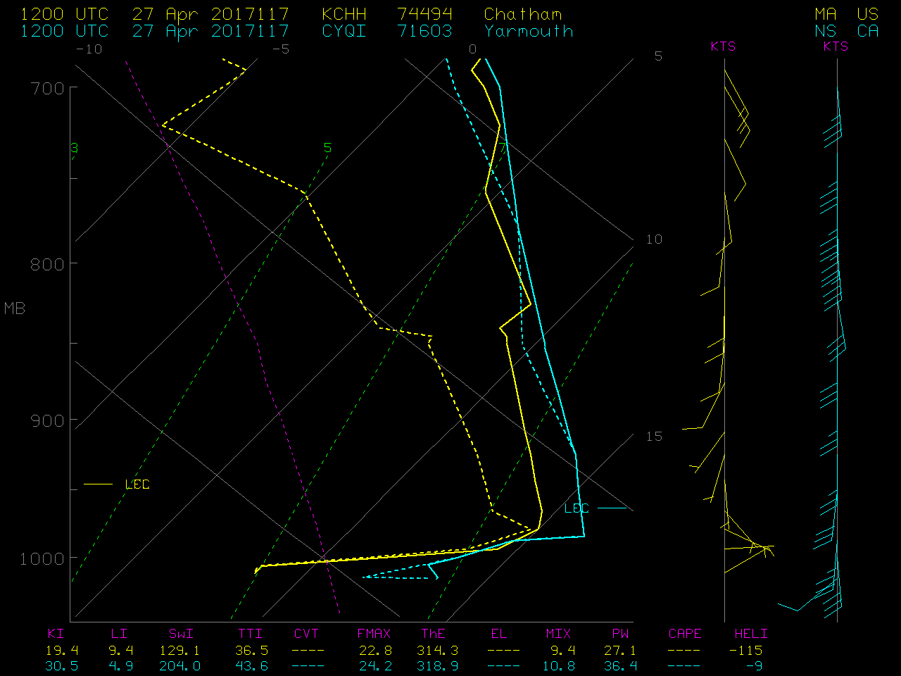
numerous packets of wave clouds associated with undular bores were seen on GOES-16 Visible (0.64 µm) imagery over the Gulf of Maine on the morning of 27 April 2017. A longer animation with surface wind plots (below; also available as an MP4 animation) revealed the presence of 3 distinct bore structures: the largest and most well-defined which was moving eastward; a second (and much smaller) off the coast of Cape Cod which was moving southeastward; and a third which as moving northwestward (and eventually intersected the northern end of the primary eastward-moving bore).
![GOES-16 Visible (0.64 µm) images, with surface winds (knots) plotted in cyan [click to play animation]](https://cimss.ssec.wisc.edu/satellite-blog/wp-content/uploads/sites/5/2017/04/170427_goes16_visible_surface_winds_ME_MA_undular_bores_anim.gif)
GOES-16 Visible (0.64 µm) images, with surface winds (knots) plotted in cyan [click to play animation]
![GOES-16 Visible (0.64 µm, left) and GOES-13 Visible (0.63 µm, right) images [click to play animation]](https://cimss.ssec.wisc.edu/satellite-blog/wp-content/uploads/sites/5/2017/04/170427_goes16_goes13_visible_surface_winds_ME_MA_undular_bores_anim.gif)
GOES-16 Visible (0.64 µm, left) and GOES-13 Visible (0.63 µm, right) images [click to play animation]
![GOES-16 Infrared Window (10.3 µm) images [click to play MP4 animation]](https://cimss.ssec.wisc.edu/satellite-blog/wp-content/uploads/sites/5/2017/04/960x1280_AGOES16_B13_G16_IR_ME_MA_BORES_26-27APR2017_2017116_120720_0001PANEL.GIF)
GOES-16 Infrared Window (10.3 µm) images [click to play MP4 animation]