Melting snow and thinning ice
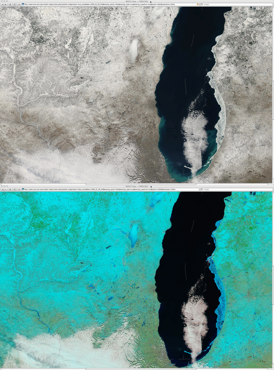
The National Weather Service at Milwaukee/Sullivan posted a nice animation of MODIS true color imagery (using the AWIPS “MODIS True Color Imagery Viewer” that Jordan Gerth developed as part of the CIMSS/SSEC MODIS in D2D project) which shows the breakup of ice in southern Lake Michigan and the melting of snow cover over far southeastern Wisconsin during a 3-day period of warm temperatures in early February 2009. A comparison of MODIS “true color” (Red/Green/Blue composite using channels 01/04/03) and “false color” (Red/Green/Blue composite using channels 07/02/01) images from the SSEC MODIS Today site (above) also showed some interesting clues about the thinning of the ice on some of the inland lakes and rivers on 08 February 2008. Snow and ice appear as white features on the true color image, but appear as varying shades of cyan on the false color image — however, thinner ice shows up as a darker blue color on the false color image (due in part to a higher meltwater content within the top layer of the ice).
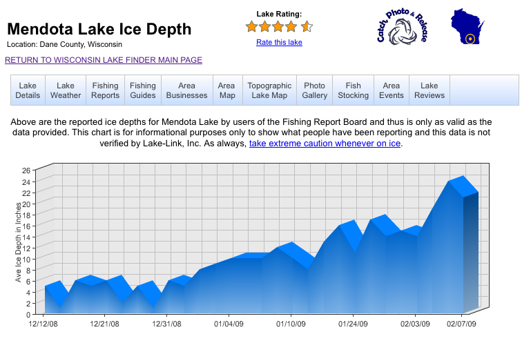
Even though the appearance of the inland lake ice was beginning to show signs of degradation and thinning on the MODIS imagery, recent reports of ice thickness (below, courtesy of Lake-Link.com) indicated that there was still over 20 inches of ice on some parts of the larger lakes such as Lake Winnebago (the largest lake in east-central Wisconsin), as well as on smaller lakes like Lake Mendota (the largest of the lakes in the Madison area). Note that some of the lakes in southern Wisconsin are already ice-free — these lakes exhibit a darker appearance on both the true color and the false color images. In addition, a significant amount of lake ice can still be seen along the eastern nearshore waters of Lake Michigan.


