Extratropical Cyclogenesis over the western Pacific
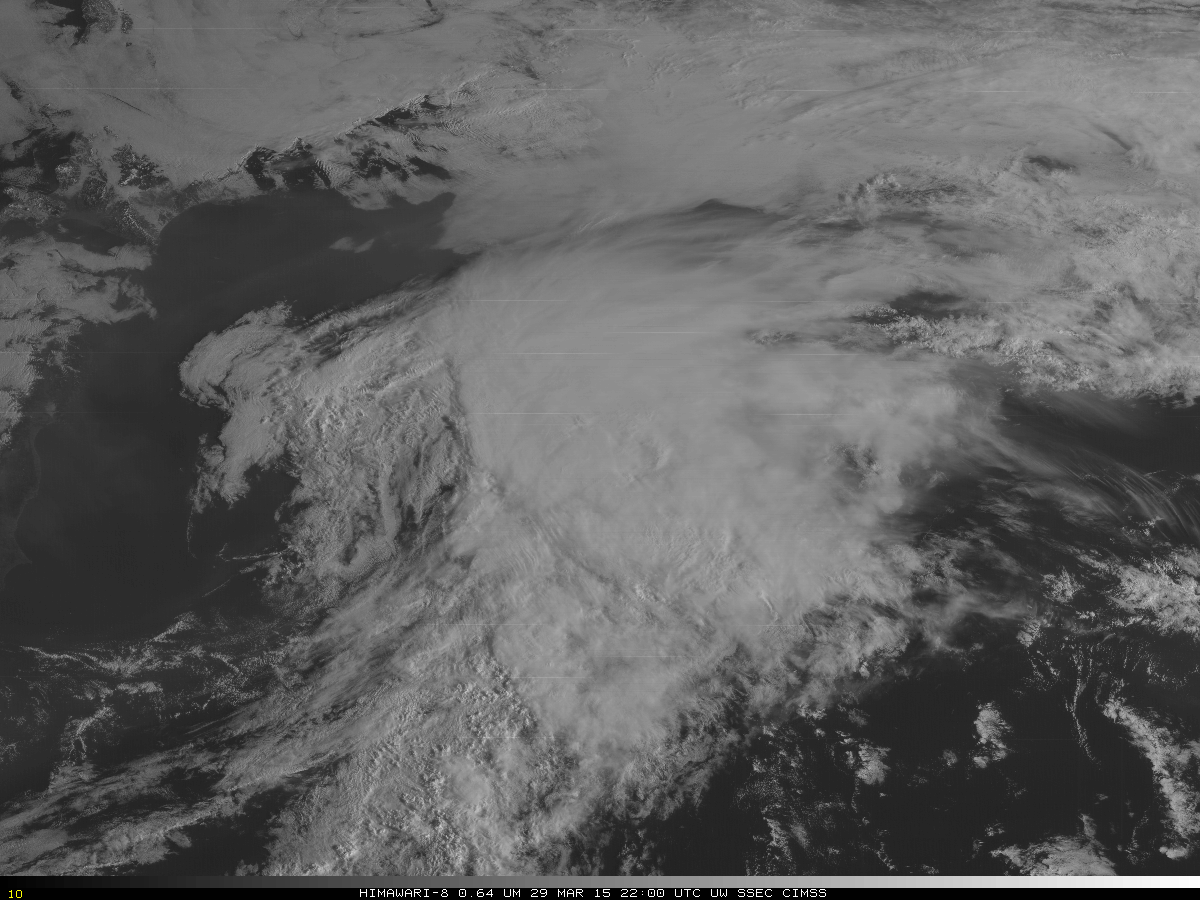
Himawari-8 AHI 0.64 µm visible channel images (click to play animation)
The AHI Instrument on Himawari-8 has 16 different channels sensing the atmosphere. The instrument is still in Post-Launch Testing, a period when instrument performance is monitored and adjusted. Extratropical cyclogenesis that occurred east of Japan on 30 March was captured by the different channels.
The 0.64 µm visible imagery, above, is the highest-resolution channel on AHI, with nominal 0.5-km resolution at the subsatellite point. The imagery above — at 1.5 km resolution and every 10 minutes — shows the development of an extratropical cyclone east of the main island of Japan (visible at the left edge of the imagery). Thin cirrus is spreading north of the storm and convection is developing both in the cool air north of the surface circulation center and along the cold front that is just to the west of the cirrus shield associated with the warm conveyor belt. Northerly surface winds north of the system and southern surface winds south of the system speak to the strengthening of the frontal boundary along which the storm is developing.

Himawari-8 AHI 0.85 µm infrared channel images (click to play animation)
The 0.85 µm imagery, above, is in the near-infrared part of the electromagnetic spectrum, at wavelengths just a bit longer than red visible light (which is at 0.7 µm). It does an excellent job highlighting the land/water contrast (because bodies of water strongly absorb 0.85 µm solar radiation and land and clouds reflects it). This channel also is sensitive to vegetation. The larger-scale view shows jetstream cirrus south and southwest of the developing storm and an occluded system decaying to the east of Kamchatka.
The 0.46 µm imagery, below, is in the visible part of the electromagnetic spectrum, and is quite sensitive to aerosols (Click here for a fact sheet on ABI’s 0.46 µm “Blue Band”; fact sheets for all ABI Bands will be here in the future). The smog and pollution that surrounds Tokyo is more apparent in this imagery. Smog is also indicated near Osaka and Nagoya. A toggle between 0.64 µm, 0.46 µm and 0.85 µm imagery, here, from 30 March 2015 at 0000 UTC allows a comparison of the imagery.
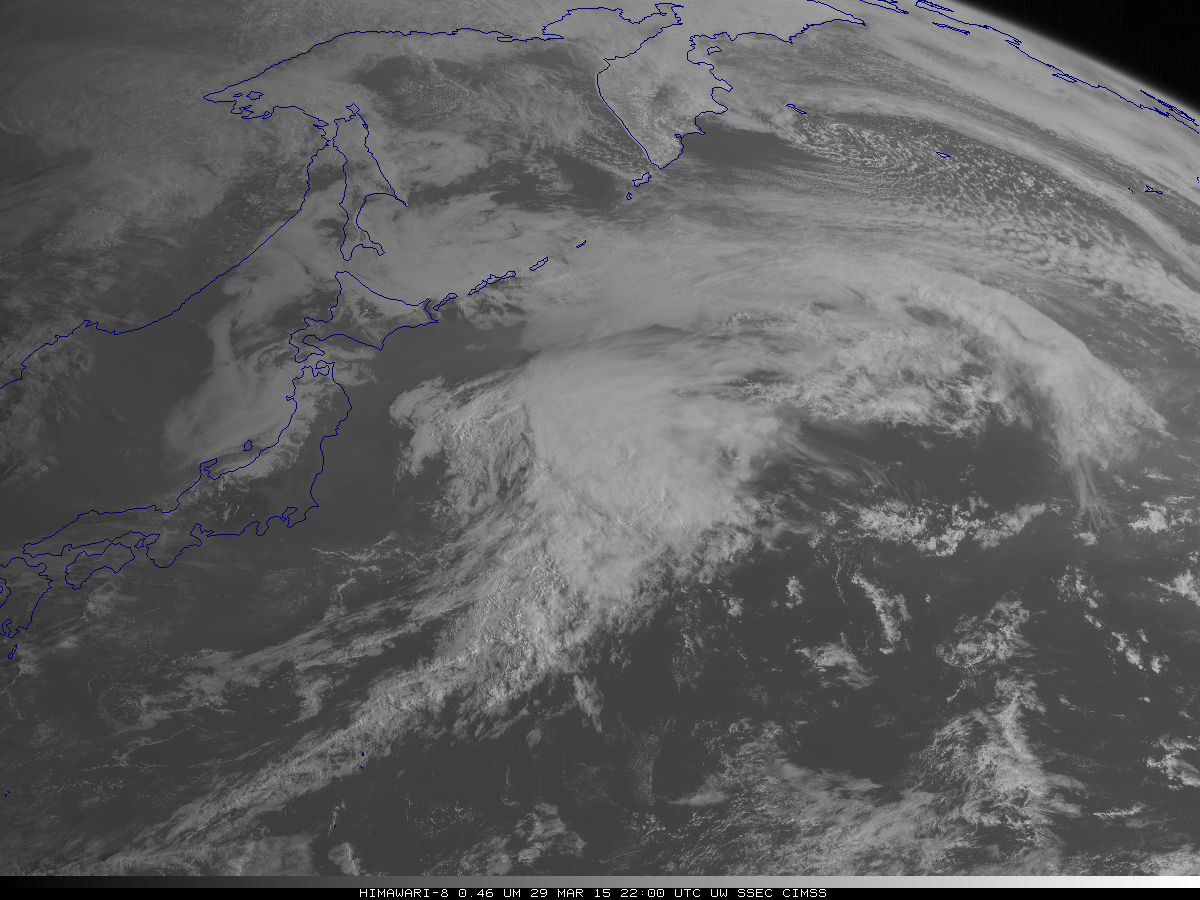
Himawari-8 AHI 0.46 µm visible channel images (click to play animation)
The 1.60 µm imagery on AHI is useful because it can distinguish between clouds with water droplets (that scatter and reflect solar 1.60 µm radiation very effectively) and clouds with ice crystals (that absorb 1.60 µm radiation). In a standard enhancement, clouds with ice crystals appear grey, clouds with water droplets appear white. In the animation below, the glaciated cirrus canopy of the warm conveyor belt is readily apparent. Note also how the convection developing along the warm front has glaciated by the end of the animation.

Himawari-8 AHI 1.60 µm infrared channel images (click to play animation)
The 3.9 µm on Himawari-8 provide detailed information about the sea surface temperature if clouds are not present, as was the case over the Kuroshio Current just east of Japan on 30 October. The animation below shows little change over 2 hours, as expected, except along the north wall of the current. Brightness Temperatures drop 10 C across the temperature gradient at the north end of the current.

Himawari-8 AHI 3.90 µm infrared channel images (click to play animation)