Severe Weather over the Southern Plains
The Storm Prediction Center in Norman issued a Moderate Risk of severe weather over the Southern Plains on March 25, 2015. Convective products were available in AWIPS to help monitor the evolution of this event.
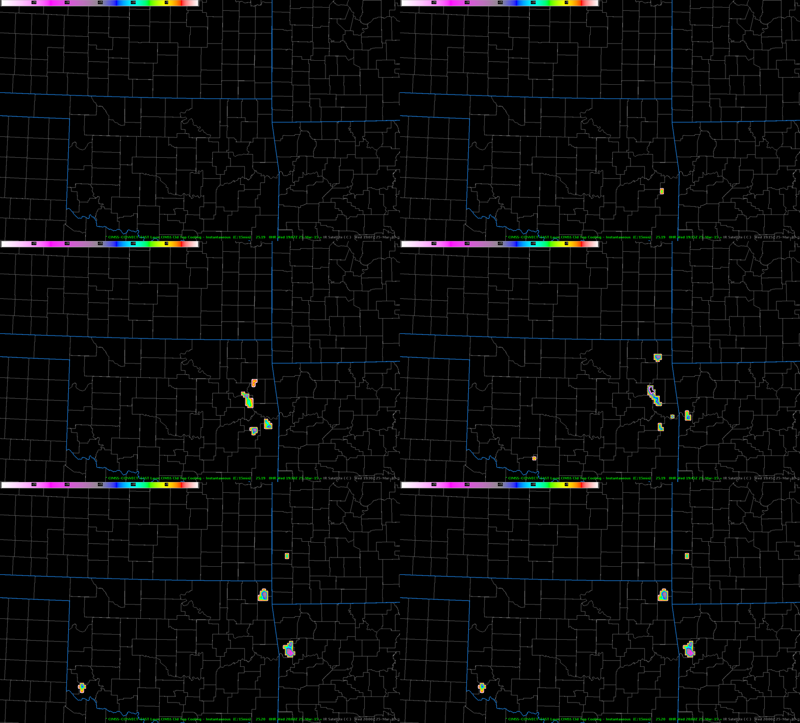
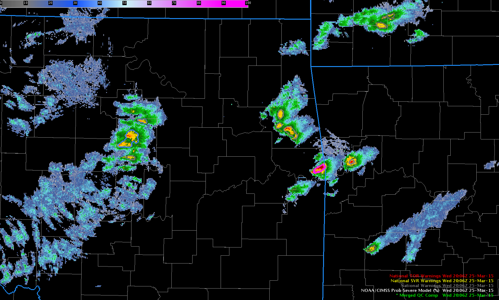
For example, the Cloud-Top Cooling product, above, monitored rapid development of convection over eastern Arkansas just between 1915 and 2000 UTC (the 10.7µm imagery for about the same time is here). Cloud-Top Cooling depicts where the strongest vertical cloud growth is occurring and is most useful for the initiation of the convection (or subsequent re-energized growth). The NOAA/CIMSS ProbSevere product, below, can also monitor the evolution of the storm from initial growth through maturity and beyond.
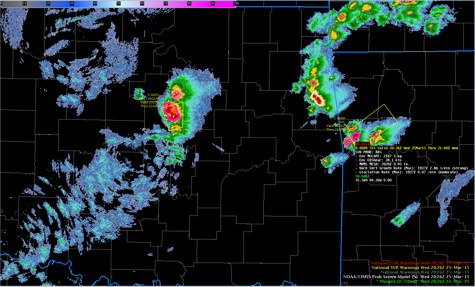
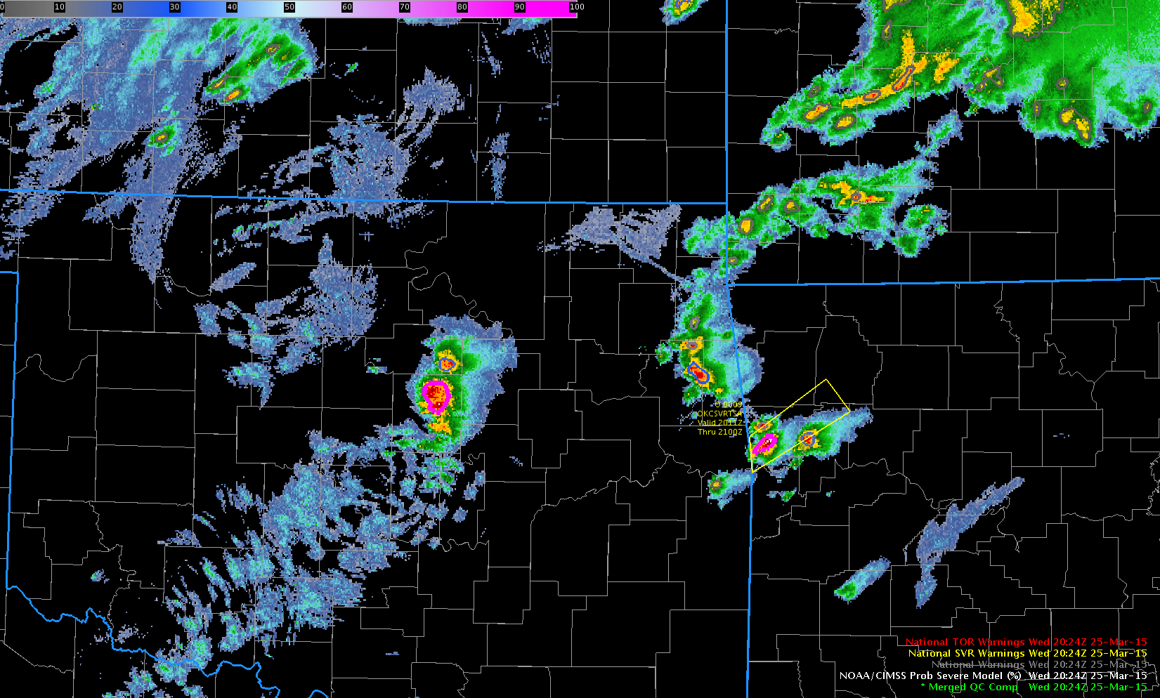
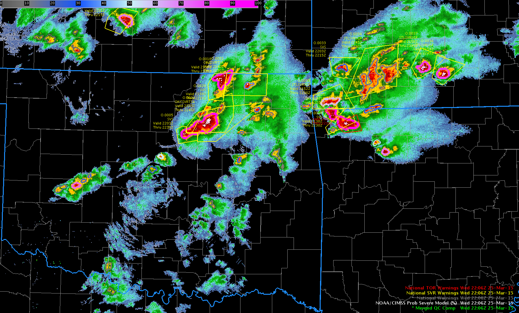
The NOAA/CIMSS ProbSevere product gauges the likelihood of a storm first producing severe weather (of any kind) in the next 60 minutes. It combines information about the environment (Most Unstable CAPE, Environmental Shear) from the Rapid Refresh Model, about the growing cloud (Vertical Growth Rate as a percentage of the troposphere per minute and Glaciation Rate, also as a percentage per minute), and Maximum Expected Hail Size (MESH) from the MRMS. The storm over east-central OK, crossing over the border of Arkansas, showed a ProbSevere value of 45% at 2004 UTC and of 87% at 2006 UTC; 1-inch hail was reported with this storm (in Roland, OK) at 2005 UTC, and a Severe Thunderstorm warning was issued at 2026 UTC. AWIPS-2 imagery that includes readouts for this storm are below.
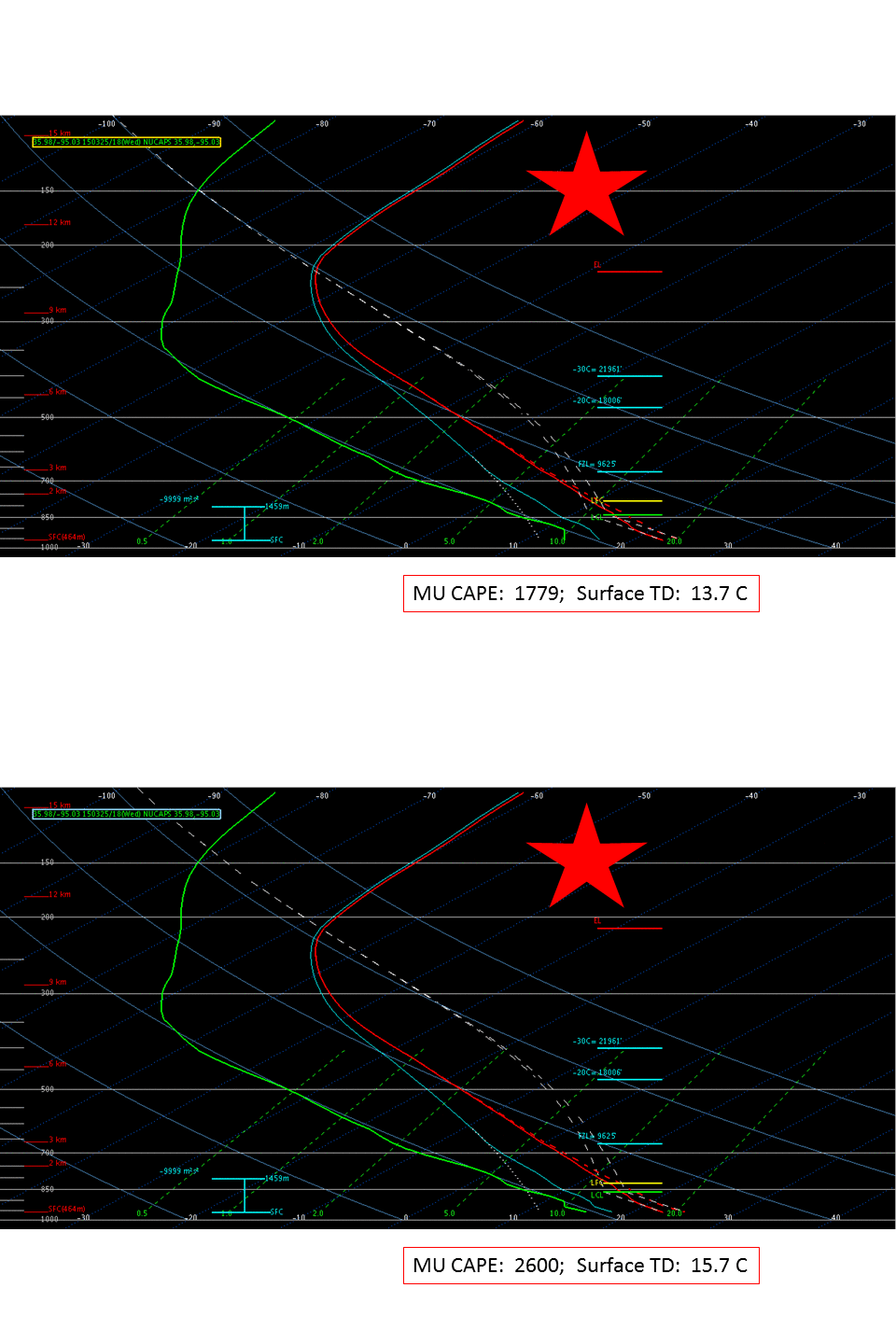
Suomi NPP overflew the region shortly before convection developed, and the NUCAPS soundings in the clear pre-convective air described the thermodynamics of the environment. The location of the NUCAPS soundings are shown below, overlain on top of the Suomi NPP VIIRS visible imagery. The Red and Yellow stars show two sounding locations to be discussed. It’s helpful when using NUCAPS soundings to know surface values of temperature and dewpoint, because it can be helpful to adjust the NUCAPS soundings so that surface values are more in line with observations as reported by METARS. Accordingly, the VIIRS visible image with surface METARS plotted is here. Dewpoints in eastern OK and western AR are close to 60 F/15 C.
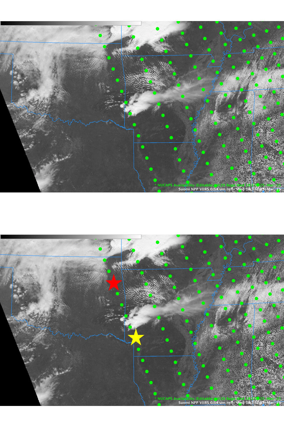
NUCAPS Sounding Locations at 1833 UTC on 25 March 2015; Red and Yellow Stars indicate sounding locations described below (Click to enlarge)
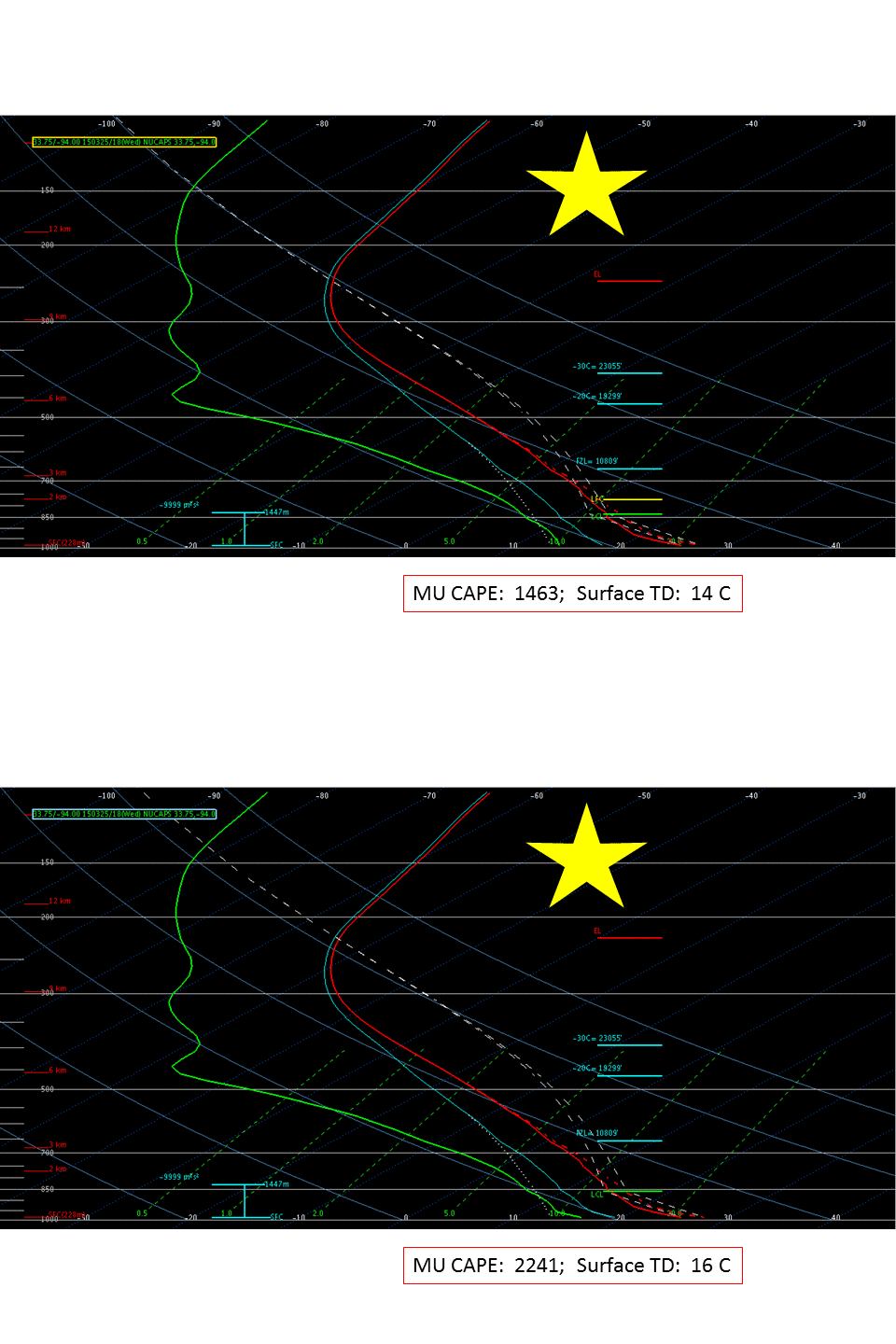
The soundings from the two starred sites are below. In both cases, the original sounding and a sounding that has been modified by increasing the lowest dewpoint by 2 C are shown. Most Unstable CAPE for the plotted soundings (original and modified) are indicated. NUCAPS Soundings suggest greater instability over west-central/northwest Arkansas than over southwestern Arkansas.
A short (1900-2015 UTC) GOES-13 visible image animation as the convection started is shown below. Click here for a longer animation (1300 – 2345 UTC); Click here for a faster version of the 1300-2345 UTC animation.
[Added: This severe weather outbreak caused the first tornado fatality of 2015, in Tulsa County, OK. Satellite imagery of those storms can be found here. ProbSevere product animations from 2024 to 2230 UTC on 25 March and also from 2206 UTC on 25 March to 0012 UTC on 26 March are shown below]


