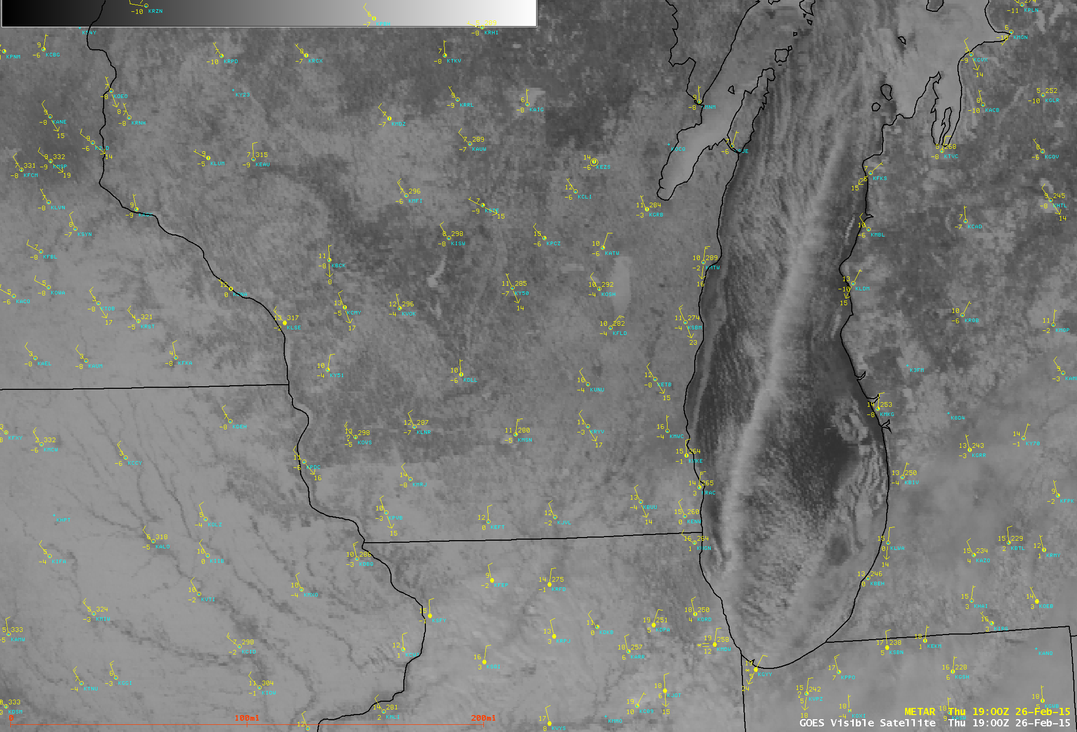
Lake effect snow band over Lake Michigan
GOES-13 (GOES-East) 0.63 µm visible channel images (above; click image to play animation) showed the development and motion of a long single-band lake effect cloud feature over Lake Michigan on 26 February 2015. Snowfall from this band helped to boost total event accumulations (including other lake effect snow bands on the previous day) as high as 8 inches in the Chicago area, bringing this to the 3rd snowiest February on record there.
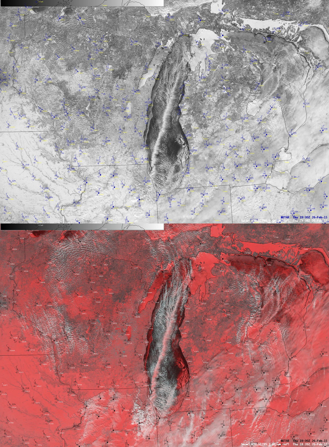
A comparison of the 18:39 UTC Suomi NPP VIIRS 0.64 µm visible channel image with the corresponding false-color Red/Green/Blue (RGB) is shown below. On the RGB image, snow, ice, and ice crystal clouds appear as varying shades of pink to red — and it can be seen that portions of the lake effect cloud band looked to be glaciated. Supercooled water droplet clouds appear as varying shades of white on this type of snow/ice-vs-cloud discrimination RGB image.
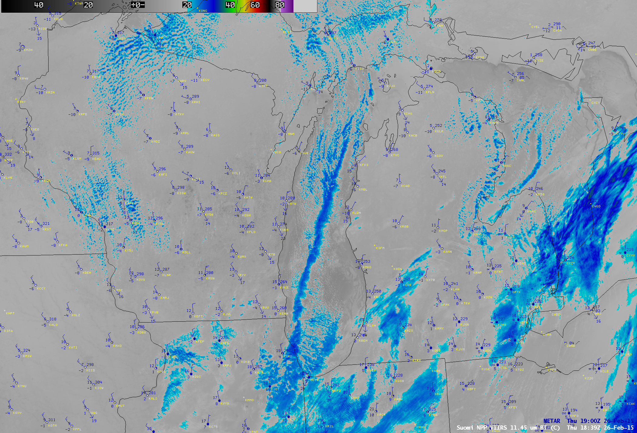
The 18:39 UTC Suomi NPP VIIRS 11.45 µm IR channel image (below) showed that cloud-top IR brightness temperatures were in the -20 to -30º C range (cyan to dark blue color enhancement) along the entire length of the lake effect cloud band, which also suggested that glaciation was likely.


