Airborne glacial silt over the Gulf of Alaska
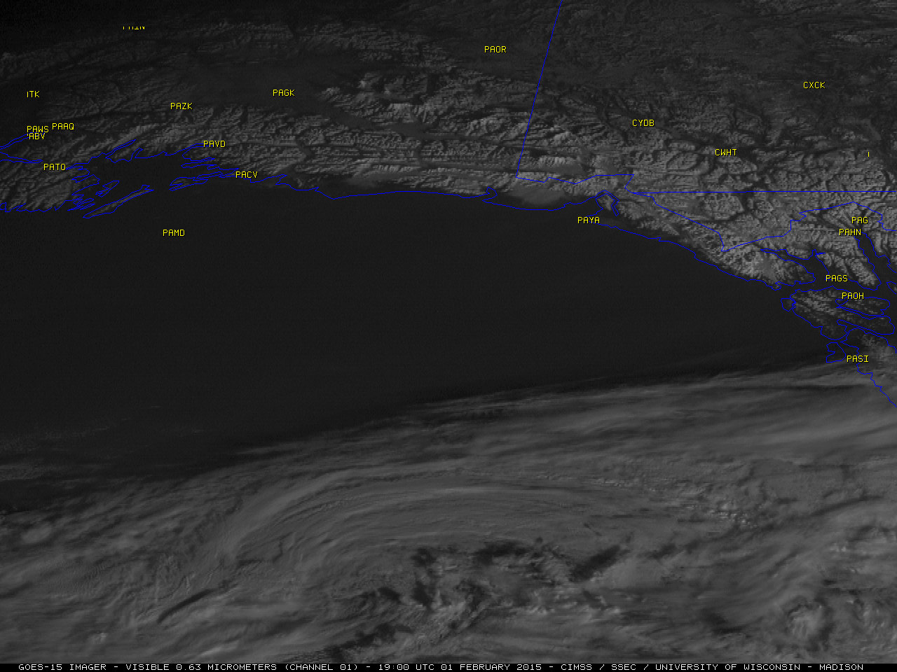
GOES-15 0.63 µm visible channel images (click to play animation)
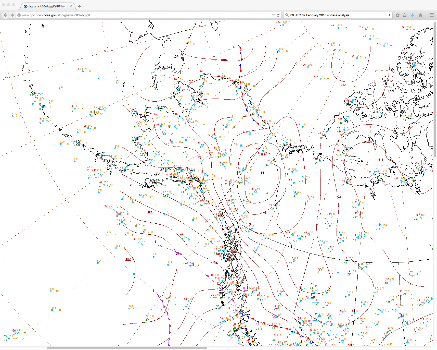
Due to a tight pressure gradient between a high over the Yukon and a low over the Gulf of Alaska (surface analysis), strong offshore winds (with gusts as high as 78 mph) were lofting glacial silt from the northern portion of the Alaska Panhandle region and carrying it westward over the Gulf of Alaska on 01 February 2015. Hints of the narrow light grey plumes could be seen streaming southwestward then westward on GOES-15 (GOES-West) 0.63 µm visible channel images (above; click to play animation).
A closer look using a comparison of Suomi NPP VIIRS 0.7 µm Day/Night Band (DNB) and 0.64 µm visible channel images (below) showed that the areal extent of the airborne aerosols was much more evident on the DNB image (in part due to it’s more broad spectral response). However, other more intricate patterns were seen on the DNB image in the general vicinity of Middleton Island (station identifier PAMD) that did not appear to match the character of the airborne glacial silt features being blown westward from the Alaska Panhandle region.
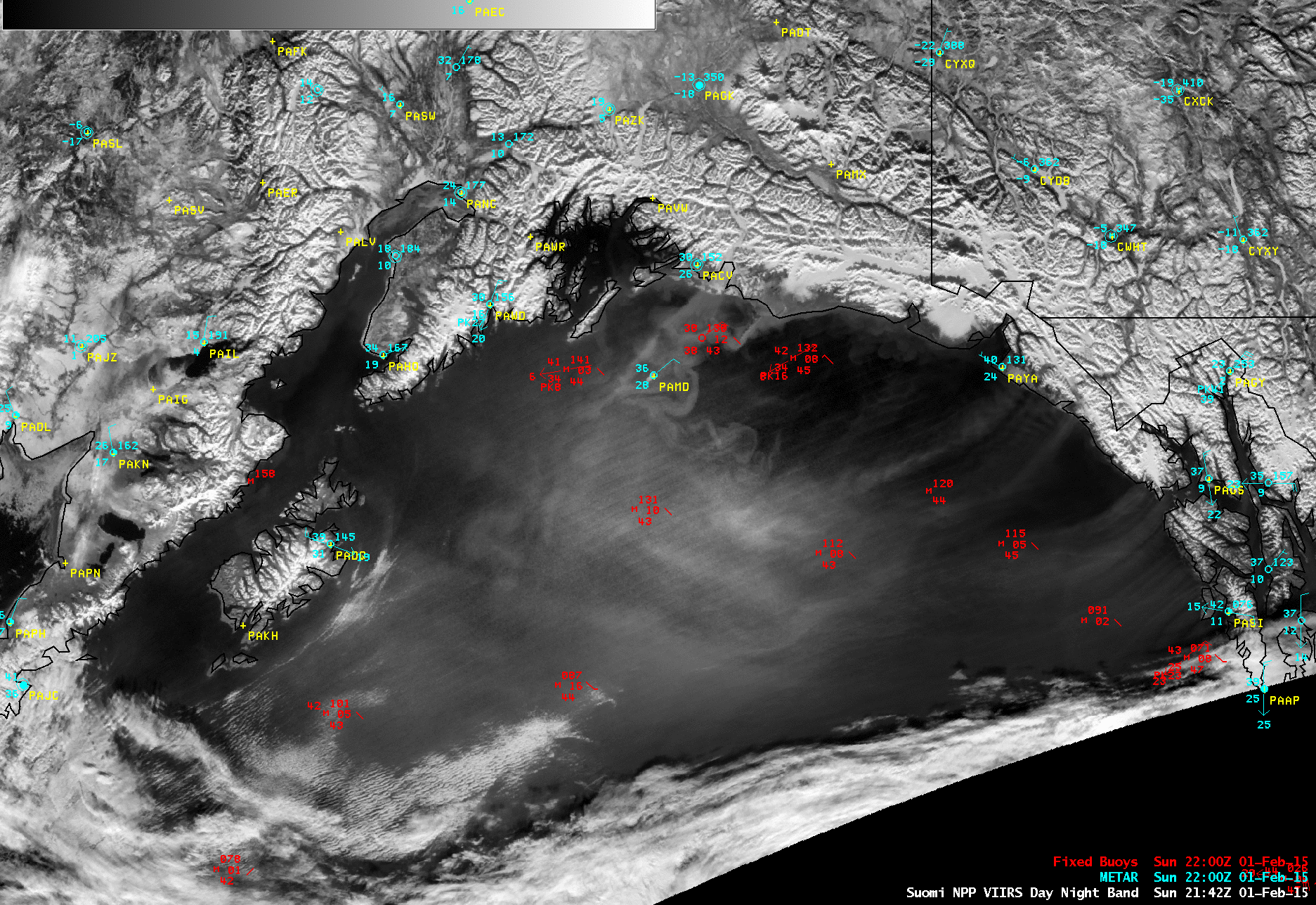
Suomi NPP VIIRS 0.7 µm Day/Night Band and 0.64 µm visible channel images
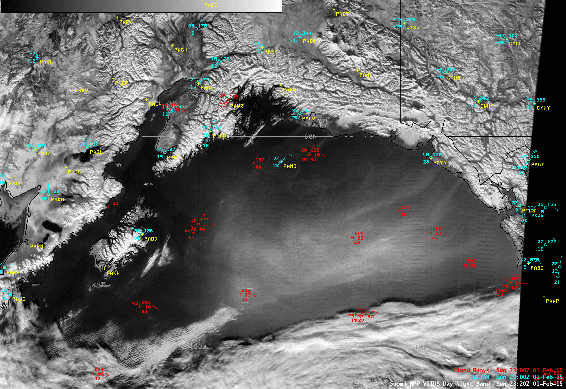
A Suomi NPP VIIRS true-color Red/Green/Blue (RGB) image from the SSEC RealEarth web map server (below) offers a clue to help explain the meandering features that stretched from the coast east of Prince William Sound toward the Middleton Island area: strands of phytoplankton, fed by nutrients in the river waters draining from the interior into the Gulf of Alaska. Sun glint along the edge of the VIIRS scan may have helped to highlight these features in the DNB image above. In fact, these water features were less obvious — and the airborne glacial silt more obvious — in a subsequent VIIRS DNB vs Visible image at 23:20 UTC.

Suomi NPP VIIRS true-color image