Rare low-elevation snowfall in the eastern Mojave Desert
A cold storm system moving through the Southwest US on 31 December 2014 produced significant snowfall in many of the higher-elevation mountain ranges of California, Baja California, Nevada, and Arizona (up to 20 inches at Mountainaire AZ), but also left lighter amounts of snowfall at some low-elevation locations of the eastern Mojave Desert where snowfall is considered to be quite rare (NWS Las Vegas Public Information Statement) | Event Summary). This event marked the first time that snowfall had been recorded during the month of December at Needles, California.
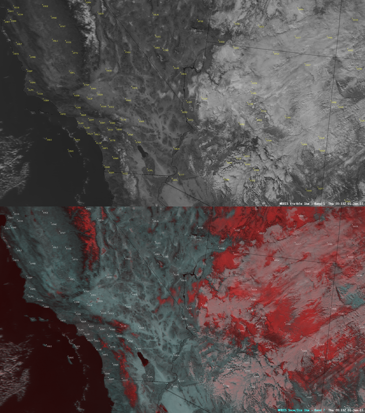
As clouds began to clear over the region on the following day (01 January 2015), areas which still had snow on the ground could be seen using satellite imagery. On a comparison of Aqua MODIS 0.65 µm visible channel and false-color Red/Green/Blue (RGB) images at 20:33 UTC or 1:33 PM local time (above), snow cover that appeared as shades of white on the visible image also appeared as darker shades of red on the RGB image.
As the day progressed, the sun had the effect of melting the lighter amounts of snow cover, as seen on GOES-15 (GOES-West) 0.63 µm visible channel images (below; click image to play animation). However, due to the presence of the unusually cold air mass, new records for coldest 01 January daily maximum temperature were set for Phoenix (46ºF) and Tucson (41ºF).


