White Christmas in Hawai’i
According to the National Operational Hydrologic Remote Sensing Center, only 35.5% of the Lower 48 states had snow cover on 25 December 2014. However, a deep cutoff low over the Hawaiian Islands had brought unusually cold air aloft (the 500 hPa temperature on the Lihue rawinsonde report was as cold as -18º C, which is extremely cold by Hawaiian standards) and strong winds, which prompted Blizzard Warnings to be issued for the high elevation summits of the Big Island of Hawai’i on 23-24 December. As the cutoff low departed and skies began to clear, GOES-15 (GOES-West) 0.63 µm visible channel images (above; click image to play animation) revealed the bright white snow-covered summits of Mauna Kea and Mauna Loa on Christmas Day.
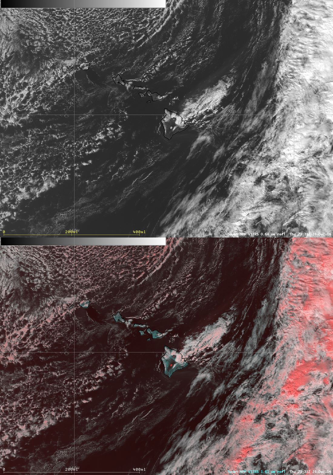
A toggle between a Suomi NPP VIIRS 0.64 µm visible channel and a false-color Red/Green/Blue (RGB) “snow vs cloud discrimination” image at 23:22 UTC (below) confirmed that the bright white features seen in the GOES-15 visible images was indeed snow cover — snow (and fully-glaciated ice clouds) appear as darker shades of red on the RGB image. Cloud tops that are partially glaciated appear as lighter shades of pink.
===== 26 December Update =====
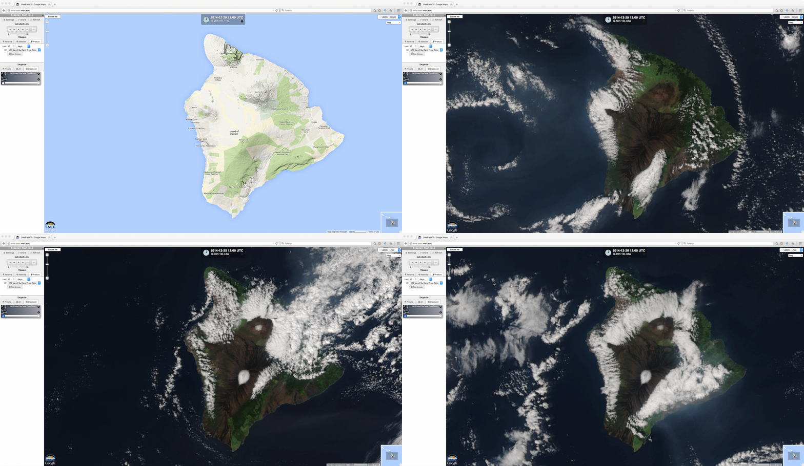
Using the SSEC RealEarth web map server, the comparison below shows 375-meter resolution Suomi NPP VIIRS true-color RGB images of the Big Island of Hawai’i on 20 December (before the snowfall on the Mauna Kea and Mauna Loa summits) and also on 25-26 December (after the snowfall). On the 26 December image, you can see that the patches of snow had melted somewhat at the 2 summits; in addition, an increase in hazy volcanic fog (vog) can be seen drifting southeastward off the island; this vog was being generated by the ongoing eruption of the Kilauwea volcano in the Hawai’i Volcanoes National Park.


