Airborne glacial silt from the Copper River Valley in Alaska
McIDAS images of GOES-15 0.63 µm visible channel data (above; click image to play animation) showed the hazy signature of airborne glacial silt drifting southward out of the Copper River valley and over the adjacent waters of the Gulf of Alaska on 28 October 2014. The strong winds lofting the silt were very localized to the Copper River valley itself, with cold dense arctic air from further inland (air temperatures were 8 to 10º F at Gulkana, PAGV) accelerating through narrow mountain passes — note how winds at nearby Cordova (PACV) were generally calm during much of the period. As the western edge of the airborne silt reached Middleton Island (PAMD), the surface visibility dropped as low as 5 miles.
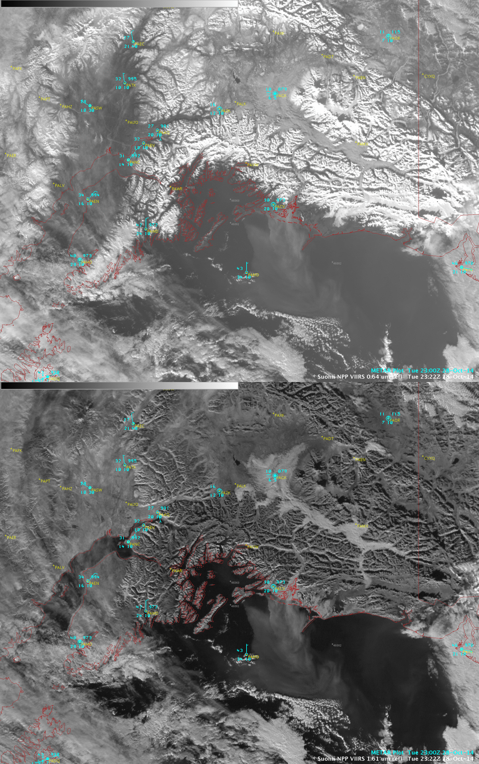
AWIPS II images of Suomi NPP VIIRS data provided a better view of the aerial coverage of the glacial silt: a comparison of VIIRS 0.64 µm visible channel and 1.61 µm near-IR “snow/ice channel” images (below) showed that the 1.61 µm image offered better contrast to help locate the edges of the feature. This 1.61 µm channel imagery will be available from the Advanced Baseline Imager (ABI) on GOES-R.
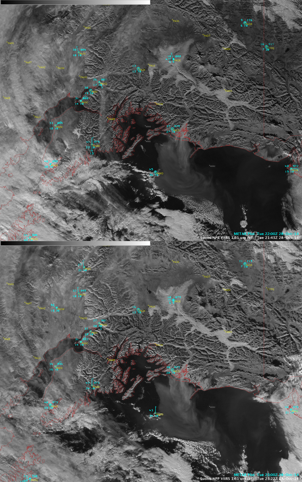
Two consecutive VIIRS 1.61 µm images (below) revealed the changes in aerosol coverage between 21:43 UTC and 23:22 UTC.
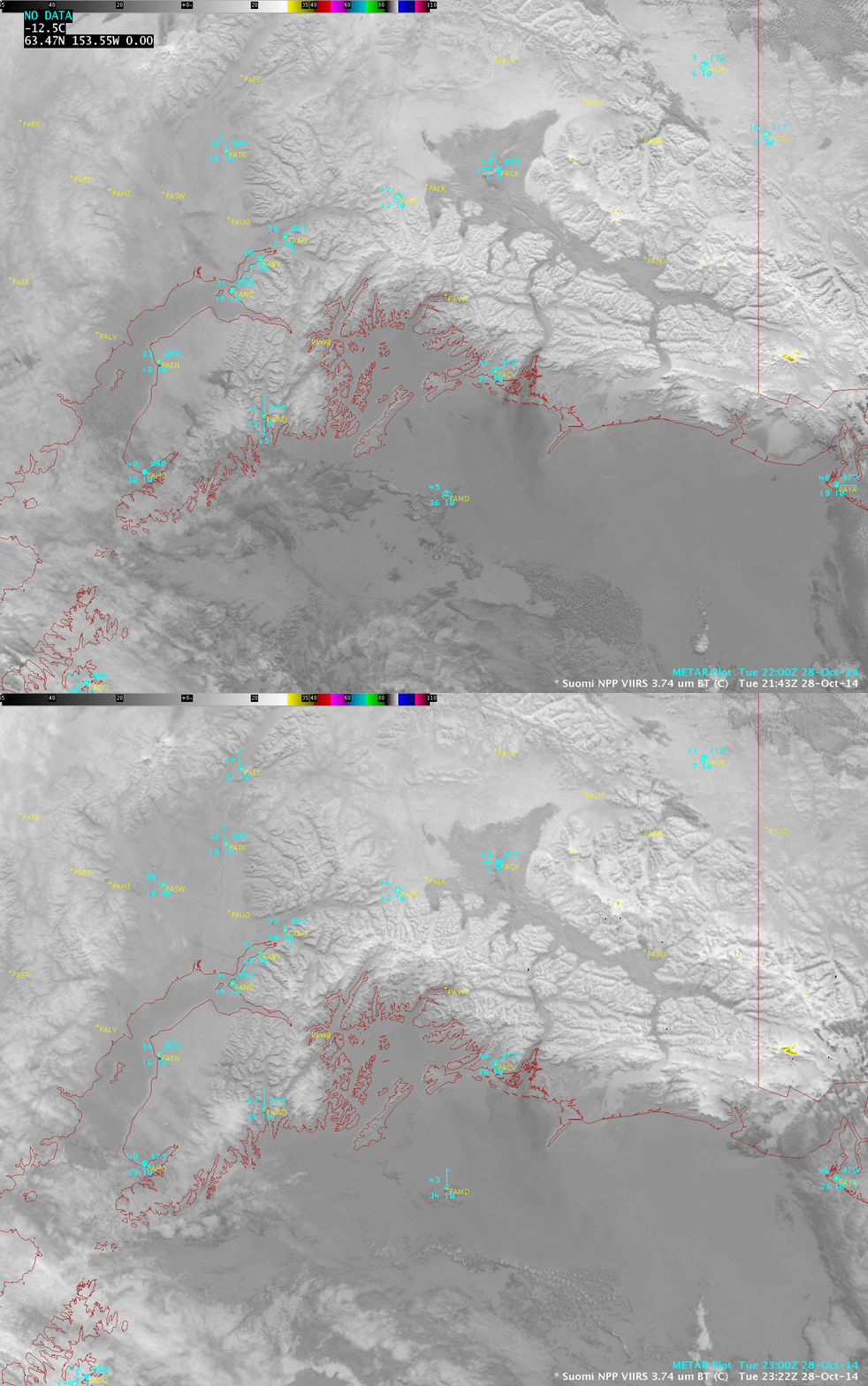
The more dense portion of the airborne glacial silt particle feature exhibited a slightly warmer (darker gray) appearance on VIIRS 3.74 µm shortwave IR images, due to efficient reflection of incoming solar radiation.
A VIIRS true-color Red/Green/Blue (RGB) image from the SSEC RealEarth site (below) offered a good view of the coverage of the glacial silt at 21:45 UTC.


