Wildfire smoke over ice in Hudson Bay
Large wildfires continued to burn during much of the month of July in the Northwest Territories of Canada, and McIDAS-X images of GOES-13 0.63 µm visible channel data on 28 July 2014 (above; click image to play animation) showed large amounts of smoke aloft streaming southwestward across the western and southwestern portion of Hudson Bay. This pattern of middle-tropospheric smoke transport was caused by the juxtaposition of a highly-amplified ridge of high pressure over central Canada and a deep area of low pressure over Quebec (500 hPa map). During the later part of the day, the clearing of patchy low clouds and the thinning of the smoke aloft revealed the presence of large ice floes over southwestern Hudson Bay. According to the Canadian Ice Service, this was thick first year ice from the previous winter season, with ice concentration values as high as 9-10/10s.
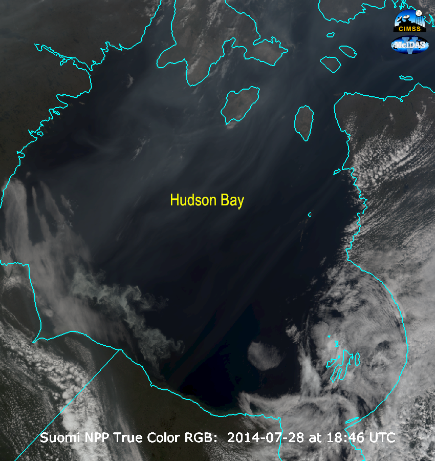
A Suomi NPP VIIRS true-color Red/Green/Blue (RGB) image combination prepared using McIDAS-V (below; courtesy of Joleen Feltz, CIMSS) showed the variety of smoke, ice, and cloud formations over Hudson Bay at 18:45 UTC.


