Tropical Depression Ernesto
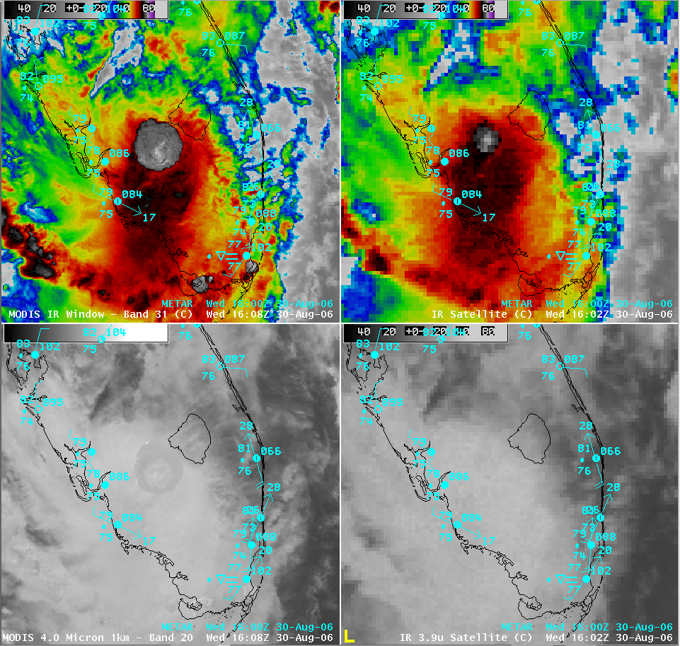
Tropcal Storm Ernesto moved inland over southern Florida this morning, and was downgraded to a Tropical Depression. The AWIPS image below shows a MODIS vs. GOES comparison of the longwave IR (“IR Window”) and shortwave IR channels around 16 UTC. Note on the 1-km resolution MODIS IR Window channel (upper left panel) the much larger circular-shaped area of colder cloud top temperatures (-75 to -80 C, gray to white enhancement) over Florida, compared to the 4-km resolution GOES-12 IR Window channel (upper right panel). Also of interest is a signature of slightly warmer cloud top temperatures (darker grey enhancement) over that same region on the MODIS shortwave IR (lower left panel) — no such signature was yet evident on the corresponding GOES-12 shortwave IR at that time (lower right panel):

This signature on the shortwave IR channel is due to the dominance of smaller cloud particles within the storm tops of the active convection (similar to what is sometimes observed with “overshooting tops” associated with severe convection) — these smaller, more numerous ice particles exhibit a larger shortwave IR albedo, which is manifest as slightly warmer shortwave IR brightness temperatures (due to enhanced solar reflectance). GOES-10 Super Rapid Scan Operations (SRSO) imagery at 1-minute intervals (IR Window | Shortwave IR | Visible) indicated that this particular burst of convection was beginning to rapidly intensify around 16 UTC; this “small ice particle signature” did eventually become obvious on the GOES-10 shortwave IR imagery, but not until around 16:11 UTC.

