40 years of Satellite Imagery
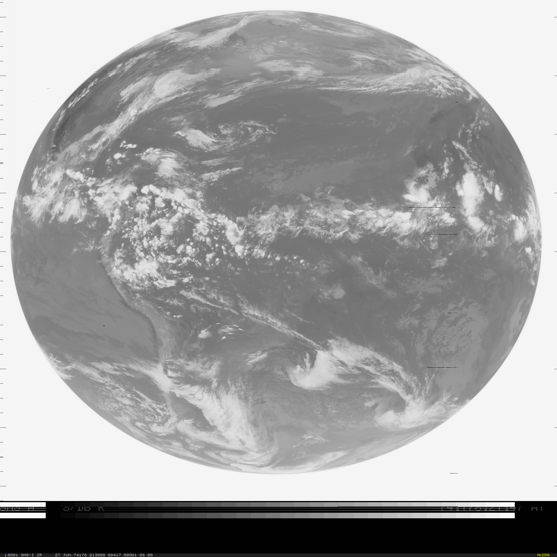
Synchronous Meteorological Satellite (SMS-1) 11 µm infrared channel image, 2130 UTC 27 June 1974 (click to enlarge)
The oldest satellite image in the SSEC data archive is shown above, taken 40 years ago on 27 June 1974, from SMS-1 (the corresponding visible image can be seen here). The infrared channel sensed radiation in a broad spectrum between 10.5 and 12.6 µm (source). The SMS-1 satellite (launched on 17 May 1974) was positioned over the Equator over eastern South America, at about 45 degrees West Longitude.
More information on the SSEC Datacenter archive is here.