Severe Mesoscale Convective System over the central US
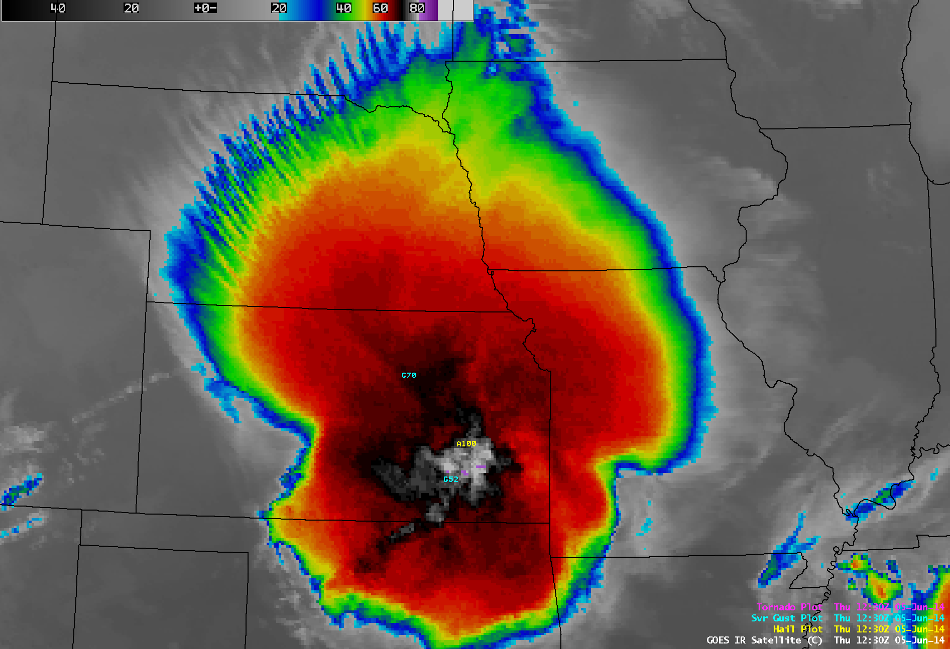
AWIPS images of 4-km resolution GOES-13 10.7 µm IR channel data with overlays of SPC storm reports (above; click image to play animation; also available as an MP4 movie file) showed the growth of a large mesoscale convective system (MCS) that formed over eastern Colorado late in the day on 04 June 2014 and became very intense as it moved east-southeastward across Kansas during the overnight hours on 05 June 2014. Although severe weather reports were not as widespread after daybreak on 05 June, the MCS still produced large hail and damaging winds across Missouri into the Mississippi River Valley (SPC storm reports: 04 June | 05 June). Note the cluster of high wind reports across northeastern Kansas into northwestern Missouri after about 12:00 UTC — these were due to the formation of a “wake low” in the rear portion of the exiting MCS.
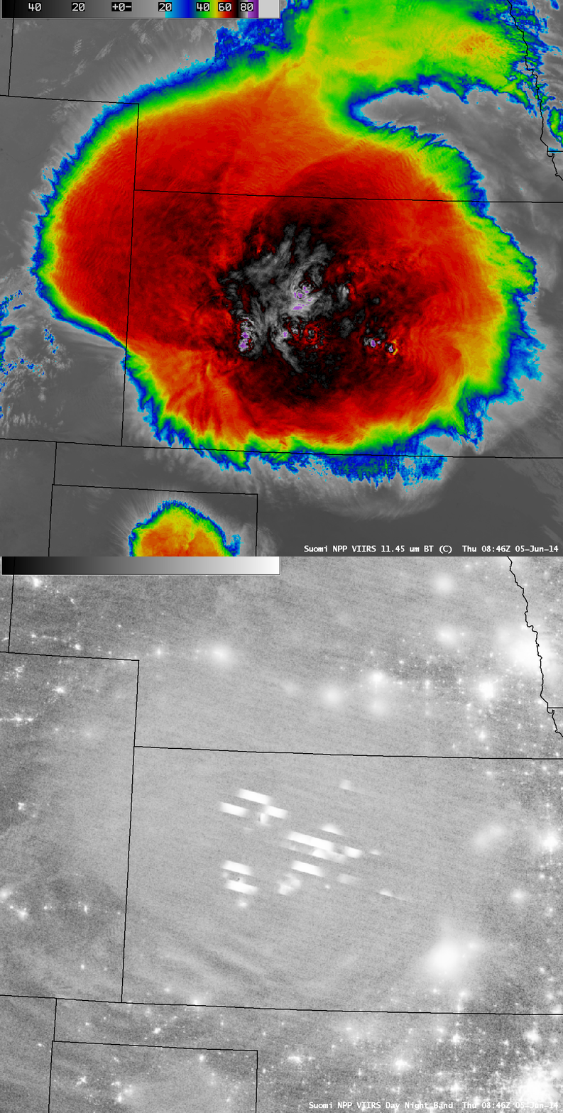
At 08:46 UTC (3:46 AM local time), a comparison of 375-meter resolution Suomi NPP VIIRS 11.45 µm IR channel and 750-meter resolution Day/Night Band images (below) revealed cloud-top IR brightness temperatures as cold as -90º C (darker violet color enhancement), along with subtle cloud-top gravity waves propagating radially outward away from the central core of intense overshooting tops. On the Day/Night Band (DNB) image, numerous bright white streaks indicated portions of the cloud top that were illuminated by intense lightning activity. Although the Moon was in the Waxing Gibbous phase at nearly 50% of full, it had set a few hours earlier, limiting its “visible image at night” capability. Another item of interest on the DNB image was the presence of larger bands of mesospheric airglow waves propagating southwestward away from the storm, seen over southwestern Kansas into far northeastern New Mexico.
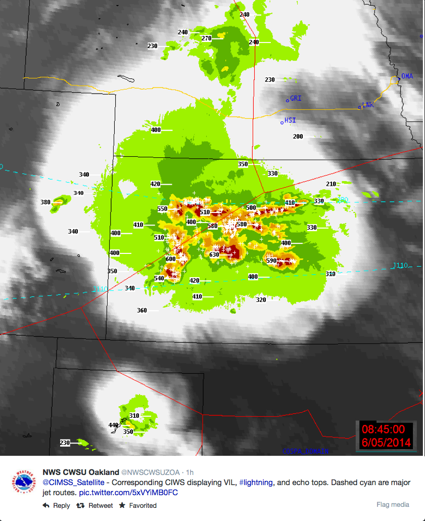
Via Twitter, the NWS CWSU in Oakland provided the corresponding 08:45 UTC GOES-13 IR image with overlays of radar-based VIL, echo tops, and lightning (below). Note that the maximum radar-based echo top was 63,000 feet.
Not surprisingly, there were numerous overshooting tops (OT) and thermal couplets (TC) associated with this severe MCS, as seen in this animation (where OT detections are blue, and TC detection are red). Icons of Automated Overshooting Top Detections (green) are plotted on GOES-13 10.7 µm IR channel images (below; click image to play animation; also available as an MP4 movie file). Of particular interest was the image at 10:00 UTC or 5:00 AM local time, when a report of hail of 3.0 inches in diameter and estimated winds of 60-70 mph beneath a cluster of overshooting top detection icons (the easternmost storm in central Kansas). Jim LaDue of the NWS WDTB in Norman OK provided this image showing Maximum Expected Size of Hail (MESH) of 2.0 inches for that particular supercell thunderstorm.
GOES-13 10.7 µm IR images, with Automated Overshooting Top Detection icons (click to play animation)
1-km resolution GOES-13 0.63 µm visible channel images after sunrise (below; click image to play animation; also available as an MP4 movie file) revealed a vivid display of transverse banding along the northwestern periphery of the MCS (primarily over Nebraska). This transverse banding is a satellite signature indicating a high potential for turbulence.
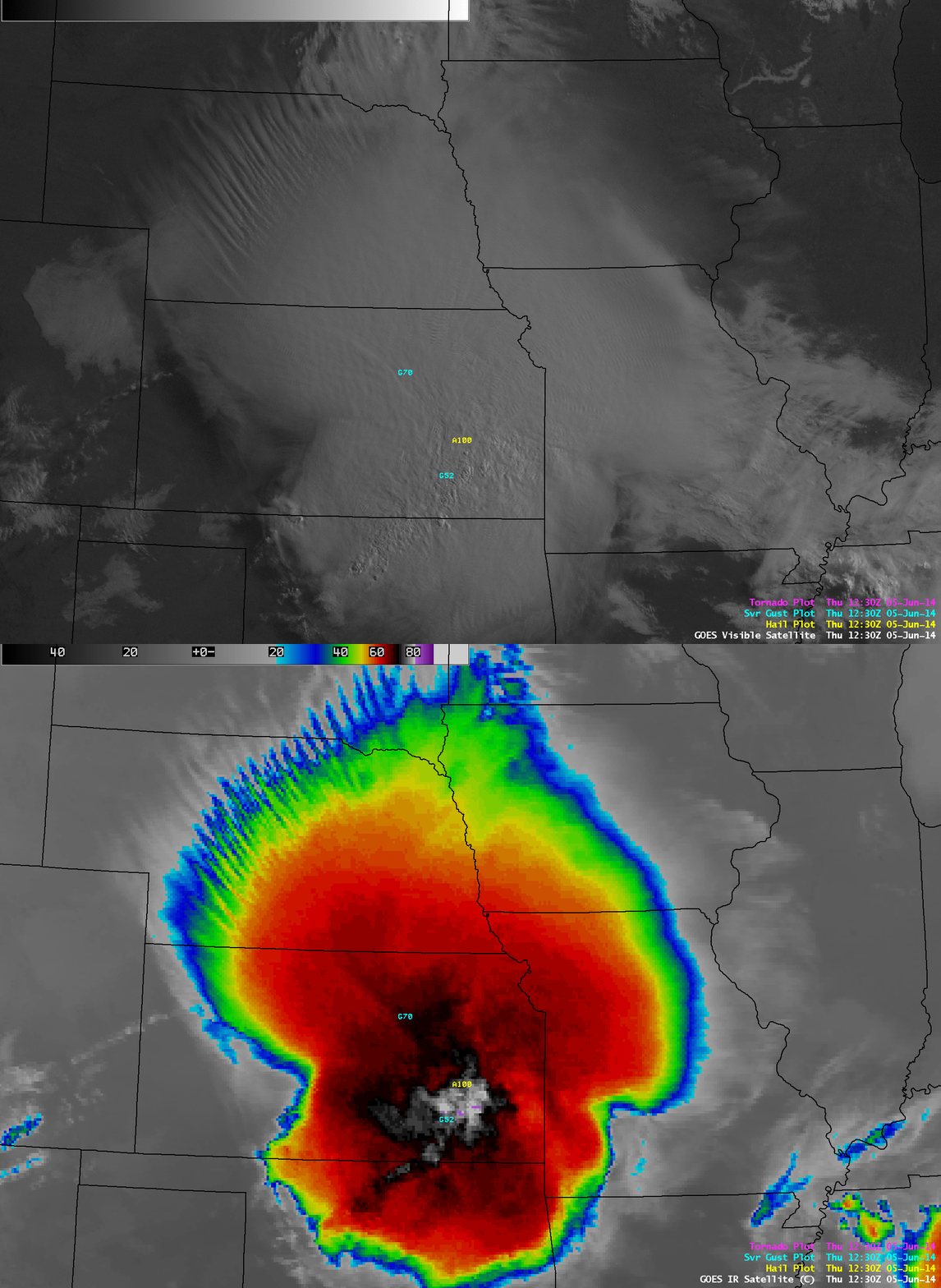
A comparison of GOES-13 1-km resolution 0.63 µm visible channel and 4-km resolution 10.7 µm IR channel images at 12:30 UTC (below) showed that portions of the transverse banding signature were resolved differently by the 2 different images.


