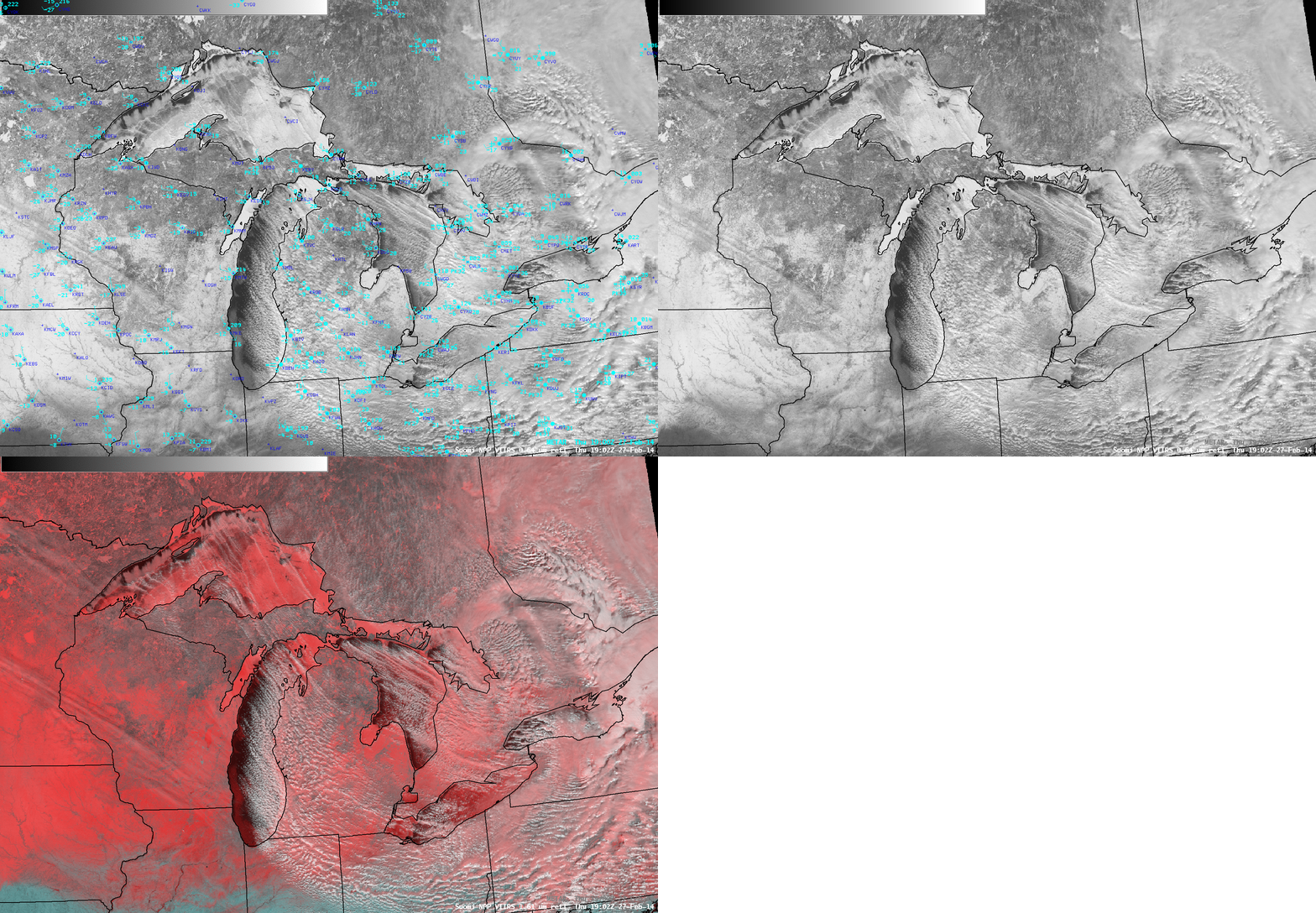
Great Lakes ice motion and lake-effect snow bands
A southward to southeastward surge of arctic air across the Great Lakes in the wake of a strong cold frontal passage (18 UTC surface analysis) on 27 February 2014 produced widespread lake-effect snow bands and also contributed to a renewed growth of ice. GOES-13 Visible (0.63 µm) images (above) showed (1) a variety of lake-effect cloud bands streaming across Lake Superior, Lake Michigan, Lake Huron, and western Lake Erie, (2) the motion of lake ice, due to strong northerly, northwesterly, and westerly winds across the region, and (3) the rapid formation of new lake ice in the previously ice-free nearshore waters in the far northwestern portion of Lake Superior.A comparison of Suomi NPP VIIRS Visible (0.64 µm) and False Color “snow/ice vs cloud discrimination” Red/Green/Blue (RGB) images at 19:02 UTC (below) demonstrated how the RGB product could be used to highlight the various cloud features — snow and ice appeared as darker shades of red, while supercooled water droplet clouds were depicted as varying shades of white (glaciated cloud features exhibited a pink to lighter red appearance).


